TopoQuest Logo
Do you find TopoQuest useful?
Help keep TopoQuest running and adding new maps/features by donating!
Bitcoin:  19c7KJd3qBynnjoSw5npx9KScwjBe4ifkT
Litecoin:  LXs6TkuXGGXo1vDsWCkWVdjQX94eUKd6ui
Home View Maps Find Maps Find Places Resources & Links


Fairfield, Idaho Topographic Map

USGS Map Title: Fairfield, ID
USGS Map MRC: 43114C7
DRG (GeoTIFF) Download: o43114c7.tif


Neighboring USGS Topographic Map Quads:


  Smoky Dome, ID  
43114D8
 

  Phillips Creek, ID  
43114D7
 

  Cannonball Mountain, ID  
43114D6
 

  Corral, ID  
43114C8
 

  Fairfield, ID  
43114C7
 

  Spring Creek Reservoir, ID  
43114C6
 

  Davis Mountain, ID  
43114B8
 

  Fir Grove Mountain, ID  
43114B7
 

  McHan Reservoir, ID  
43114B6


Map MRC Location:

N44°
W115°
N44°
W114°
H8 H7 H6 H5 H4 H3 H2 H1
G8 G7 G6 G5 G4 G3 G2 G1
F8 F7 F6 F5 F4 F3 F2 F1
E8 E7 E6 E5 E4 E3 E2 E1
D8 D7 D6 D5 D4 D3 D2 D1
C8 C7 C6 C5 C4 C3 C2 C1
B8 B7 B6 B5 B4 B3 B2 B1
A8 A7 A6 A5 A4 A3 A2 A1
N43°
W115°
N43°
W114°

Fairfield, ID USGS 1:24K Topographic Map Preview:
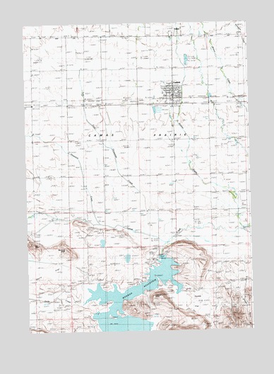
Fairfield, ID USGS Topographic Map
Click on map above to begin viewing in our Map Viewer.

This topographic map contains these locations and features:
Feature Name Type Latitude Longitude GNIS ID View Map
Big BluffCliffN43.2857°W114.8726°371482View Map
Camas County - Fairfield Volunteer Fire DistrictBuildingN43.3458°W114.7931°2619013View Map
Camas County AirportAirportN43.3419°W114.7969°400816View Map
Camas County Elementary - Junior High SchoolSchoolN43.3472°W114.7907°401561View Map
Camas County High SchoolSchoolN43.3471°W114.7912°401452View Map
Camas County Sheriff's OfficeBuildingN43.3458°W114.7929°2722367View Map
Camas PrairieFlatN43.3205°W114.8092°378740View Map
City of FairfieldCivilN43.3489°W114.8006°2410475View Map
Dairy CreekStreamN43.2630°W114.8412°371178View Map
Davis FlatFlatN43.2738°W114.8620°396377View Map
East Fork Threemile CreekStreamN43.2893°W114.8095°381187View Map
FairfieldPopulated PlaceN43.3466°W114.7917°399870View Map
Fairfield Post OfficePost OfficeN43.3464°W114.7917°2767305View Map
Lookout PointSummitN43.2649°W114.8009°373736View Map
Mormon DamDamN43.2807°W114.8001°398631View Map
Mormon ReservoirReservoirN43.2504°W114.8304°397930View Map
Mormon Reservoir Access AreaLocaleN43.2782°W114.8048°401621View Map
Shoots GulchValleyN43.2688°W114.7545°375012View Map
SoldierPopulated PlaceN43.3702°W114.7917°397181View Map
Soldier CreekStreamN43.2918°W114.7542°390819View Map
Squaw FlatFlatN43.2635°W114.7795°375237View Map
Threemile CreekStreamN43.2935°W114.8345°392099View Map
Windmill BluffCliffN43.2832°W114.8520°375964View Map

Note: Coordinates in the location and feature list above are referenced to NAD83 datum.


Copyright (C) 2008-2025 Ryan Niemi / Sunset Dynamics ... All Rights Reserved