TopoQuest Logo
Do you find TopoQuest useful?
Help keep TopoQuest running and adding new maps/features by donating!
Bitcoin:  19c7KJd3qBynnjoSw5npx9KScwjBe4ifkT
Litecoin:  LXs6TkuXGGXo1vDsWCkWVdjQX94eUKd6ui
Home View Maps Find Maps Find Places Resources & Links


Phillips Creek, Idaho Topographic Map

USGS Map Title: Phillips Creek, ID
USGS Map MRC: 43114D7
DRG (GeoTIFF) Download: o43114d7.tif


Neighboring USGS Topographic Map Quads:


  Boardman Creek, ID  
43114E8
 

  Sydney Butte, ID  
43114E7
 

  Dollarhide Mountain, ID  
43114E6
 

  Smoky Dome, ID  
43114D8
 

  Phillips Creek, ID  
43114D7
 

  Cannonball Mountain, ID  
43114D6
 

  Corral, ID  
43114C8
 

  Fairfield, ID  
43114C7
 

  Spring Creek Reservoir, ID  
43114C6


Map MRC Location:

N44°
W115°
N44°
W114°
H8 H7 H6 H5 H4 H3 H2 H1
G8 G7 G6 G5 G4 G3 G2 G1
F8 F7 F6 F5 F4 F3 F2 F1
E8 E7 E6 E5 E4 E3 E2 E1
D8 D7 D6 D5 D4 D3 D2 D1
C8 C7 C6 C5 C4 C3 C2 C1
B8 B7 B6 B5 B4 B3 B2 B1
A8 A7 A6 A5 A4 A3 A2 A1
N43°
W115°
N43°
W114°

Phillips Creek, ID USGS 1:24K Topographic Map Preview:
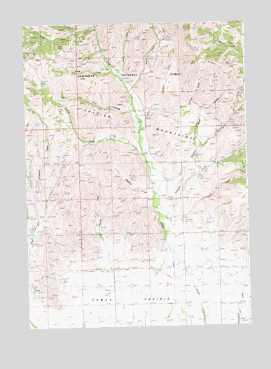
Phillips Creek, ID USGS Topographic Map
Click on map above to begin viewing in our Map Viewer.

This topographic map contains these locations and features:
Feature Name Type Latitude Longitude GNIS ID View Map
Bridge CreekStreamN43.4802°W114.8245°378215View Map
Brush CanyonValleyN43.4480°W114.7784°378320View Map
Camas CountyCivilN43.4633°W114.8058°399408View Map
Edwards GulchValleyN43.4302°W114.8065°381264View Map
Elk RidgeRidgeN43.4860°W114.7765°381393View Map
Free Gold CreekStreamN43.4607°W114.8117°382029View Map
Lawrence CreekStreamN43.4593°W114.8090°376074View Map
McCan GulchValleyN43.4063°W114.8298°386570View Map
Mountain View CemeteryCemeteryN43.4130°W114.7903°387301View Map
North Fork Soldier CreekStreamN43.4977°W114.8334°387787View Map
Owens CreekStreamN43.4721°W114.8153°388049View Map
Phillips CreekStreamN43.4482°W114.8092°388404View Map
Pioneer CampgroundLocaleN43.4906°W114.8311°388553View Map
Reedy CreekStreamN43.4771°W114.8198°389271View Map
Richard Allen MineMineN43.4680°W114.8159°389343View Map
Sampson CreekStreamN43.4310°W114.8003°389878View Map
Soldier Forest CampLocaleN43.4824°W114.8262°390822View Map
Soldier Mountain Ski AreaLocaleN43.4847°W114.8292°2071327View Map
South Fork Soldier CreekStreamN43.4977°W114.8334°391031View Map
Wardrop CreekStreamN43.4357°W114.7962°392835View Map
Wells SummitSummitN43.4791°W114.7584°392998View Map
Williams CreekStreamN43.4652°W114.8037°393928View Map

Note: Coordinates in the location and feature list above are referenced to NAD83 datum.


Copyright (C) 2008-2024 Ryan Niemi / Sunset Dynamics ... All Rights Reserved