TopoQuest Logo
Do you find TopoQuest useful?
Help keep TopoQuest running and adding new maps/features by donating!
Bitcoin:  19c7KJd3qBynnjoSw5npx9KScwjBe4ifkT
Litecoin:  LXs6TkuXGGXo1vDsWCkWVdjQX94eUKd6ui
Home View Maps Find Maps Find Places Resources & Links


Falmouth, Indiana Topographic Map

USGS Map Title: Falmouth, IN
USGS Map MRC: 39085F3
DRG (GeoTIFF) Download: o39085f3.tif


Neighboring USGS Topographic Map Quads:


  Dunreith, IN  
39085G4
 

  Lewisville, IN  
39085G3
 

  Cambridge City, IN  
39085G2
 

  Mays, IN  
39085F4
 

  Falmouth, IN  
39085F3
 

  Connersville, IN  
39085F2
 

  Rushville, IN  
39085E4
 

  New Salem, IN  
39085E3
 

  Alpine, IN  
39085E2


Map MRC Location:

N40°
W86°
N40°
W85°
H8 H7 H6 H5 H4 H3 H2 H1
G8 G7 G6 G5 G4 G3 G2 G1
F8 F7 F6 F5 F4 F3 F2 F1
E8 E7 E6 E5 E4 E3 E2 E1
D8 D7 D6 D5 D4 D3 D2 D1
C8 C7 C6 C5 C4 C3 C2 C1
B8 B7 B6 B5 B4 B3 B2 B1
A8 A7 A6 A5 A4 A3 A2 A1
N39°
W86°
N39°
W85°

Falmouth, IN USGS 1:24K Topographic Map Preview:
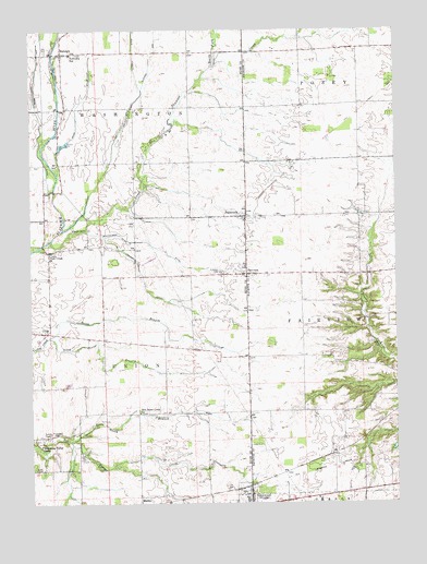
Falmouth, IN USGS Topographic Map
Click on map above to begin viewing in our Map Viewer.

This topographic map contains these locations and features:
Feature Name Type Latitude Longitude GNIS ID View Map
Ben Davis Creek ChurchChurchN39.6492°W85.3383°430792View Map
FairviewPopulated PlaceN39.6856°W85.3011°434309View Map
Fairview CemeteryCemeteryN39.6859°W85.3099°434320View Map
FalmouthPopulated PlaceN39.7009°W85.3011°434385View Map
Frazee Elementary SchoolSchoolN39.6409°W85.3461°434791View Map
GingsPopulated PlaceN39.6709°W85.3708°435089View Map
GlenwoodPopulated PlaceN39.6259°W85.3002°435123View Map
Glenwood Police DepartmentBuildingN39.6272°W85.3004°2758473View Map
Glidden ArmCanalN39.7439°W85.3316°435129View Map
Glidden DitchCanalN39.7348°W85.3361°453059View Map
Hinchman CemeteryCemeteryN39.6433°W85.3679°436228View Map
Kirkpatrick DitchCanalN39.6925°W85.3302°437360View Map
Lawless DitchCanalN39.6787°W85.3222°437663View Map
Mahoning Valley CampParkN39.6403°W85.3719°438479View Map
Miles DitchCanalN39.7317°W85.3561°439136View Map
North Branch Ben Davis CreekStreamN39.6417°W85.3616°440218View Map
North Branch Turkey CreekStreamN39.6692°W85.3689°440228View Map
North Fork Shawnee CreekStreamN39.7406°W85.3125°440258View Map
Plum Creek ChurchChurchN39.6912°W85.3686°441368View Map
Prine DitchCanalN39.7242°W85.3702°441602View Map
RaleighPopulated PlaceN39.7439°W85.3639°441751View Map
Raleigh Fire Department Station 1BuildingN39.7436°W85.3614°2701475View Map
Shaker RunStreamN39.7364°W85.3275°443269View Map
Shawnee CreekStreamN39.6948°W85.3677°443323View Map
South Branch Turkey CreekStreamN39.6692°W85.3689°443792View Map
Town of GlenwoodCivilN39.6261°W85.3021°2396962View Map
Township of FairviewCivilN39.6716°W85.2721°453289View Map
Township of UnionCivilN39.6588°W85.3560°453932View Map
Township of WashingtonCivilN39.7438°W85.3550°454018View Map
Wikoff DitchCanalN39.7153°W85.3475°446009View Map
Zion CemeteryCemeteryN39.7443°W85.3699°2575398View Map

Note: Coordinates in the location and feature list above are referenced to NAD83 datum.


Copyright (C) 2008-2024 Ryan Niemi / Sunset Dynamics ... All Rights Reserved