TopoQuest Logo
Do you find TopoQuest useful?
Help keep TopoQuest running and adding new maps/features by donating!
Bitcoin:  19c7KJd3qBynnjoSw5npx9KScwjBe4ifkT
Litecoin:  LXs6TkuXGGXo1vDsWCkWVdjQX94eUKd6ui
Home View Maps Find Maps Find Places Resources & Links


Falun, Wisconsin Topographic Map

USGS Map Title: Falun, WI
USGS Map MRC: 45092G5
DRG (GeoTIFF) Download: o45092g5.tif


Neighboring USGS Topographic Map Quads:


  Lake Clayton, MN  
45092H6
 

  Monson Lake, WI  
45092H5
 

  Yellow Lake, WI  
45092H4
 

  Grantsburg, WI  
45092G6
 

  Falun, WI  
45092G5
 

  Siren West, WI  
45092G4
 

  Trade River, WI  
45092F6
 

  Trade Lake, WI  
45092F5
 

  Frederic, WI  
45092F4


Map MRC Location:

N46°
W93°
N46°
W92°
H8 H7 H6 H5 H4 H3 H2 H1
G8 G7 G6 G5 G4 G3 G2 G1
F8 F7 F6 F5 F4 F3 F2 F1
E8 E7 E6 E5 E4 E3 E2 E1
D8 D7 D6 D5 D4 D3 D2 D1
C8 C7 C6 C5 C4 C3 C2 C1
B8 B7 B6 B5 B4 B3 B2 B1
A8 A7 A6 A5 A4 A3 A2 A1
N45°
W93°
N45°
W92°

Falun, WI USGS 1:24K Topographic Map Preview:
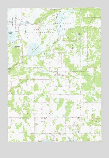
Falun, WI USGS Topographic Map
Click on map above to begin viewing in our Map Viewer.

This topographic map contains these locations and features:
Feature Name Type Latitude Longitude GNIS ID View Map
AlphaPopulated PlaceN45.7725°W92.5796°1560802View Map
Anscarius CemeteryCemeteryN45.7722°W92.6013°1560885View Map
Crex Meadows DamDamN45.8583°W92.6035°1793441View Map
Crex Meadows North Fork DikeDamN45.8300°W92.5969°1793437View Map
Crex Meadows State Public Hunting GroundsParkN45.8491°W92.6149°1563533View Map
Crex Meadows State Wildlife RefugeParkN45.8625°W92.6238°1843106View Map
Dike 1 FlowageReservoirN45.8607°W92.6035°1843118View Map
FalunPopulated PlaceN45.7719°W92.5277°1564850View Map
Freya CemeteryCemeteryN45.8124°W92.5577°1565320View Map
Hildas CornerLocaleN45.8611°W92.5380°1843133View Map
Indian LakeLakeN45.7590°W92.5310°1566920View Map
Middle North Fork FlowageReservoirN45.8436°W92.5820°2771602View Map
Midway TabernacleChurchN45.7730°W92.6221°1569449View Map
Nelson Elementary SchoolSchoolN45.7726°W92.5740°2713340View Map
North Fork FlowageReservoirN45.8354°W92.5897°1843154View Map
Paulson FlowageReservoirN45.8516°W92.5330°1843158View Map
Phantom Lake BypassCanalN45.8541°W92.6085°1843161View Map
Pumphouse DitchCanalN45.8505°W92.5999°1843163View Map
Reed LakeReservoirN45.8607°W92.6035°1793442View Map
Refuge BypassCanalN45.8650°W92.6130°1843166View Map
Sandberg FlowageReservoirN45.8327°W92.5716°1843175View Map
Smiths Stopping PlaceLocaleN45.8594°W92.5827°1843185View Map
South Refuge FlowageReservoirN45.8491°W92.6225°1843188View Map
Town of Wood RiverCivilN45.7725°W92.5894°1584478View Map
Upper North Fork FlowageReservoirN45.8625°W92.5522°1843197View Map
Upper Phantom FlowageReservoirN45.8393°W92.6173°1843198View Map
Wood CreekStreamN45.7822°W92.6191°1576962View Map
Wood Lake CemeteryCemeteryN45.7652°W92.5896°1576970View Map

Note: Coordinates in the location and feature list above are referenced to NAD83 datum.


Copyright (C) 2008-2024 Ryan Niemi / Sunset Dynamics ... All Rights Reserved