TopoQuest Logo
Do you find TopoQuest useful?
Help keep TopoQuest running and adding new maps/features by donating!
Bitcoin:  19c7KJd3qBynnjoSw5npx9KScwjBe4ifkT
Litecoin:  LXs6TkuXGGXo1vDsWCkWVdjQX94eUKd6ui
Home View Maps Find Maps Find Places Resources & Links


Fannett East, Texas Topographic Map

USGS Map Title: Fannett East, TX
USGS Map MRC: 29094H2
DRG (GeoTIFF) Download: o29094h2.tif


Neighboring USGS Topographic Map Quads:


  China, TX  
30094A3
 

  Beaumont West, TX  
30094A2
 

  Beaumont East, TX  
30094A1
 

  Fannett West, TX  
29094H3
 

  Fannett East, TX  
29094H2
 

  Port Acres, TX  
29094H1
 

  Hamshire, TX  
29094G3
 

  Alligator Hole Marsh, TX  
29094G2
 

  Big Hill Bayou, TX  
29094G1


Map MRC Location:

N30°
W95°
N30°
W94°
H8 H7 H6 H5 H4 H3 H2 H1
G8 G7 G6 G5 G4 G3 G2 G1
F8 F7 F6 F5 F4 F3 F2 F1
E8 E7 E6 E5 E4 E3 E2 E1
D8 D7 D6 D5 D4 D3 D2 D1
C8 C7 C6 C5 C4 C3 C2 C1
B8 B7 B6 B5 B4 B3 B2 B1
A8 A7 A6 A5 A4 A3 A2 A1
N29°
W95°
N29°
W94°

Fannett East, TX USGS 1:24K Topographic Map Preview:
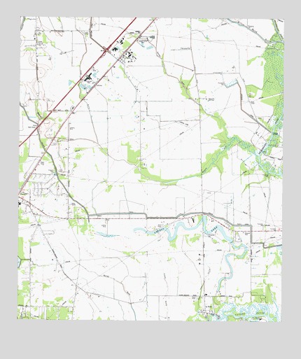
Fannett East, TX USGS Topographic Map
Click on map above to begin viewing in our Map Viewer.

This topographic map contains these locations and features:
Feature Name Type Latitude Longitude GNIS ID View Map
Bayou DinStreamN29.9433°W94.1368°1372419View Map
Bayou Din Golf ClubLocaleN29.9669°W94.1616°1384523View Map
Boyt LakeLakeN29.9774°W94.2377°1352794View Map
Broussard CemeteryCemeteryN29.9874°W94.1718°1352953View Map
CheekPopulated PlaceN29.9835°W94.2027°1354336View Map
Fannett Census Designated PlaceCensusN29.9249°W94.2390°2586930View Map
Fannett Church of ChristChurchN29.9791°W94.2071°2020666View Map
Fannett SchoolSchoolN29.9947°W94.2424°1357220View Map
GallowayPopulated PlaceN29.9724°W94.2138°1379821View Map
Hillebrandt CemeteryCemeteryN29.9477°W94.1285°1359271View Map
Jefferson CanalCanalN29.9619°W94.1438°1360198View Map
Kelley Crop Service AirportAirportN29.9156°W94.2087°1386627View Map
Kidd GullyValleyN29.9480°W94.2128°1374368View Map
La BellePopulated PlaceN29.8797°W94.1610°1360796View Map
Labelle - Fannett Volunteer Fire Department / Emergency Medical ServicesBuildingN29.9229°W94.2451°2334397View Map
Labelle - Fannett Volunteer Fire Department / Emergency Medical Services SubstationBuildingN29.8784°W94.1603°2655662View Map
Labelle DivisionCivilN29.9196°W94.1551°1938895View Map
Landrum CemeteryCemeteryN29.9477°W94.2324°1360921View Map
Lovell LakeLakeN29.9135°W94.1696°1361887View Map
Lovell LakePopulated PlaceN29.9424°W94.1257°1361888View Map
Lovell Lake Oil FieldOilfieldN29.9497°W94.1327°1361889View Map
Pevitot GullyValleyN29.9496°W94.1498°1372189View Map
Port Arthur Country ClubLocaleN29.8761°W94.1352°1384757View Map
Red Haw GullyValleyN29.8799°W94.1646°1366151View Map
Spindletop-Gladys City Boomtown MuseumBuildingN29.9294°W94.1610°2014634View Map
Willow Marsh BayouStreamN29.9908°W94.1263°1376823View Map

Note: Coordinates in the location and feature list above are referenced to NAD83 datum.


Copyright (C) 2008-2025 Ryan Niemi / Sunset Dynamics ... All Rights Reserved