TopoQuest Logo
Do you find TopoQuest useful?
Help keep TopoQuest running and adding new maps/features by donating!
Bitcoin:  19c7KJd3qBynnjoSw5npx9KScwjBe4ifkT
Litecoin:  LXs6TkuXGGXo1vDsWCkWVdjQX94eUKd6ui
Home View Maps Find Maps Find Places Resources & Links


Big Hill Bayou, Texas Topographic Map

USGS Map Title: Big Hill Bayou, TX
USGS Map MRC: 29094G1
DRG (GeoTIFF) Download: o29094g1.tif


Neighboring USGS Topographic Map Quads:


  Fannett East, TX  
29094H2
 

  Port Acres, TX  
29094H1
 

  Port Arthur North, TX  
29093H8
 

  Alligator Hole Marsh, TX  
29094G2
 

  Big Hill Bayou, TX  
29094G1
 

  Port Arthur South, TX  
29093G8
 

  Star Lake, TX  
29094F2
 

  Clam Lake, TX  
29094F1
 

  Sabine Pass, TX  
29093F8


Map MRC Location:

N30°
W95°
N30°
W94°
H8 H7 H6 H5 H4 H3 H2 H1
G8 G7 G6 G5 G4 G3 G2 G1
F8 F7 F6 F5 F4 F3 F2 F1
E8 E7 E6 E5 E4 E3 E2 E1
D8 D7 D6 D5 D4 D3 D2 D1
C8 C7 C6 C5 C4 C3 C2 C1
B8 B7 B6 B5 B4 B3 B2 B1
A8 A7 A6 A5 A4 A3 A2 A1
N29°
W95°
N29°
W94°

Big Hill Bayou, TX USGS 1:24K Topographic Map Preview:
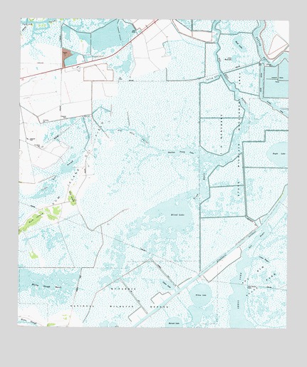
Big Hill Bayou, TX USGS Topographic Map
Click on map above to begin viewing in our Map Viewer.

This topographic map contains these locations and features:
Feature Name Type Latitude Longitude GNIS ID View Map
Barnett LakeLakeN29.7512°W94.0525°1330070View Map
Big Hill BayouGutN29.8499°W94.0288°1372553View Map
Big Hill Bayou Wildlife Management AreaParkN29.8274°W94.0249°1372554View Map
Big Hill ReservoirReservoirN29.8624°W94.0146°1372555View Map
Blind BayouBayN29.8080°W94.0388°1330868View Map
Blind LakeLakeN29.7955°W94.0502°1330869View Map
Cabin LakeLakeN29.7675°W94.0558°1331811View Map
Coffee Bean SloughLakeN29.8088°W94.1091°1333054View Map
Crane BayouBayN29.7783°W94.0110°1333621View Map
Derring GullyBayN29.8510°W94.0349°1334277View Map
Gum IslandIslandN29.7941°W94.1171°1337123View Map
Hog IslandIslandN29.8033°W94.1010°1337900View Map
J D Murphee State Wildlife Management AreaParkN29.8544°W94.0468°2029166View Map
Salt BayouBayN29.7863°W94.0141°1346191View Map
Shallow Prong LakeLakeN29.7875°W94.0516°1346960View Map
Shell LakeLakeN29.7569°W94.0229°1347016View Map
Willow LakeLakeN29.7607°W94.0403°1350198View Map

Note: Coordinates in the location and feature list above are referenced to NAD83 datum.


Copyright (C) 2008-2024 Ryan Niemi / Sunset Dynamics ... All Rights Reserved