TopoQuest Logo
Do you find TopoQuest useful?
Help keep TopoQuest running and adding new maps/features by donating!
Bitcoin:  19c7KJd3qBynnjoSw5npx9KScwjBe4ifkT
Litecoin:  LXs6TkuXGGXo1vDsWCkWVdjQX94eUKd6ui
Home View Maps Find Maps Find Places Resources & Links


Farm Lake, Minnesota Topographic Map

USGS Map Title: Farm Lake, MN
USGS Map MRC: 47091H6
DRG (GeoTIFF) Download: o47091h6.tif


Neighboring USGS Topographic Map Quads:


  Fourtown Lake, MN  
48091A7
 

  Basswood Lake West, MN  
48091A6
 

  Basswood Lake East, MN  
48091A5
 

  Ely, MN  
47091H7
 

  Farm Lake, MN  
47091H6
 

  Ojibway Lake, MN  
47091H5
 

  Kangas Bay, MN  
47091G7
 

  Bogberry Lake, MN  
47091G6
 

  Gabbro Lake, MN  
47091G5


Map MRC Location:

N48°
W92°
N48°
W91°
H8 H7 H6 H5 H4 H3 H2 H1
G8 G7 G6 G5 G4 G3 G2 G1
F8 F7 F6 F5 F4 F3 F2 F1
E8 E7 E6 E5 E4 E3 E2 E1
D8 D7 D6 D5 D4 D3 D2 D1
C8 C7 C6 C5 C4 C3 C2 C1
B8 B7 B6 B5 B4 B3 B2 B1
A8 A7 A6 A5 A4 A3 A2 A1
N47°
W92°
N47°
W91°

Farm Lake, MN USGS 1:24K Topographic Map Preview:
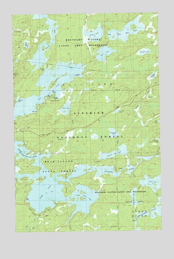
Farm Lake, MN USGS Topographic Map
Click on map above to begin viewing in our Map Viewer.

This topographic map contains these locations and features:
Feature Name Type Latitude Longitude GNIS ID View Map
Charlies IslandIslandN47.9646°W91.6974°659162View Map
Clear LakeLakeN47.9022°W91.6320°655745View Map
Ella Hall LakeLakeN47.9895°W91.6523°656145View Map
Eskwagama LakeLakeN47.8939°W91.6485°656169View Map
Fall LakeLakeN47.9501°W91.7413°656193View Map
Fall Lake CampgroundLocaleN47.9524°W91.7165°659158View Map
Farm LakeLakeN47.8994°W91.7253°656204View Map
Garden LakeLakeN47.9211°W91.7475°656355View Map
Kawishiwi RiverStreamN47.9055°W91.7174°656858View Map
Kemptons LakeLakeN47.9309°W91.6648°656876View Map
Mile IslandIslandN47.9607°W91.7162°657394View Map
Mud LakeLakeN47.9769°W91.6716°657517View Map
Mulkuk BayBayN47.9505°W91.7454°659163View Map
Muskeg LakeLakeN47.9881°W91.6794°657548View Map
Newton FallsFallsN47.9693°W91.7229°658825View Map
Newton LakeLakeN47.9837°W91.7233°657590View Map
Pea Soup LakeLakeN47.9437°W91.6616°657756View Map
Pickerel LakeLakeN47.9196°W91.6644°657813View Map
Slumber LakeLakeN47.9772°W91.6369°658307View Map
Sourdough LakeLakeN47.9635°W91.6300°658351View Map
South Farm LakeLakeN47.8891°W91.6924°658362View Map
Stub LakeLakeN47.9457°W91.7054°658511View Map
Superior Forest Lodge and CampgroundLocaleN47.8903°W91.7153°2093255View Map
Thirtythree LakeLakeN47.9825°W91.7381°659261View Map
Timber Trail Resort and CampgroundsLocaleN47.8889°W91.7347°2093256View Map

Note: Coordinates in the location and feature list above are referenced to NAD83 datum.


Copyright (C) 2008-2025 Ryan Niemi / Sunset Dynamics ... All Rights Reserved