TopoQuest Logo
Do you find TopoQuest useful?
Help keep TopoQuest running and adding new maps/features by donating!
Bitcoin:  19c7KJd3qBynnjoSw5npx9KScwjBe4ifkT
Litecoin:  LXs6TkuXGGXo1vDsWCkWVdjQX94eUKd6ui
Home View Maps Find Maps Find Places Resources & Links


Ojibway Lake, Minnesota Topographic Map

USGS Map Title: Ojibway Lake, MN
USGS Map MRC: 47091H5
DRG (GeoTIFF) Download: o47091h5.tif


Neighboring USGS Topographic Map Quads:


  Basswood Lake West, MN  
48091A6
 

  Basswood Lake East, MN  
48091A5
 

  Ensign Lake West, MN  
48091A4
 

  Farm Lake, MN  
47091H6
 

  Ojibway Lake, MN  
47091H5
 

  Snowbank Lake, MN  
47091H4
 

  Bogberry Lake, MN  
47091G6
 

  Gabbro Lake, MN  
47091G5
 

  Quadga Lake, MN  
47091G4


Map MRC Location:

N48°
W92°
N48°
W91°
H8 H7 H6 H5 H4 H3 H2 H1
G8 G7 G6 G5 G4 G3 G2 G1
F8 F7 F6 F5 F4 F3 F2 F1
E8 E7 E6 E5 E4 E3 E2 E1
D8 D7 D6 D5 D4 D3 D2 D1
C8 C7 C6 C5 C4 C3 C2 C1
B8 B7 B6 B5 B4 B3 B2 B1
A8 A7 A6 A5 A4 A3 A2 A1
N47°
W92°
N47°
W91°

Ojibway Lake, MN USGS 1:24K Topographic Map Preview:
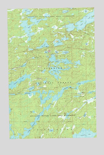
Ojibway Lake, MN USGS Topographic Map
Click on map above to begin viewing in our Map Viewer.

This topographic map contains these locations and features:
Feature Name Type Latitude Longitude GNIS ID View Map
Astray LakeLakeN47.9007°W91.5897°655172View Map
Carefree LakeLakeN47.9147°W91.5269°655634View Map
Clearwater LakeLakeN47.8763°W91.5201°655750View Map
Conchu LakeLakeN47.9231°W91.5923°655781View Map
Cortes LakeLakeN47.8825°W91.5648°655810View Map
Dan LakeLakeN47.9378°W91.6249°655926View Map
Finch LakeLakeN47.9963°W91.5121°659134View Map
Gem LakeLakeN47.9647°W91.5119°656362View Map
Glacier PondLakeN47.9577°W91.5702°656381View Map
Greenstone LakeLakeN47.9300°W91.6111°656453View Map
Hula LakeLakeN47.9978°W91.5969°656675View Map
Jasper CreekStreamN47.9843°W91.5465°659135View Map
Jasper LakeLakeN47.9675°W91.5501°656774View Map
Jewell LakeLakeN47.9459°W91.5663°656788View Map
Kamimela LakeLakeN47.9394°W91.5742°656849View Map
Lark LakeLakeN47.9292°W91.5728°659133View Map
Madden CreekStreamN47.9746°W91.5993°657277View Map
Madden LakeLakeN47.9456°W91.6030°657278View Map
Moose LakeLakeN47.9932°W91.5047°657470View Map
Ojibway LakeLakeN47.9467°W91.5431°658796View Map
Pagami CreekStreamN47.9121°W91.5043°657723View Map
Pagami LakeLakeN47.8969°W91.5400°657724View Map
Plukesley LakeLakeN47.9177°W91.5182°659129View Map
Refuge PondLakeN47.9577°W91.5555°658012View Map
Rookie LakeLakeN47.9607°W91.5933°658085View Map
Section Twelve LakeLakeN47.9571°W91.5427°655618View Map
Tofte LakeLakeN47.9645°W91.5737°658703View Map
Triangle LakeLakeN47.9388°W91.5551°658745View Map
Uncle Judas CreekStreamN47.9788°W91.5173°658810View Map
Upper Uranus LakeLakeN47.9321°W91.5837°659132View Map
Uranus LakeLakeN47.9271°W91.5832°658830View Map
Weasel LakeLakeN47.8966°W91.5163°658916View Map
Wedge LakeLakeN47.9524°W91.5890°658922View Map
Witness LakeLakeN47.9963°W91.5420°659052View Map
Wood LakeLakeN47.9839°W91.5907°659066View Map

Note: Coordinates in the location and feature list above are referenced to NAD83 datum.


Copyright (C) 2008-2025 Ryan Niemi / Sunset Dynamics ... All Rights Reserved