TopoQuest Logo
Do you find TopoQuest useful?
Help keep TopoQuest running and adding new maps/features by donating!
Bitcoin:  19c7KJd3qBynnjoSw5npx9KScwjBe4ifkT
Litecoin:  LXs6TkuXGGXo1vDsWCkWVdjQX94eUKd6ui
Home View Maps Find Maps Find Places Resources & Links


Farmersburg, Iowa Topographic Map

USGS Map Title: Farmersburg, IA
USGS Map MRC: 42091H3
DRG (GeoTIFF) Download: o42091h3.tif


Neighboring USGS Topographic Map Quads:


  Monona, IA  
43091A4
 

  Giard, IA  
43091A3
 

  Prairie du Chien, WI  
43091A2
 

  Saint Olaf, IA  
42091H4
 

  Farmersburg, IA  
42091H3
 

  Clayton, IA  
42091H2
 

  Elkader, IA  
42091G4
 

  Littleport, IA  
42091G3
 

  Garnavillo, IA  
42091G2


Map MRC Location:

N43°
W92°
N43°
W91°
H8 H7 H6 H5 H4 H3 H2 H1
G8 G7 G6 G5 G4 G3 G2 G1
F8 F7 F6 F5 F4 F3 F2 F1
E8 E7 E6 E5 E4 E3 E2 E1
D8 D7 D6 D5 D4 D3 D2 D1
C8 C7 C6 C5 C4 C3 C2 C1
B8 B7 B6 B5 B4 B3 B2 B1
A8 A7 A6 A5 A4 A3 A2 A1
N42°
W92°
N42°
W91°

Farmersburg, IA USGS 1:24K Topographic Map Preview:
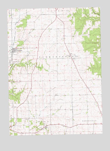
Farmersburg, IA USGS Topographic Map
Click on map above to begin viewing in our Map Viewer.

This topographic map contains these locations and features:
Feature Name Type Latitude Longitude GNIS ID View Map
Bismark Post Office (historical)Post OfficeN42.9967°W91.3582°466462View Map
Bismark StationLocaleN42.9967°W91.3582°463995View Map
City of FarmersburgCivilN42.9589°W91.3671°2394745View Map
Clayton CenterPopulated PlaceN42.8833°W91.3268°455451View Map
Clayton Center CemeteryCemeteryN42.8841°W91.3226°1949295View Map
Clayton County FarmBuildingN42.8911°W91.3521°463646View Map
Colony Catholic CemeteryCemeteryN42.8833°W91.3585°1949297View Map
County Home CemeteryCemeteryN42.8917°W91.3501°1949240View Map
Driftless Area National Wildlife RefugeParkN42.9466°W91.3624°2765275View Map
Dry HollowValleyN42.9462°W91.3583°456026View Map
FarmersburgPopulated PlaceN42.9611°W91.3679°456536View Map
Farmersburg - Wagner CemeteryCemeteryN42.9480°W91.3701°456552View Map
Farmersburg (historical)LocaleN42.9597°W91.3690°1949179View Map
Farmersburg Fire DepartmentBuildingN42.9579°W91.3683°1949178View Map
Farmersburg LibraryBuildingN42.9611°W91.3679°1949177View Map
Farmersburg Post OfficePost OfficeN42.9611°W91.3679°1949175View Map
Giard CemeteryCemeteryN42.9930°W91.3088°456894View Map
KCTN-FM (Garnavillo)TowerN42.8850°W91.3199°467121View Map
NationalLocaleN42.9505°W91.2893°459439View Map
National CemeteryCemeteryN42.9534°W91.2906°459442View Map
National Post Office (historical)Post OfficeN42.9505°W91.2893°1949028View Map
Read Post Office (historical)Post OfficeN42.8869°W91.3293°1949019View Map
Saint John Lutheran ChurchChurchN42.9611°W91.3679°1949176View Map
Sigel Post Office (historical)Post OfficeN42.8925°W91.3687°1949017View Map
Township of FarmersburgCivilN42.9500°W91.3102°467822View Map
Wabasha Post Office (historical)Post OfficeN42.8778°W91.3501°1949013View Map
Winkawitsch CemeteryCemeteryN42.9792°W91.3501°1949238View Map
Zion Lutheran CemeteryCemeteryN42.8841°W91.3251°1949296View Map

Note: Coordinates in the location and feature list above are referenced to NAD83 datum.


Copyright (C) 2008-2024 Ryan Niemi / Sunset Dynamics ... All Rights Reserved