TopoQuest Logo
Do you find TopoQuest useful?
Help keep TopoQuest running and adding new maps/features by donating!
Bitcoin:  19c7KJd3qBynnjoSw5npx9KScwjBe4ifkT
Litecoin:  LXs6TkuXGGXo1vDsWCkWVdjQX94eUKd6ui
Home View Maps Find Maps Find Places Resources & Links


Littleport, Iowa Topographic Map

USGS Map Title: Littleport, IA
USGS Map MRC: 42091G3
DRG (GeoTIFF) Download: o42091g3.tif


Neighboring USGS Topographic Map Quads:


  Saint Olaf, IA  
42091H4
 

  Farmersburg, IA  
42091H3
 

  Clayton, IA  
42091H2
 

  Elkader, IA  
42091G4
 

  Littleport, IA  
42091G3
 

  Garnavillo, IA  
42091G2
 

  Edgewood, IA  
42091F4
 

  Garber, IA  
42091F3
 

  Colesburg, IA  
42091F2


Map MRC Location:

N43°
W92°
N43°
W91°
H8 H7 H6 H5 H4 H3 H2 H1
G8 G7 G6 G5 G4 G3 G2 G1
F8 F7 F6 F5 F4 F3 F2 F1
E8 E7 E6 E5 E4 E3 E2 E1
D8 D7 D6 D5 D4 D3 D2 D1
C8 C7 C6 C5 C4 C3 C2 C1
B8 B7 B6 B5 B4 B3 B2 B1
A8 A7 A6 A5 A4 A3 A2 A1
N42°
W92°
N42°
W91°

Littleport, IA USGS 1:24K Topographic Map Preview:
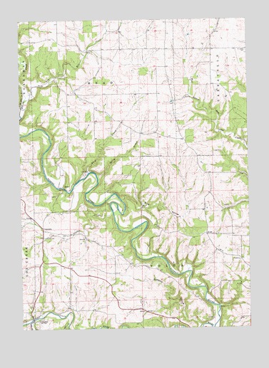
Littleport, IA USGS Topographic Map
Click on map above to begin viewing in our Map Viewer.

This topographic map contains these locations and features:
Feature Name Type Latitude Longitude GNIS ID View Map
Beddows HollowValleyN42.7514°W91.2779°454469View Map
Bente BranchStreamN42.8133°W91.3376°464459View Map
Blanchaine CemeteryCemeteryN42.7667°W91.3418°1949251View Map
Chapin CemeteryCemeteryN42.8631°W91.3524°1949241View Map
Clayton CountyCivilN42.8447°W91.3414°465210View Map
Clayton County FairgroundsLocaleN42.7811°W91.2854°463645View Map
CommuniaPopulated PlaceN42.7900°W91.3629°464505View Map
Communia CemeteryCemeteryN42.7869°W91.3630°455554View Map
Communia Post Office (historical)Post OfficeN42.7900°W91.3629°1949045View Map
Doe CreekStreamN42.7519°W91.3496°455941View Map
Dry Mill CreekStreamN42.8422°W91.3732°456028View Map
Dry Run BridgeBridgeN42.7539°W91.3690°1949335View Map
Eberhard CemeteryCemeteryN42.7583°W91.3418°1949280View Map
Garnavillo Township CulbertBridgeN42.8667°W91.2585°1949331View Map
Hartshey CemeteryCemeteryN42.7555°W91.2835°1949278View Map
Honey CreekStreamN42.7539°W91.3679°457612View Map
Krumm CemeteryCemeteryN42.7914°W91.3024°1949279View Map
LittleportPopulated PlaceN42.7547°W91.3693°458533View Map
Littleport (historical)LocaleN42.7547°W91.3693°1949054View Map
Littleport Fire DepartmentBuildingN42.7506°W91.3702°2577166View Map
Littleport First Respond Ambulance ServiceBuildingN42.7502°W91.3701°2599906View Map
Littleport Post OfficePost OfficeN42.7547°W91.3693°1949052View Map
Littleport Public LibraryBuildingN42.7547°W91.3693°1949053View Map
Meenan CemeteryCemeteryN42.8000°W91.3585°1949281View Map
MotorPopulated PlaceN42.8069°W91.3512°464661View Map
Motor Mill (historical)LocaleN42.8069°W91.3501°1949190View Map
Motor Mill AccessLocaleN42.8067°W91.3515°1948990View Map
Motor Mill BridgeBridgeN42.8069°W91.3512°1949326View Map
Old Garber CemeteryCemeteryN42.7555°W91.2585°1949277View Map
Panther CreekStreamN42.7961°W91.3249°460013View Map
Pine HollowValleyN42.8022°W91.3198°460172View Map
Read Township CulvertBridgeN42.8333°W91.3196°1949327View Map
Rentz Memorial Woods State PreserveParkN42.8153°W91.3418°1948984View Map
Roberts CreekStreamN42.8369°W91.3749°460697View Map
Saint Joseph CemeteryCemeteryN42.8628°W91.2504°461084View Map
Saint Joseph CemeteryCemeteryN42.8625°W91.2501°461095View Map
Spring BranchStreamN42.8103°W91.3329°464752View Map
Township of ReadCivilN42.8570°W91.3314°468589View Map
Township of VolgaCivilN42.7733°W91.2958°468876View Map
Union CemeteryCemeteryN42.8083°W91.3501°1949282View Map
Upper Mississippi Region - 2-digit Hydrologic Unit Code - 07AreaN42.8612°W91.3174°2730137View Map

Note: Coordinates in the location and feature list above are referenced to NAD83 datum.


Copyright (C) 2008-2024 Ryan Niemi / Sunset Dynamics ... All Rights Reserved