TopoQuest Logo
Do you find TopoQuest useful?
Help keep TopoQuest running and adding new maps/features by donating!
Bitcoin:  19c7KJd3qBynnjoSw5npx9KScwjBe4ifkT
Litecoin:  LXs6TkuXGGXo1vDsWCkWVdjQX94eUKd6ui
Home View Maps Find Maps Find Places Resources & Links


Farwell Mountain, Colorado Topographic Map

USGS Map Title: Farwell Mountain, CO
USGS Map MRC: 40106G7
DRG (GeoTIFF) Download: o40106g7.tif


Neighboring USGS Topographic Map Quads:


  Elkhorn Mountain, CO  
40106H8
 

  West Fork Lake, CO  
40106H7
 

  Davis Peak, CO  
40106H6
 

  Hahns Peak, CO  
40106G8
 

  Farwell Mountain, CO  
40106G7
 

  Mount Zirkel, CO  
40106G6
 

  Clark, CO  
40106F8
 

  Floyd Peak, CO  
40106F7
 

  Mount Ethel, CO  
40106F6


Map MRC Location:

N41°
W107°
N41°
W106°
H8 H7 H6 H5 H4 H3 H2 H1
G8 G7 G6 G5 G4 G3 G2 G1
F8 F7 F6 F5 F4 F3 F2 F1
E8 E7 E6 E5 E4 E3 E2 E1
D8 D7 D6 D5 D4 D3 D2 D1
C8 C7 C6 C5 C4 C3 C2 C1
B8 B7 B6 B5 B4 B3 B2 B1
A8 A7 A6 A5 A4 A3 A2 A1
N40°
W107°
N40°
W106°

Farwell Mountain, CO USGS 1:24K Topographic Map Preview:
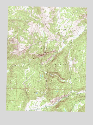
Farwell Mountain, CO USGS Topographic Map
Click on map above to begin viewing in our Map Viewer.

This topographic map contains these locations and features:
Feature Name Type Latitude Longitude GNIS ID View Map
Agnes CreekStreamN40.8469°W106.7545°170503View Map
Boulder ParkFlatN40.7639°W106.7923°170487View Map
Box CanyonValleyN40.7677°W106.7786°170488View Map
Coulton Creek TrailTrailN40.7741°W106.8450°169369View Map
Diamond ParkFlatN40.8508°W106.7575°170485View Map
Dome PeakSummitN40.8741°W106.8209°170492View Map
English CreekStreamN40.7830°W106.7734°170505View Map
Farwell CreekStreamN40.8316°W106.8059°170499View Map
Farwell LakeLakeN40.8402°W106.8262°170495View Map
Farwell MountainSummitN40.8241°W106.8489°170496View Map
Farwell Mountain Northwest MineMineN40.8305°W106.8600°1683291View Map
Hinman CanyonValleyN40.8050°W106.8223°170493View Map
Hinman CreekStreamN40.7505°W106.8387°170501View Map
Hinman Creek TrailTrailN40.8075°W106.8139°196775View Map
Hinman ParkFlatN40.7583°W106.8275°170486View Map
Hole-in-Wall CanyonValleyN40.7951°W106.8146°170497View Map
King Solomon Creek MineMineN40.8541°W106.8628°1683292View Map
Lost Dog CreekStreamN40.7930°W106.7750°170504View Map
Middle Fork Elk RiverStreamN40.7703°W106.7750°170484View Map
North Fork Elk CreekStreamN40.7697°W106.7742°170507View Map
North Three Island CreekStreamN40.7647°W106.7500°170428View Map
Scott RunStreamN40.7975°W106.8170°170498View Map
Seedhouse Guard StationLocaleN40.7750°W106.7645°170491View Map
South Fork Elk RiverStreamN40.7555°W106.8139°170506View Map
Stevens CreekStreamN40.8386°W106.7698°170502View Map
Trail CreekStreamN40.8247°W106.7770°169921View Map
Zinc Mountain MineMineN40.8091°W106.7923°1683293View Map

Note: Coordinates in the location and feature list above are referenced to NAD83 datum.


Copyright (C) 2008-2025 Ryan Niemi / Sunset Dynamics ... All Rights Reserved