TopoQuest Logo
Do you find TopoQuest useful?
Help keep TopoQuest running and adding new maps/features by donating!
Bitcoin:  19c7KJd3qBynnjoSw5npx9KScwjBe4ifkT
Litecoin:  LXs6TkuXGGXo1vDsWCkWVdjQX94eUKd6ui
Home View Maps Find Maps Find Places Resources & Links


Elkhorn Mountain, Colorado Topographic Map

USGS Map Title: Elkhorn Mountain, CO
USGS Map MRC: 40106H8
DRG (GeoTIFF) Download: o40106h8.tif


Neighboring USGS Topographic Map Quads:


  Fletcher Peak, WY  
41107A1
 

  Solomon Creek, WY  
41106A8
 

  Dudley Creek, WY  
41106A7
 

  Shield Mountain, CO  
40107H1
 

  Elkhorn Mountain, CO  
40106H8
 

  West Fork Lake, CO  
40106H7
 

  Meaden Peak, CO  
40107G1
 

  Hahns Peak, CO  
40106G8
 

  Farwell Mountain, CO  
40106G7


Map MRC Location:

N41°
W107°
N41°
W106°
H8 H7 H6 H5 H4 H3 H2 H1
G8 G7 G6 G5 G4 G3 G2 G1
F8 F7 F6 F5 F4 F3 F2 F1
E8 E7 E6 E5 E4 E3 E2 E1
D8 D7 D6 D5 D4 D3 D2 D1
C8 C7 C6 C5 C4 C3 C2 C1
B8 B7 B6 B5 B4 B3 B2 B1
A8 A7 A6 A5 A4 A3 A2 A1
N40°
W107°
N40°
W106°

Elkhorn Mountain, CO USGS 1:24K Topographic Map Preview:
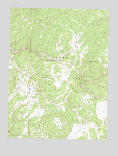
Elkhorn Mountain, CO USGS Topographic Map
Click on map above to begin viewing in our Map Viewer.

This topographic map contains these locations and features:
Feature Name Type Latitude Longitude GNIS ID View Map
Big Red ParkFlatN40.9027°W106.8784°201867View Map
Box CreekStreamN40.9311°W106.9851°169889View Map
Butter HillSummitN40.9319°W106.9951°169913View Map
Circle Bar BasinFlatN40.8902°W106.9381°169915View Map
Crane ParkFlatN40.9333°W106.9339°169912View Map
Dead Mexican ParkFlatN40.8958°W106.9153°169914View Map
Dead Mexican Park CemeteryCemeteryN40.8959°W106.9152°2400530View Map
Elkhorn MineMineN40.9844°W106.9520°169917View Map
Elkhorn MountainSummitN40.9875°W106.9648°169909View Map
Independence CreekStreamN40.9239°W106.9767°169908View Map
King Solomon Creek MineMineN40.9080°W106.9453°1683261View Map
Little Red ParkFlatN40.8833°W106.9089°201868View Map
Little Snake MineMineN40.9325°W106.9114°1683260View Map
McCargar DamDamN40.9050°W106.9706°200996View Map
McCargar ReservoirReservoirN40.9051°W106.9723°200997View Map
Middle Fork LodeMineN40.9450°W106.9203°1683259View Map
Pioneer CreekStreamN40.9539°W106.9353°169911View Map
Silver City CreekStreamN40.9114°W106.8750°169906View Map
Smith CreekStreamN40.9016°W106.9720°169890View Map
Summit CreekStreamN40.9022°W106.9609°169907View Map
Summit Creek Guard StationLocaleN40.8794°W106.9764°169916View Map
Whiskey CreekStreamN40.9496°W106.9409°169905View Map
Whiskey ParkFlatN40.9694°W106.9159°169910View Map
Whiskey Park MineMineN40.9694°W106.9262°1683258View Map

Note: Coordinates in the location and feature list above are referenced to NAD83 datum.


Copyright (C) 2008-2025 Ryan Niemi / Sunset Dynamics ... All Rights Reserved