TopoQuest Logo
Do you find TopoQuest useful?
Help keep TopoQuest running and adding new maps/features by donating!
Bitcoin:  19c7KJd3qBynnjoSw5npx9KScwjBe4ifkT
Litecoin:  LXs6TkuXGGXo1vDsWCkWVdjQX94eUKd6ui
Home View Maps Find Maps Find Places Resources & Links


Fayette, Indiana Topographic Map

USGS Map Title: Fayette, IN
USGS Map MRC: 39086H4
DRG (GeoTIFF) Download: o39086h4.tif


Neighboring USGS Topographic Map Quads:


  Hazelrigg, IN  
40086A5
 

  Lebanon, IN  
40086A4
 

  Rosston, IN  
40086A3
 

  Lizton, IN  
39086H5
 

  Fayette, IN  
39086H4
 

  Zionsville, IN  
39086H3
 

  Danville, IN  
39086G5
 

  Brownsburg, IN  
39086G4
 

  Clermont, IN  
39086G3


Map MRC Location:

N40°
W87°
N40°
W86°
H8 H7 H6 H5 H4 H3 H2 H1
G8 G7 G6 G5 G4 G3 G2 G1
F8 F7 F6 F5 F4 F3 F2 F1
E8 E7 E6 E5 E4 E3 E2 E1
D8 D7 D6 D5 D4 D3 D2 D1
C8 C7 C6 C5 C4 C3 C2 C1
B8 B7 B6 B5 B4 B3 B2 B1
A8 A7 A6 A5 A4 A3 A2 A1
N39°
W87°
N39°
W86°

Fayette, IN USGS 1:24K Topographic Map Preview:
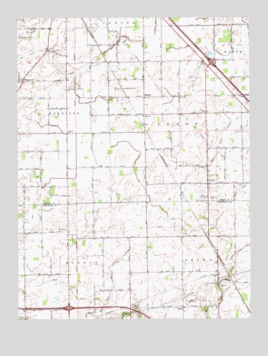
Fayette, IN USGS Topographic Map
Click on map above to begin viewing in our Map Viewer.

This topographic map contains these locations and features:
Feature Name Type Latitude Longitude GNIS ID View Map
Beaman DitchCanalN39.8873°W86.4111°430605View Map
Bethesda CemeteryCemeteryN39.8883°W86.3915°430964View Map
Bethesda ChurchChurchN39.8795°W86.4114°430968View Map
Bett DitchCanalN39.9648°W86.4642°430991View Map
Brock DitchCanalN39.9973°W86.3764°431553View Map
Brownsburg Fire Station 132BuildingN39.9087°W86.3935°2626209View Map
Central SchoolSchoolN39.9606°W86.3992°432368View Map
Concord ChurchChurchN39.9523°W86.4728°432863View Map
Corinth ChurchChurchN39.9095°W86.4094°432967View Map
Cynthiana ChurchChurchN39.9595°W86.4308°433273View Map
Dickerson CemeteryCemeteryN39.9244°W86.3949°433537View Map
Edlin DitchCanalN39.9992°W86.4617°434024View Map
FayettePopulated PlaceN39.9312°W86.3972°434422View Map
HerrPopulated PlaceN39.9556°W86.4317°436061View Map
Howards CemeteryCemeteryN39.9307°W86.3813°436533View Map
Johnson CemeteryCemeteryN39.9163°W86.3977°437039View Map
Keeney DitchCanalN39.8895°W86.4761°437189View Map
Main Edlin DitchCanalN39.9853°W86.4908°438486View Map
Martin Dugan DitchCanalN39.9042°W86.3786°438674View Map
MilledgevillePopulated PlaceN39.9742°W86.4969°439175View Map
Mount Tabor ChurchChurchN39.9381°W86.3981°439711View Map
Mount Union CemeteryCemeteryN39.9862°W86.4809°439716View Map
Perry Township Volunteer Fire DepartmentBuildingN39.9316°W86.3981°2625835View Map
Seven Mile PrairieFlatN39.9453°W86.4758°448357View Map
ShepherdPopulated PlaceN39.9673°W86.4314°443358View Map
Smith - Shepherd CemeteryCemeteryN39.9164°W86.3978°2093547View Map
Smith CemeteryCemeteryN39.9750°W86.4075°443670View Map
Township of BrownCivilN39.8909°W86.3791°453138View Map
Township of HarrisonCivilN39.9585°W86.4957°453379View Map
Township of PerryCivilN39.9553°W86.4076°453716View Map
Weaver CemeteryCemeteryN39.8804°W86.4359°445598View Map
White Lick Golf CourseLocaleN39.9248°W86.4000°452413View Map
Wiley Thompson DitchCanalN39.9220°W86.4267°446032View Map
WNON-FM (Lebanon)TowerN39.9598°W86.4461°448982View Map

Note: Coordinates in the location and feature list above are referenced to NAD83 datum.


Copyright (C) 2008-2024 Ryan Niemi / Sunset Dynamics ... All Rights Reserved