TopoQuest Logo
Do you find TopoQuest useful?
Help keep TopoQuest running and adding new maps/features by donating!
Bitcoin:  19c7KJd3qBynnjoSw5npx9KScwjBe4ifkT
Litecoin:  LXs6TkuXGGXo1vDsWCkWVdjQX94eUKd6ui
Home View Maps Find Maps Find Places Resources & Links


Danville, Indiana Topographic Map

USGS Map Title: Danville, IN
USGS Map MRC: 39086G5
DRG (GeoTIFF) Download: o39086g5.tif


Neighboring USGS Topographic Map Quads:


  New Ross, IN  
39086H6
 

  Lizton, IN  
39086H5
 

  Fayette, IN  
39086H4
 

  North Salem, IN  
39086G6
 

  Danville, IN  
39086G5
 

  Brownsburg, IN  
39086G4
 

  Coatesville, IN  
39086F6
 

  Clayton, IN  
39086F5
 

  Plainfield, IN  
39086F4


Map MRC Location:

N40°
W87°
N40°
W86°
H8 H7 H6 H5 H4 H3 H2 H1
G8 G7 G6 G5 G4 G3 G2 G1
F8 F7 F6 F5 F4 F3 F2 F1
E8 E7 E6 E5 E4 E3 E2 E1
D8 D7 D6 D5 D4 D3 D2 D1
C8 C7 C6 C5 C4 C3 C2 C1
B8 B7 B6 B5 B4 B3 B2 B1
A8 A7 A6 A5 A4 A3 A2 A1
N39°
W87°
N39°
W86°

Danville, IN USGS 1:24K Topographic Map Preview:
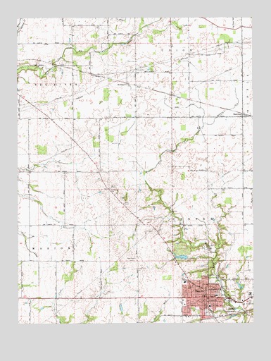
Danville, IN USGS Topographic Map
Click on map above to begin viewing in our Map Viewer.

This topographic map contains these locations and features:
Feature Name Type Latitude Longitude GNIS ID View Map
Arnold CemeteryCemeteryN39.7872°W86.5192°2093548View Map
Arnold Stuart CemeteryCemeteryN39.8201°W86.5419°2093549View Map
Ayears CemeteryCemeteryN39.7935°W86.5148°2093550View Map
Barnette DitchCanalN39.8512°W86.5119°430514View Map
Cofer CemeteryCemeteryN39.8132°W86.5159°2093645View Map
DanvillePopulated PlaceN39.7606°W86.5264°433314View Map
Danville Apostolic ChurchChurchN39.7528°W86.5358°2094655View Map
Danville Christian ChurchChurchN39.7611°W86.5261°2094656View Map
Danville Community High SchoolSchoolN39.7617°W86.5203°447018View Map
Danville Conservation Club LakeReservoirN39.7651°W86.5071°448397View Map
Danville Conservation Club Lake DamDamN39.7634°W86.5067°448396View Map
Danville Courthouse Square Historic DistrictParkN39.7603°W86.5244°2663157View Map
Danville East CemeteryCemeteryN39.7622°W86.5186°2093646View Map
Danville Fire Department Station 192BuildingN39.7558°W86.5049°2626184View Map
Danville Fire Department Station 91BuildingN39.7614°W86.5276°2625910View Map
Danville Police DepartmentBuildingN39.7613°W86.5198°2758381View Map
Danville South CemeteryCemeteryN39.7544°W86.5250°2093647View Map
Danville United Methodist ChurchChurchN39.7575°W86.5367°2094657View Map
Devenport CemeteryCemeteryN39.8377°W86.6123°2093779View Map
Dunbar FieldAirportN39.8466°W86.5090°2677077View Map
Eads DitchCanalN39.8384°W86.5383°433832View Map
Ellis ParkParkN39.7622°W86.5164°2094658View Map
Gentry CemeteryCemeteryN39.7868°W86.5633°2093648View Map
Hardwick CemeteryCemeteryN39.7756°W86.5636°2093649View Map
Hendricks CountyCivilN39.7695°W86.5100°450358View Map
Hendricks County Sheriff's OfficeBuildingN39.7586°W86.5040°2758334View Map
Hendricks Regional HealthHospitalN39.7619°W86.5020°2660432View Map
Hyten CemeteryCemeteryN39.8025°W86.5197°2093656View Map
JR's AirportAirportN39.8196°W86.5423°449139View Map
Kiger CemeteryCemeteryN39.7814°W86.5167°2093660View Map
Layne FieldAirportN39.7785°W86.6149°2676948View Map
Leach Number 1 CemeteryCemeteryN39.8600°W86.5540°2094100View Map
Leach Number 2 CemeteryCemeteryN39.8744°W86.5483°2094101View Map
MaplewoodPopulated PlaceN39.8345°W86.5053°438584View Map
Mary Queen Of Peace ChurchChurchN39.7592°W86.5375°2094659View Map
Meadors FieldAirportN39.7916°W86.5744°2677070View Map
MontclairPopulated PlaceN39.8481°W86.5669°439352View Map
Mount Pleasant CemeteryCemeteryN39.8048°W86.5761°439656View Map
Nichols CemeteryCemeteryN39.7536°W86.5677°2093672View Map
Noland Number 2 CemeteryCemeteryN39.7992°W86.5689°2093766View Map
North Elementary SchoolSchoolN39.7670°W86.5369°447016View Map
Peck CemeteryCemeteryN39.7750°W86.6230°2094086View Map
PHI Air Medical - DanvilleBuildingN39.7636°W86.5002°2719372View Map
Primitive Baptist CemeteryCemeteryN39.7619°W86.5197°2093767View Map
Pritchett CemeteryCemeteryN39.8636°W86.5665°2094103View Map
Rawlings Family CemeteryCemeteryN39.8052°W86.5772°2094084View Map
Reynolds Landing Strip (historical)AirportN39.8453°W86.5861°449292View Map
Saint Augustine Episcopal ChurchChurchN39.7692°W86.5244°442490View Map
Saint Augustine Memorial GardensCemeteryN39.7694°W86.5250°2093768View Map
Sears CemeteryCemeteryN39.7871°W86.5867°2094089View Map
Shannon CemeteryCemeteryN39.8039°W86.6043°2094090View Map
South Elementary SchoolSchoolN39.7575°W86.5236°447017View Map
Stout LakeReservoirN39.7772°W86.5379°448482View Map
Stout Lake DamDamN39.7767°W86.5350°448483View Map
Templin CemeteryCemeteryN39.7807°W86.5238°2093769View Map
Thompson CreekStreamN39.7789°W86.5200°449535View Map
Tinder CemeteryCemeteryN39.8146°W86.6042°2094091View Map
Town of DanvilleCivilN39.7607°W86.5083°2396678View Map
Township of CenterCivilN39.7707°W86.5208°453181View Map
Trotter CemeteryCemeteryN39.8571°W86.6063°2093790View Map
WGRT-FM (Danville)TowerN39.7792°W86.5419°448978View Map
Windridge Jersey FarmLocaleN39.7700°W86.5628°2628456View Map

Note: Coordinates in the location and feature list above are referenced to NAD83 datum.


Copyright (C) 2008-2025 Ryan Niemi / Sunset Dynamics ... All Rights Reserved