TopoQuest Logo
Do you find TopoQuest useful?
Help keep TopoQuest running and adding new maps/features by donating!
Bitcoin:  19c7KJd3qBynnjoSw5npx9KScwjBe4ifkT
Litecoin:  LXs6TkuXGGXo1vDsWCkWVdjQX94eUKd6ui
Home View Maps Find Maps Find Places Resources & Links


Fern Canyon, California Topographic Map

USGS Map Title: Fern Canyon, CA
USGS Map MRC: 41124D1
DRG (GeoTIFF) Download: o41124d1.tif


Neighboring USGS Topographic Map Quads:


  Requa, CA  
41124E1
 

  Klamath Glen, CA  
41123E8


  Fern Canyon, CA  
41124D1
 

  Ah Pah Ridge, CA  
41123D8


  Orick, CA  
41124C1
 

  Holter Ridge, CA  
41123C8


Map MRC Location:

N42°
W125°
N42°
W124°
H8 H7 H6 H5 H4 H3 H2 H1
G8 G7 G6 G5 G4 G3 G2 G1
F8 F7 F6 F5 F4 F3 F2 F1
E8 E7 E6 E5 E4 E3 E2 E1
D8 D7 D6 D5 D4 D3 D2 D1
C8 C7 C6 C5 C4 C3 C2 C1
B8 B7 B6 B5 B4 B3 B2 B1
A8 A7 A6 A5 A4 A3 A2 A1
N41°
W125°
N41°
W124°

Fern Canyon, CA USGS 1:24K Topographic Map Preview:
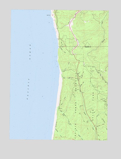
Fern Canyon, CA USGS Topographic Map
Click on map above to begin viewing in our Map Viewer.

This topographic map contains these locations and features:
Feature Name Type Latitude Longitude GNIS ID View Map
Boat CreekStreamN41.4062°W124.0679°219561View Map
Brown CreekStreamN41.3860°W124.0184°257490View Map
Butler CreekStreamN41.4398°W124.0634°220278View Map
Crea TrailTrailN41.4018°W124.0203°221814View Map
Fern CanyonValleyN41.4038°W124.0642°223451View Map
Foothill TrailTrailN41.3810°W124.0140°223660View Map
Gold Bluffs BeachBeachN41.3965°W124.0684°1702455View Map
Home CreekStreamN41.4026°W124.0687°225496View Map
Hope CreekStreamN41.4385°W124.0412°225560View Map
Hope Creek TrailTrailN41.4362°W124.0367°225561View Map
James Irvine TrailTrailN41.3873°W124.0453°226126View Map
Johnson CreekStreamN41.4635°W124.0659°226302View Map
Little CreekStreamN41.4268°W124.0373°227238View Map
Loop TrailTrailN41.3754°W124.0109°227650View Map
Murrelet State WildernessReserveN41.3953°W124.0458°2741286View Map
Ossagon CreekStreamN41.4421°W124.0640°230142View Map
Prairie Creek Redwoods State ParkParkN41.4071°W124.0203°265022View Map
Rhododendron TrailTrailN41.3893°W124.0034°231523View Map
South Fork TrailTrailN41.3893°W124.0095°235059View Map
Split RockPillarN41.4946°W124.0745°235210View Map
Squashan CreekStreamN41.3890°W124.0706°235299View Map
Ten Tapo TrailTrailN41.4379°W124.0340°236102View Map
West Ridge TrailTrailN41.3882°W124.0273°237517View Map
Zigzag TrailTrailN41.3926°W124.0265°238317View Map
Zigzag Trail ThreeTrailN41.4229°W124.0412°238319View Map
Zigzag Trail TwoTrailN41.4229°W124.0412°238318View Map

Note: Coordinates in the location and feature list above are referenced to NAD83 datum.


Copyright (C) 2008-2025 Ryan Niemi / Sunset Dynamics ... All Rights Reserved