TopoQuest Logo
Do you find TopoQuest useful?
Help keep TopoQuest running and adding new maps/features by donating!
Bitcoin:  19c7KJd3qBynnjoSw5npx9KScwjBe4ifkT
Litecoin:  LXs6TkuXGGXo1vDsWCkWVdjQX94eUKd6ui
Home View Maps Find Maps Find Places Resources & Links


Fingerboard Saddle, Oregon Topographic Map

USGS Map Title: Fingerboard Saddle, OR
USGS Map MRC: 45116F6
DRG (GeoTIFF) Download: o45116f6.tif


Neighboring USGS Topographic Map Quads:


  Deadhorse Ridge, OR  
45116G7
 

  Cactus Mountain, OR  
45116G6
 

  Wolf Creek, ID  
45116G5
 

  Haas Hollow, OR  
45116F7
 

  Fingerboard Saddle, OR  
45116F6
 

  Lord Flat, OR  
45116F5
 

  Imnaha, OR  
45116E7
 

  Sleepy Ridge, OR  
45116E6
 

  Temperance Creek, OR  
45116E5


Map MRC Location:

N46°
W117°
N46°
W116°
H8 H7 H6 H5 H4 H3 H2 H1
G8 G7 G6 G5 G4 G3 G2 G1
F8 F7 F6 F5 F4 F3 F2 F1
E8 E7 E6 E5 E4 E3 E2 E1
D8 D7 D6 D5 D4 D3 D2 D1
C8 C7 C6 C5 C4 C3 C2 C1
B8 B7 B6 B5 B4 B3 B2 B1
A8 A7 A6 A5 A4 A3 A2 A1
N45°
W117°
N45°
W116°

Fingerboard Saddle, OR USGS 1:24K Topographic Map Preview:
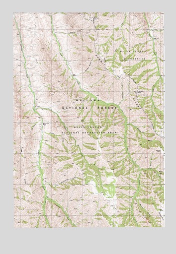
Fingerboard Saddle, OR USGS Topographic Map
Click on map above to begin viewing in our Map Viewer.

This topographic map contains these locations and features:
Feature Name Type Latitude Longitude GNIS ID View Map
Buckaroo GulchValleyN45.6582°W116.6474°1138837View Map
Butcherknife CreekStreamN45.6493°W116.7257°1139042View Map
Dad SpringSpringN45.6352°W116.6321°1140584View Map
Fingerboard GulchValleyN45.6954°W116.6640°1142096View Map
Fingerboard SaddleGapN45.7088°W116.6426°1142097View Map
Git'em CreekStreamN45.6804°W116.7265°1142749View Map
Kernan PointSummitN45.6710°W116.6304°1156649View Map
Litch RanchLocaleN45.7135°W116.7018°1145062View Map
Long ProngStreamN45.6579°W116.6315°1145442View Map
Mormon ProngStreamN45.6421°W116.6504°1146462View Map
Rhodes CreekStreamN45.6935°W116.7326°1148406View Map
Rhodes Creek RanchLocaleN45.6852°W116.7260°1133844View Map
Rowley GulchValleyN45.7379°W116.7163°1148814View Map
Roy CanyonValleyN45.6871°W116.7274°1148816View Map
Schleur GulchValleyN45.7115°W116.6993°1149122View Map
Sleepy CreekStreamN45.6421°W116.7235°1149676View Map
Smooth GulchValleyN45.6585°W116.6388°1149781View Map
Square MountainSummitN45.7468°W116.6860°1150218View Map
Teaser CreekStreamN45.7379°W116.6399°1150932View Map
West Fork Deep CreekStreamN45.7127°W116.6304°1152066View Map
Winters GulchValleyN45.6849°W116.6576°1152550View Map
Winters SpringSpringN45.6785°W116.6271°1152551View Map

Note: Coordinates in the location and feature list above are referenced to NAD83 datum.


Copyright (C) 2008-2024 Ryan Niemi / Sunset Dynamics ... All Rights Reserved