TopoQuest Logo
Do you find TopoQuest useful?
Help keep TopoQuest running and adding new maps/features by donating!
Bitcoin:  19c7KJd3qBynnjoSw5npx9KScwjBe4ifkT
Litecoin:  LXs6TkuXGGXo1vDsWCkWVdjQX94eUKd6ui
Home View Maps Find Maps Find Places Resources & Links


Wolf Creek, Idaho Topographic Map

USGS Map Title: Wolf Creek, ID
USGS Map MRC: 45116G5
DRG (GeoTIFF) Download: o45116g5.tif


Neighboring USGS Topographic Map Quads:


  Rattlesnake Ridge, ID  
45116H6
 

  Boles, ID  
45116H5
 

  Moughmer Point, ID  
45116H4
 

  Cactus Mountain, OR  
45116G6
 

  Wolf Creek, ID  
45116G5
 

  Joseph, ID  
45116G4
 

  Fingerboard Saddle, OR  
45116F6
 

  Lord Flat, OR  
45116F5
 

  Grave Point, ID  
45116F4


Map MRC Location:

N46°
W117°
N46°
W116°
H8 H7 H6 H5 H4 H3 H2 H1
G8 G7 G6 G5 G4 G3 G2 G1
F8 F7 F6 F5 F4 F3 F2 F1
E8 E7 E6 E5 E4 E3 E2 E1
D8 D7 D6 D5 D4 D3 D2 D1
C8 C7 C6 C5 C4 C3 C2 C1
B8 B7 B6 B5 B4 B3 B2 B1
A8 A7 A6 A5 A4 A3 A2 A1
N45°
W117°
N45°
W116°

Wolf Creek, ID USGS 1:24K Topographic Map Preview:
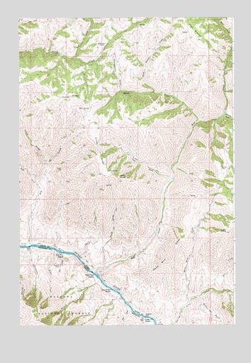
Wolf Creek, ID USGS Topographic Map
Click on map above to begin viewing in our Map Viewer.

This topographic map contains these locations and features:
Feature Name Type Latitude Longitude GNIS ID View Map
Bar CreekStreamN45.7793°W116.6010°1137502View Map
Basin CreekStreamN45.8321°W116.5224°377003View Map
Bean CreekStreamN45.7807°W116.6043°1137626View Map
Birch CreekStreamN45.7732°W116.5749°377652View Map
Blue SpringSpringN45.8381°W116.5847°377949View Map
Bob CreekStreamN45.7627°W116.5682°1138365View Map
Cat CreekStreamN45.7627°W116.5674°1139458View Map
Cat Creek RanchLocaleN45.7610°W116.5690°1161752View Map
Chamberlain GulchValleyN45.8457°W116.5668°379164View Map
Christmas CreekStreamN45.7815°W116.6185°1139714View Map
Christmas Creek CampLocaleN45.7818°W116.6190°1161751View Map
Copper (historical)Populated PlaceN45.7513°W116.5482°1152814View Map
Copper CreekStreamN45.7529°W116.5507°1140101View Map
Copper Creek RapidsRapidsN45.7529°W116.5507°379713View Map
Copper Post Office (historical)Post OfficeN45.7513°W116.5482°1165086View Map
DavidsonPopulated PlaceN45.8429°W116.5954°397604View Map
Dorrance RanchLocaleN45.7746°W116.6018°1141199View Map
Dry CreekStreamN45.7824°W116.6210°380810View Map
Dry Creek RapidsRapidsN45.7824°W116.6232°1158592View Map
Fir CreekStreamN45.7643°W116.5065°381704View Map
Five Pine RapidsRapidsN45.7796°W116.5996°372713View Map
High BreaksRangeN45.8699°W116.5238°383167View Map
High Breaks CreekStreamN45.8446°W116.5476°383168View Map
Joe PointSummitN45.7874°W116.5051°383935View Map
Left Fork Divide CreekStreamN45.8588°W116.5940°384527View Map
Left Fork Dry CreekStreamN45.8063°W116.6143°384529View Map
Left Fork Wolf CreekStreamN45.8088°W116.5360°384548View Map
Mexican PlacePopulated PlaceN45.8127°W116.5065°397904View Map
Quinn CreekStreamN45.8352°W116.5057°388994View Map
Ragtown BarBarN45.7538°W116.5526°389026View Map
Rankin GulchValleyN45.7629°W116.5004°374573View Map
Roland Bar RapidsRapidsN45.7646°W116.5724°389579View Map
Roland CreekStreamN45.7677°W116.5779°1148705View Map
Sawmill GulchValleyN45.8352°W116.5057°389981View Map
Spring Camp RanchLocaleN45.8638°W116.5765°391153View Map
Thorn CreekStreamN45.7777°W116.5907°392051View Map
Vance GulchValleyN45.8168°W116.6110°392699View Map
White Bird CreekStreamN45.7590°W116.5268°393311View Map
White Bird RidgeRidgeN45.7782°W116.5346°393316View Map
Wilmer Owl GulchValleyN45.7615°W116.5204°393538View Map
Windy PointSummitN45.8099°W116.5696°398374View Map
Windy RidgeRidgeN45.8221°W116.5793°393587View Map
Wolf CreekStreamN45.7707°W116.5813°393626View Map
Wolf Creek RapidsRapidsN45.7707°W116.5821°375975View Map

Note: Coordinates in the location and feature list above are referenced to NAD83 datum.


Copyright (C) 2008-2024 Ryan Niemi / Sunset Dynamics ... All Rights Reserved