TopoQuest Logo
Do you find TopoQuest useful?
Help keep TopoQuest running and adding new maps/features by donating!
Bitcoin:  19c7KJd3qBynnjoSw5npx9KScwjBe4ifkT
Litecoin:  LXs6TkuXGGXo1vDsWCkWVdjQX94eUKd6ui
Home View Maps Find Maps Find Places Resources & Links


Fisher Towers, Utah Topographic Map

USGS Map Title: Fisher Towers, UT
USGS Map MRC: 38109F3
DRG (GeoTIFF) Download: o38109f3.tif


Neighboring USGS Topographic Map Quads:


  Cisco SW, UT  
38109G4
 

  Dewey, UT  
38109G3
 

  Blue Chief Mesa, UT  
38109G2
 

  Big Bend, UT  
38109F4
 

  Fisher Towers, UT  
38109F3
 

  Fisher Valley, UT  
38109F2
 

  Rill Creek, UT  
38109E4
 

  Warner Lake, UT  
38109E3
 

  Mount Waas, UT  
38109E2


Map MRC Location:

N39°
W110°
N39°
W109°
H8 H7 H6 H5 H4 H3 H2 H1
G8 G7 G6 G5 G4 G3 G2 G1
F8 F7 F6 F5 F4 F3 F2 F1
E8 E7 E6 E5 E4 E3 E2 E1
D8 D7 D6 D5 D4 D3 D2 D1
C8 C7 C6 C5 C4 C3 C2 C1
B8 B7 B6 B5 B4 B3 B2 B1
A8 A7 A6 A5 A4 A3 A2 A1
N38°
W110°
N38°
W109°

Fisher Towers, UT USGS 1:24K Topographic Map Preview:
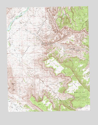
Fisher Towers, UT USGS Topographic Map
Click on map above to begin viewing in our Map Viewer.

This topographic map contains these locations and features:
Feature Name Type Latitude Longitude GNIS ID View Map
Buckhorn BasinBasinN38.7403°W109.2854°1448202View Map
Bunchground CanyonValleyN38.6272°W109.2734°1439325View Map
Castle RockPillarN38.6514°W109.3679°1439518View Map
Castle Rock/Priest and Nuns Point of InterestLocaleN38.6553°W109.3662°1453029View Map
Fisher MesaSummitN38.6725°W109.2768°1441092View Map
Fisher TowersPillarN38.7217°W109.3043°1441094View Map
Fisher Towers Picnic AreaParkN38.7253°W109.3090°1448402View Map
Hellroaring CanyonValleyN38.6553°W109.3162°1441685View Map
Mary Jane CanyonValleyN38.6552°W109.3153°1443215View Map
Moab DivisionCivilN38.6907°W109.2571°1939390View Map
Onion CreekStreamN38.7364°W109.3621°1444098View Map
Onion Creek RapidsRapidsN38.7361°W109.3629°1448779View Map
Priest and NunsPillarN38.6528°W109.3679°1444644View Map
RichardsonLocaleN38.7017°W109.3710°1444887View Map
Richardson AmphitheaterBasinN38.7228°W109.3498°1444888View Map
Stinking SpringSpringN38.6985°W109.2746°1449072View Map
The NarrowsValleyN38.6989°W109.2812°1448723View Map
The TitanPillarN38.7171°W109.2995°2711988View Map
Titan TowerSummitN38.7183°W109.2834°1449107View Map
Titus RanchLocaleN38.7239°W109.3707°1446622View Map
Totem PolePillarN38.7044°W109.3104°1450201View Map

Note: Coordinates in the location and feature list above are referenced to NAD83 datum.


Copyright (C) 2008-2025 Ryan Niemi / Sunset Dynamics ... All Rights Reserved