TopoQuest Logo
Do you find TopoQuest useful?
Help keep TopoQuest running and adding new maps/features by donating!
Bitcoin:  19c7KJd3qBynnjoSw5npx9KScwjBe4ifkT
Litecoin:  LXs6TkuXGGXo1vDsWCkWVdjQX94eUKd6ui
Home View Maps Find Maps Find Places Resources & Links


Warner Lake, Utah Topographic Map

USGS Map Title: Warner Lake, UT
USGS Map MRC: 38109E3
DRG (GeoTIFF) Download: o38109e3.tif


Neighboring USGS Topographic Map Quads:


  Big Bend, UT  
38109F4
 

  Fisher Towers, UT  
38109F3
 

  Fisher Valley, UT  
38109F2
 

  Rill Creek, UT  
38109E4
 

  Warner Lake, UT  
38109E3
 

  Mount Waas, UT  
38109E2
 

  Kane Springs, UT  
38109D4
 

  Mount Tukuhnikivatz, UT  
38109D3
 

  Mount Peale, UT  
38109D2


Map MRC Location:

N39°
W110°
N39°
W109°
H8 H7 H6 H5 H4 H3 H2 H1
G8 G7 G6 G5 G4 G3 G2 G1
F8 F7 F6 F5 F4 F3 F2 F1
E8 E7 E6 E5 E4 E3 E2 E1
D8 D7 D6 D5 D4 D3 D2 D1
C8 C7 C6 C5 C4 C3 C2 C1
B8 B7 B6 B5 B4 B3 B2 B1
A8 A7 A6 A5 A4 A3 A2 A1
N38°
W110°
N38°
W109°

Warner Lake, UT USGS 1:24K Topographic Map Preview:
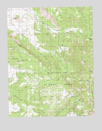
Warner Lake, UT USGS Topographic Map
Click on map above to begin viewing in our Map Viewer.

This topographic map contains these locations and features:
Feature Name Type Latitude Longitude GNIS ID View Map
Adobe MesaSummitN38.6214°W109.3037°1438133View Map
Bald MesaBenchN38.5261°W109.3123°1438354View Map
Boren MesaSummitN38.5003°W109.2812°1439012View Map
Cain HollowValleyN38.5758°W109.3007°1450272View Map
Castle Valley OverlookLocaleN38.5433°W109.3118°1453009View Map
CastletonLocaleN38.6039°W109.3176°1439525View Map
Castleton CemeteryCemeteryN38.6071°W109.3203°2769382View Map
Cold SpringSpringN38.5450°W109.2895°1448290View Map
Dry Fork Mill CreekStreamN38.5105°W109.2529°1440629View Map
Gold KnobSummitN38.5308°W109.2715°1449928View Map
Grand ViewSummitN38.5622°W109.2626°1441888View Map
Harpole MesaBenchN38.5769°W109.2973°1441609View Map
Horse MountainSummitN38.5511°W109.2521°1448489View Map
Jerry Stocks MineMineN38.5569°W109.3207°1449921View Map
Jimmy Keen FlatBenchN38.5372°W109.3459°1442144View Map
Lake OowahReservoirN38.5008°W109.2736°1447718View Map
Lake Oowah DamDamN38.5017°W109.2740°1447719View Map
Maloy ParkAreaN38.5755°W109.3548°1448636View Map
Mason DrawValleyN38.5589°W109.3126°1448648View Map
Mason SpringSpringN38.5425°W109.3038°1448649View Map
Mason Spring CreekStreamN38.5792°W109.3323°1449923View Map
Mesa Guard StationLocaleN38.5150°W109.3298°1449929View Map
Mill Creek Canyon OverlookLocaleN38.5039°W109.3023°1453016View Map
Miners BasinBasinN38.5400°W109.2554°1449922View Map
Miners BasinValleyN38.5458°W109.2818°1443512View Map
Oowah CampgroundLocaleN38.5028°W109.2723°1451314View Map
Pinhook CreekStreamN38.5792°W109.3326°1448839View Map
Pinhook Draw Historical MarkerParkN38.5822°W109.3057°1448840View Map
Pinhook ValleyValleyN38.5792°W109.3321°1444424View Map
Porcupine DrawValleyN38.5792°W109.3321°1444581View Map
Porcupine RanchLocaleN38.5803°W109.3351°1444585View Map
Round MountainSummitN38.6130°W109.3618°1445171View Map
Shuman GulchValleyN38.5089°W109.2929°1450199View Map
South MesaSummitN38.5169°W109.3657°1445905View Map
Spring BranchStreamN38.6028°W109.3132°1449046View Map
Warner CampgroundLocaleN38.5189°W109.2762°1451375View Map
Warner LakeReservoirN38.5179°W109.2739°1449158View Map
Warner Ranger StationLocaleN38.5200°W109.2748°1446991View Map
Webb Hollow CreekStreamN38.5203°W109.3337°1447086View Map
Wet Fork Mill CreekStreamN38.5108°W109.2529°1447196View Map
Wilcox FlatFlatN38.5255°W109.2818°1447493View Map
Wilson MesaSummitN38.5425°W109.3698°1447457View Map

Note: Coordinates in the location and feature list above are referenced to NAD83 datum.


Copyright (C) 2008-2025 Ryan Niemi / Sunset Dynamics ... All Rights Reserved