TopoQuest Logo
Do you find TopoQuest useful?
Help keep TopoQuest running and adding new maps/features by donating!
Bitcoin:  19c7KJd3qBynnjoSw5npx9KScwjBe4ifkT
Litecoin:  LXs6TkuXGGXo1vDsWCkWVdjQX94eUKd6ui
Home View Maps Find Maps Find Places Resources & Links


Fishs Eddy, New York Topographic Map

USGS Map Title: Fishs Eddy, NY
USGS Map MRC: 41075H2
DRG (GeoTIFF) Download: o41075h2.tif


Neighboring USGS Topographic Map Quads:


  Cannonsville Reservoir, NY  
42075A3
 

  Readburn, NY  
42075A2
 

  Corbett, NY  
42075A1
 

  Hancock, NY  
41075H3
 

  Fishs Eddy, NY  
41075H2
 

  Horton, NY  
41075H1
 

  Lake Como, PA  
41075G3
 

  Long Eddy, NY  
41075G2
 

  Callicoon, NY  
41075G1


Map MRC Location:

N42°
W76°
N42°
W75°
H8 H7 H6 H5 H4 H3 H2 H1
G8 G7 G6 G5 G4 G3 G2 G1
F8 F7 F6 F5 F4 F3 F2 F1
E8 E7 E6 E5 E4 E3 E2 E1
D8 D7 D6 D5 D4 D3 D2 D1
C8 C7 C6 C5 C4 C3 C2 C1
B8 B7 B6 B5 B4 B3 B2 B1
A8 A7 A6 A5 A4 A3 A2 A1
N41°
W76°
N41°
W75°

Fishs Eddy, NY USGS 1:24K Topographic Map Preview:
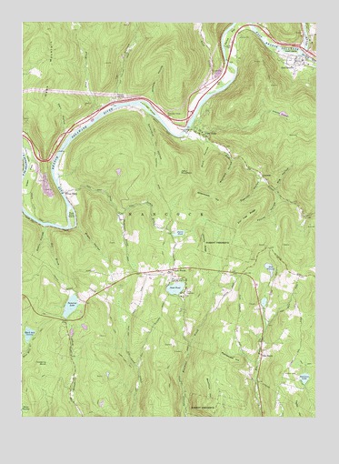
Fishs Eddy, NY USGS Topographic Map
Click on map above to begin viewing in our Map Viewer.

This topographic map contains these locations and features:
Feature Name Type Latitude Longitude GNIS ID View Map
Beaver KillStreamN41.9906°W75.1313°969859View Map
Big HollowValleyN41.9472°W75.1428°943898View Map
Bittersweet HillSummitN41.9431°W75.1660°944061View Map
Black Ash SwampLakeN41.9012°W75.2468°944068View Map
Bolton BrookStreamN41.9981°W75.1504°944410View Map
Bouchoux HillSummitN41.8806°W75.1699°944484View Map
Brady HollowValleyN41.9351°W75.2266°944593View Map
Bridge Street BridgeBridgeN41.9895°W75.1294°2614876View Map
Camp DeerheadLocaleN41.9148°W75.1802°945569View Map
Camp Pine ConeLocaleN41.9181°W75.1838°945641View Map
City BrookStreamN41.9701°W75.2185°946710View Map
Cranberry MarshSwampN41.8920°W75.2388°947661View Map
Dark HollowValleyN41.9634°W75.2310°948035View Map
Deerlick HollowValleyN41.9504°W75.1488°948247View Map
Delaware LakeLakeN41.8875°W75.1299°948266View Map
Dunn SwampSwampN41.8773°W75.2492°948813View Map
Earlys FlatFlatN41.9959°W75.1613°948962View Map
East BranchPopulated PlaceN41.9884°W75.1338°948988View Map
East Branch CemeteryCemeteryN41.9864°W75.1311°2548337View Map
East Branch Post OfficePost OfficeN41.9889°W75.1350°2617897View Map
East Branch Volunteer Fire DepartmentBuildingN41.9881°W75.1305°2735062View Map
Eel Weir HollowValleyN41.9392°W75.2488°949415View Map
Elm SwampLakeN41.9222°W75.1447°949558View Map
Elm Tree RidgeSummitN41.9356°W75.1579°949559View Map
Fish CreekStreamN41.9656°W75.1810°950127View Map
Fish Eddy - Sullivan Road BridgeBridgeN41.9662°W75.1801°2614905View Map
Fishs EddyPopulated PlaceN41.9637°W75.1749°950180View Map
Fourth HollowValleyN41.9464°W75.1420°950542View Map
French WoodsPopulated PlaceN41.9212°W75.1860°972512View Map
French Woods Church CemeteryCemeteryN41.9212°W75.1871°2548336View Map
French Woods Golf and Country ClubLocaleN41.9259°W75.1793°2615399View Map
Gee BrookStreamN41.9359°W75.2404°950970View Map
Green FlatsFlatN41.9515°W75.2466°951678View Map
Hancock QuarryMineN41.9486°W75.2414°2564201View Map
Hawk IslandIslandN41.9912°W75.1360°952397View Map
Johnny RidgeSummitN41.9259°W75.1718°954090View Map
Lakin BrookStreamN41.9398°W75.2093°954996View Map
Lakins IslandIslandN41.9579°W75.2474°954997View Map
LuzernePopulated PlaceN41.9515°W75.1479°972747View Map
Maynard HollowValleyN41.9568°W75.1610°956712View Map
Nancokus HollowValleyN41.9712°W75.1963°958243View Map
Old East Branch CemeteryCemeteryN41.9876°W75.1360°2548338View Map
Orleans SwampLakeN41.9711°W75.1392°959487View Map
Pacatacan (historical)Populated PlaceN41.9883°W75.1333°2368017View Map
Partridge IslandIslandN41.9729°W75.1957°959957View Map
Partridge Island CemeteryCemeteryN41.9699°W75.1889°959958View Map
Pea BrookPopulated PlaceN41.8945°W75.1479°972925View Map
Pea Brook CemeteryCemeteryN41.8966°W75.1478°2548335View Map
Peas EddyPopulated PlaceN41.9459°W75.2310°960060View Map
Peas Eddy BrookStreamN41.9459°W75.2321°960061View Map
Peas Eddy IslandIslandN41.9381°W75.2285°960062View Map
Pierce PondLakeN41.9333°W75.1832°960357View Map
Pond HollowValleyN41.9612°W75.1707°960894View Map
Rattlesnake HillSummitN41.8931°W75.1599°962219View Map
Read CreekStreamN41.9801°W75.1643°962256View Map
Sand PondLakeN41.9158°W75.1845°964397View Map
Somerset LakeLakeN41.9102°W75.2290°965635View Map
Stony HollowValleyN41.9348°W75.2402°966572View Map
Tar HollowValleyN41.9751°W75.2110°967062View Map
Taylor HillSummitN41.8806°W75.1332°967088View Map
Town of HancockCivilN41.9573°W75.1632°979043View Map
Tylers SwitchLocaleN41.9759°W75.2102°968099View Map
Wheeler HollowValleyN41.9751°W75.1949°971010View Map

Note: Coordinates in the location and feature list above are referenced to NAD83 datum.


Copyright (C) 2008-2024 Ryan Niemi / Sunset Dynamics ... All Rights Reserved