TopoQuest Logo
Do you find TopoQuest useful?
Help keep TopoQuest running and adding new maps/features by donating!
Bitcoin:  19c7KJd3qBynnjoSw5npx9KScwjBe4ifkT
Litecoin:  LXs6TkuXGGXo1vDsWCkWVdjQX94eUKd6ui
Home View Maps Find Maps Find Places Resources & Links


Fitting, Nevada Topographic Map

USGS Map Title: Fitting, NV
USGS Map MRC: 40118C1
DRG (GeoTIFF) Download: o40118c1.tif


Neighboring USGS Topographic Map Quads:


  Congress Canyon, NV  
40118D2
 

  Unionville, NV  
40118D1
 

  Kyle Hot Springs, NV  
40117D8
 

  Rochester, NV  
40118C2
 

  Fitting, NV  
40118C1
 

  Kyle Hot Springs SW, NV  
40117C8
 

  Buffalo Mountain, NV  
40118B2
 

  Fisher Canyon, NV  
40118B1
 

  West of McKinney Pass, NV  
40117B8


Map MRC Location:

N41°
W119°
N41°
W118°
H8 H7 H6 H5 H4 H3 H2 H1
G8 G7 G6 G5 G4 G3 G2 G1
F8 F7 F6 F5 F4 F3 F2 F1
E8 E7 E6 E5 E4 E3 E2 E1
D8 D7 D6 D5 D4 D3 D2 D1
C8 C7 C6 C5 C4 C3 C2 C1
B8 B7 B6 B5 B4 B3 B2 B1
A8 A7 A6 A5 A4 A3 A2 A1
N40°
W119°
N40°
W118°

Fitting, NV USGS 1:24K Topographic Map Preview:
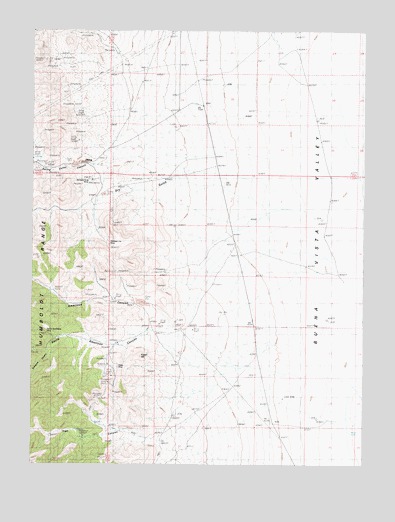
Fitting, NV USGS Topographic Map
Click on map above to begin viewing in our Map Viewer.

This topographic map contains these locations and features:
Feature Name Type Latitude Longitude GNIS ID View Map
American CanyonValleyN40.2899°W118.0699°848493View Map
American Canyon (historical)LocaleN40.2849°W118.0912°847658View Map
American Canyon MinesMineN40.2974°W118.0874°855133View Map
Bonanza King MineMineN40.3324°W118.1035°854890View Map
Cinnabar City MineMineN40.3130°W118.0976°839538View Map
Dry GulchValleyN40.3302°W118.0860°848537View Map
Dry Gulch MinesMineN40.3260°W118.1018°855135View Map
Enterprise MineMineN40.2682°W118.1024°855131View Map
FittingPopulated PlaceN40.3363°W118.1051°857990View Map
Fitting Post Office (historical)Post OfficeN40.3363°W118.1051°865008View Map
Fossil HillSummitN40.2810°W118.0871°863337View Map
Hillside MineMineN40.3249°W118.0957°855134View Map
Indian CreekStreamN40.3627°W118.0249°841252View Map
Kaolinite MineMineN40.3002°W118.1176°855127View Map
Little Linda MineMineN40.2977°W118.0946°864826View Map
Pacific Matchless MineMineN40.2874°W118.1201°857794View Map
Pinite MineMineN40.2785°W118.0935°842843View Map
Porcupine CanyonValleyN40.2827°W118.1196°842935View Map
South American CanyonValleyN40.2885°W118.0790°848648View Map
South American Canyon MinesMineN40.2866°W118.1071°855128View Map
Spring Valley MinesMineN40.3369°W118.1085°855129View Map
Spring Valley Mining DistrictCivilN40.3060°W118.1065°858503View Map
Stevensville (historical)Populated PlaceN40.3413°W118.0960°846346View Map
Strief RanchLocaleN40.3730°W118.0349°855024View Map
Troy CanyonValleyN40.2602°W118.0701°844429View Map
Troy Canyon MinesMineN40.2594°W118.0904°855132View Map
Wabash MineMineN40.3357°W118.1240°855130View Map
Zimmershed RanchLocaleN40.3538°W118.0624°856758View Map

Note: Coordinates in the location and feature list above are referenced to NAD83 datum.


Copyright (C) 2008-2024 Ryan Niemi / Sunset Dynamics ... All Rights Reserved