TopoQuest Logo
Do you find TopoQuest useful?
Help keep TopoQuest running and adding new maps/features by donating!
Bitcoin:  19c7KJd3qBynnjoSw5npx9KScwjBe4ifkT
Litecoin:  LXs6TkuXGGXo1vDsWCkWVdjQX94eUKd6ui
Home View Maps Find Maps Find Places Resources & Links


Congress Canyon, Nevada Topographic Map

USGS Map Title: Congress Canyon, NV
USGS Map MRC: 40118D2
DRG (GeoTIFF) Download: o40118d2.tif


Neighboring USGS Topographic Map Quads:


  Rye Patch Reservoir South, NV  
40118E3
 

  Star Peak, NV  
40118E2
 

  Star Creek Ranch, NV  
40118E1
 

  Rye Patch Dam, NV  
40118D3
 

  Congress Canyon, NV  
40118D2
 

  Unionville, NV  
40118D1
 

  Oreana, NV  
40118C3
 

  Rochester, NV  
40118C2
 

  Fitting, NV  
40118C1


Map MRC Location:

N41°
W119°
N41°
W118°
H8 H7 H6 H5 H4 H3 H2 H1
G8 G7 G6 G5 G4 G3 G2 G1
F8 F7 F6 F5 F4 F3 F2 F1
E8 E7 E6 E5 E4 E3 E2 E1
D8 D7 D6 D5 D4 D3 D2 D1
C8 C7 C6 C5 C4 C3 C2 C1
B8 B7 B6 B5 B4 B3 B2 B1
A8 A7 A6 A5 A4 A3 A2 A1
N40°
W119°
N40°
W118°

Congress Canyon, NV USGS 1:24K Topographic Map Preview:
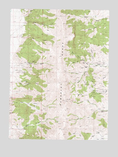
Congress Canyon, NV USGS Topographic Map
Click on map above to begin viewing in our Map Viewer.

This topographic map contains these locations and features:
Feature Name Type Latitude Longitude GNIS ID View Map
Arizona MineMineN40.4310°W118.1479°838506View Map
Bluebird MineMineN40.3788°W118.1426°838944View Map
Boston TunnelTunnelN40.4491°W118.1549°838988View Map
Buena Vista Canyon MineMineN40.4477°W118.1313°854040View Map
Buffalo CanyonValleyN40.4857°W118.2313°848513View Map
Chipmunk MineMineN40.4538°W118.2010°854042View Map
Congress CanyonValleyN40.4480°W118.1476°839652View Map
Congress Canyon MineMineN40.4582°W118.1490°854039View Map
Congress CreekStreamN40.4474°W118.1465°846217View Map
Echo CanyonValleyN40.4727°W118.2357°840295View Map
Fourth of July FlatFlatN40.4174°W118.1651°840547View Map
Henning MineMineN40.4369°W118.1513°856760View Map
Humboldt Queen (historical)LocaleN40.3924°W118.2051°846231View Map
Humboldt RangeRangeN40.4496°W118.1885°848563View Map
Indian Mining DistrictCivilN40.3874°W118.1335°854038View Map
Inskip MineMineN40.4282°W118.1526°854493View Map
John Brown CanyonValleyN40.4907°W118.1346°841387View Map
La Toska MineMineN40.3905°W118.1885°855336View Map
Marigold MineMineN40.4449°W118.1532°841939View Map
Millionaire MineMineN40.4355°W118.1438°854041View Map
Monitor CanyonValleyN40.4371°W118.1590°842187View Map
Moonlight MineMineN40.3816°W118.1360°842234View Map
North Fork Cottonwood CanyonValleyN40.4052°W118.1368°842506View Map
North Fork Straight CanyonValleyN40.4480°W118.1476°842524View Map
Panther CanyonValleyN40.4457°W118.2440°848610View Map
Panther Canyon MineMineN40.4480°W118.2199°864827View Map
Phlueger MineMineN40.4027°W118.1332°854567View Map
Rusty Pick MineMineN40.4032°W118.2113°854035View Map
Rye Patch Agnes MineMineN40.4296°W118.2371°854032View Map
Rye Patch MineMineN40.4291°W118.2293°854605View Map
Rye Patch Mining DistrictCivilN40.4427°W118.2196°854045View Map
South Fork Cottonwood CanyonValleyN40.4052°W118.1368°843848View Map
South Fork Straight CanyonValleyN40.4519°W118.1596°843865View Map
Unionville Mining DistrictCivilN40.4419°W118.1479°854044View Map
UppertownLocaleN40.4482°W118.1493°856513View Map
Wheeler MineMineN40.4185°W118.1443°854043View Map
Wilson CanyonValleyN40.4480°W118.1476°844972View Map

Note: Coordinates in the location and feature list above are referenced to NAD83 datum.


Copyright (C) 2008-2024 Ryan Niemi / Sunset Dynamics ... All Rights Reserved