TopoQuest Logo
Do you find TopoQuest useful?
Help keep TopoQuest running and adding new maps/features by donating!
Bitcoin:  19c7KJd3qBynnjoSw5npx9KScwjBe4ifkT
Litecoin:  LXs6TkuXGGXo1vDsWCkWVdjQX94eUKd6ui
Home View Maps Find Maps Find Places Resources & Links


Flatonia NW, Texas Topographic Map

USGS Map Title: Flatonia NW, TX
USGS Map MRC: 29097F2
DRG (GeoTIFF) Download: o29097f2.tif


Neighboring USGS Topographic Map Quads:


  Jeddo, TX  
29097G3
 

  Cistern, TX  
29097G2
 

  Muldoon, TX  
29097G1
 

  Waelder, TX  
29097F3
 

  Flatonia NW, TX  
29097F2
 

  Flatonia, TX  
29097F1
 

  Dilworth, TX  
29097E3
 

  Moulton, TX  
29097E2
 

  Komensky, TX  
29097E1


Map MRC Location:

N30°
W98°
N30°
W97°
H8 H7 H6 H5 H4 H3 H2 H1
G8 G7 G6 G5 G4 G3 G2 G1
F8 F7 F6 F5 F4 F3 F2 F1
E8 E7 E6 E5 E4 E3 E2 E1
D8 D7 D6 D5 D4 D3 D2 D1
C8 C7 C6 C5 C4 C3 C2 C1
B8 B7 B6 B5 B4 B3 B2 B1
A8 A7 A6 A5 A4 A3 A2 A1
N29°
W98°
N29°
W97°

Flatonia NW, TX USGS 1:24K Topographic Map Preview:
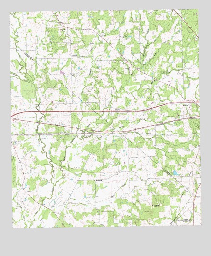
Flatonia NW, TX USGS Topographic Map
Click on map above to begin viewing in our Map Viewer.

This topographic map contains these locations and features:
Feature Name Type Latitude Longitude GNIS ID View Map
Andrews Chapel CemeteryCemeteryN29.6741°W97.2494°1329541View Map
ArmstrongPopulated PlaceN29.7238°W97.2097°1377954View Map
Avery LakeReservoirN29.7148°W97.2160°1857975View Map
Avery Lake DamDamN29.7169°W97.2169°1857974View Map
Big Fivemile CreekStreamN29.6494°W97.2222°1330595View Map
Castleman CemeteryCemeteryN29.6416°W97.1280°1332304View Map
Cedar CreekStreamN29.6791°W97.1833°1332400View Map
Cedar Spring BranchStreamN29.6766°W97.2030°1332478View Map
Cochran CemeteryCemeteryN29.7202°W97.2219°1333047View Map
Cooke County LibraryBuildingN29.7266°W97.1480°2015003View Map
Copperas CreekStreamN29.7083°W97.2353°1333333View Map
Elm CreekStreamN29.7491°W97.2467°1335367View Map
Hog BranchStreamN29.7069°W97.1605°1337876View Map
Kiel LakeReservoirN29.6557°W97.1425°1857973View Map
Kiel Lake DamDamN29.6552°W97.1436°1857972View Map
Little Fivemile CreekStreamN29.6783°W97.2064°1340096View Map
Mount Olive CemeteryCemeteryN29.7233°W97.2047°1342065View Map
NewtonvillePopulated PlaceN29.6522°W97.1950°1378754View Map
Piano Ranch AirportAirportN29.6974°W97.1636°2675796View Map
Pin Oak CreekStreamN29.7100°W97.2353°1344027View Map
Rocky CreekStreamN29.7169°W97.1633°1345444View Map
Russell HillSummitN29.6366°W97.1567°1345774View Map
Sommers CemeteryCemeteryN29.7161°W97.1708°1347379View Map
West Brook CreekStreamN29.7055°W97.1761°1349682View Map

Note: Coordinates in the location and feature list above are referenced to NAD83 datum.


Copyright (C) 2008-2025 Ryan Niemi / Sunset Dynamics ... All Rights Reserved