TopoQuest Logo
Do you find TopoQuest useful?
Help keep TopoQuest running and adding new maps/features by donating!
Bitcoin:  19c7KJd3qBynnjoSw5npx9KScwjBe4ifkT
Litecoin:  LXs6TkuXGGXo1vDsWCkWVdjQX94eUKd6ui
Home View Maps Find Maps Find Places Resources & Links


Moulton, Texas Topographic Map

USGS Map Title: Moulton, TX
USGS Map MRC: 29097E2
DRG (GeoTIFF) Download: o29097e2.tif


Neighboring USGS Topographic Map Quads:


  Waelder, TX  
29097F3
 

  Flatonia NW, TX  
29097F2
 

  Flatonia, TX  
29097F1
 

  Dilworth, TX  
29097E3
 

  Moulton, TX  
29097E2
 

  Komensky, TX  
29097E1
 

  Hamon, TX  
29097D3
 

  Shiner, TX  
29097D2
 

  Wied, TX  
29097D1


Map MRC Location:

N30°
W98°
N30°
W97°
H8 H7 H6 H5 H4 H3 H2 H1
G8 G7 G6 G5 G4 G3 G2 G1
F8 F7 F6 F5 F4 F3 F2 F1
E8 E7 E6 E5 E4 E3 E2 E1
D8 D7 D6 D5 D4 D3 D2 D1
C8 C7 C6 C5 C4 C3 C2 C1
B8 B7 B6 B5 B4 B3 B2 B1
A8 A7 A6 A5 A4 A3 A2 A1
N29°
W98°
N29°
W97°

Moulton, TX USGS 1:24K Topographic Map Preview:
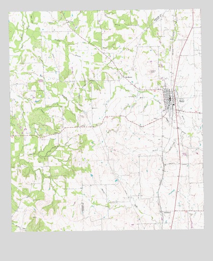
Moulton, TX USGS Topographic Map
Click on map above to begin viewing in our Map Viewer.

This topographic map contains these locations and features:
Feature Name Type Latitude Longitude GNIS ID View Map
Baldridge CreekStreamN29.6052°W97.2494°1329979View Map
Bear BranchStreamN29.6250°W97.2000°1330197View Map
Burkett CemeteryCemeteryN29.6100°W97.1525°1331679View Map
Frederick MoundSummitN29.5902°W97.1592°1336173View Map
HenkhausPopulated PlaceN29.5105°W97.1525°1378439View Map
Kuehns CreekStreamN29.5536°W97.1394°1339246View Map
MoultonPopulated PlaceN29.5750°W97.1428°1342001View Map
Moulton City HallBuildingN29.5742°W97.1458°2753433View Map
Moulton Municipal Airport (historical)AirportN29.5697°W97.1530°1387218View Map
Moulton Police DepartmentBuildingN29.5742°W97.1458°2739259View Map
Moulton Post OfficePost OfficeN29.5727°W97.1456°2731867View Map
Moulton Volunteer Fire DepartmentBuildingN29.5732°W97.1461°2552469View Map
NickelPopulated PlaceN29.5555°W97.2189°1378755View Map
Obar CreekStreamN29.6183°W97.2339°1343050View Map
Old MoultonPopulated PlaceN29.5880°W97.1767°1343184View Map
Old Moulton CemeteryCemeteryN29.5755°W97.1678°1343185View Map
Salt BranchStreamN29.6063°W97.2130°1346196View Map
Slavonic CemeteryCemeteryN29.5630°W97.1539°1347228View Map
Stonewall CemeteryCemeteryN29.5183°W97.2358°1347967View Map
Sulphur BranchStreamN29.6108°W97.2364°1348052View Map
Town of MoultonCivilN29.5722°W97.1466°2413016View Map

Note: Coordinates in the location and feature list above are referenced to NAD83 datum.


Copyright (C) 2008-2024 Ryan Niemi / Sunset Dynamics ... All Rights Reserved