TopoQuest Logo
Do you find TopoQuest useful?
Help keep TopoQuest running and adding new maps/features by donating!
Bitcoin:  19c7KJd3qBynnjoSw5npx9KScwjBe4ifkT
Litecoin:  LXs6TkuXGGXo1vDsWCkWVdjQX94eUKd6ui
Home View Maps Find Maps Find Places Resources & Links


Florence Junction, Arizona Topographic Map

USGS Map Title: Florence Junction, AZ
USGS Map MRC: 33111C3
DRG (GeoTIFF) Download: o33111c3.tif


Neighboring USGS Topographic Map Quads:


  Goldfield, AZ  
33111D4
 

  Weavers Needle, AZ  
33111D3
 

  Iron Mountain, AZ  
33111D2
 

  Superstition Mountains SW, AZ  
33111C4
 

  Florence Junction, AZ  
33111C3
 

  Picketpost Mountain, AZ  
33111C2
 

  Magma, AZ  
33111B4
 

  Florence NE, AZ  
33111B3
 

  Mineral Mountain, AZ  
33111B2


Map MRC Location:

N34°
W112°
N34°
W111°
H8 H7 H6 H5 H4 H3 H2 H1
G8 G7 G6 G5 G4 G3 G2 G1
F8 F7 F6 F5 F4 F3 F2 F1
E8 E7 E6 E5 E4 E3 E2 E1
D8 D7 D6 D5 D4 D3 D2 D1
C8 C7 C6 C5 C4 C3 C2 C1
B8 B7 B6 B5 B4 B3 B2 B1
A8 A7 A6 A5 A4 A3 A2 A1
N33°
W112°
N33°
W111°

Florence Junction, AZ USGS 1:24K Topographic Map Preview:
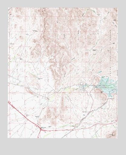
Florence Junction, AZ USGS Topographic Map
Click on map above to begin viewing in our Map Viewer.

This topographic map contains these locations and features:
Feature Name Type Latitude Longitude GNIS ID View Map
Apache Land TankReservoirN33.3074°W111.3407°25704View Map
Arizona Highway Department Florence Junction Maintenance CampLocaleN33.2564°W111.3332°43510View Map
Black PointCliffN33.3217°W111.3201°26438View Map
Burns RanchLocaleN33.3684°W111.3732°27020View Map
Comet PeakSummitN33.2939°W111.2690°27833View Map
Conley PointsSummitN33.2887°W111.3521°42761View Map
Dons TankReservoirN33.3256°W111.3589°28537View Map
Dromedary PeakSummitN33.2534°W111.2537°28611View Map
Dry TankReservoirN33.2723°W111.2894°28645View Map
Elephant ButteSummitN33.3342°W111.2779°28846View Map
Florence JunctionPopulated PlaceN33.2595°W111.3371°29067View Map
Florence Junction Airport (historical)AirportN33.2537°W111.3473°40340View Map
Gold CampPopulated PlaceN33.2937°W111.3043°1853159View Map
Hardt TankReservoirN33.3408°W111.2561°29753View Map
Junction TankReservoirN33.2611°W111.3290°30651View Map
Milk RanchLocaleN33.3648°W111.2657°31855View Map
Milk Ranch CreekStreamN33.3709°W111.2865°31856View Map
North Pinal DivisionCivilN33.2580°W111.2550°1934962View Map
Peacock SpringSpringN33.3634°W111.2551°32758View Map
Queen Creek TankReservoirN33.2696°W111.3416°33287View Map
Queen ValleyPopulated PlaceN33.2987°W111.2896°40413View Map
Queen Valley Census Designated PlaceCensusN33.2830°W111.3049°2409115View Map
Queen Valley EstatesLocaleN33.2967°W111.2868°41315View Map
Queen Valley Fire DistrictBuildingN33.2998°W111.2877°2672567View Map
Queen Valley Golf CourseLocaleN33.2992°W111.2921°43206View Map
San Mateo Castro RanchLocaleN33.3523°W111.3415°34023View Map
Smelter TownPopulated PlaceN33.2912°W111.2771°40431View Map
Tule CanyonValleyN33.3251°W111.3026°35500View Map
Upper TankReservoirN33.2753°W111.2855°35719View Map
West TankReservoirN33.3402°W111.3724°36022View Map
Whitlow CanyonValleyN33.2978°W111.3143°36133View Map
Whitlow Ranch DamDamN33.3003°W111.2751°36135View Map
Whitlow Ranch Flood Control BasinReservoirN33.2989°W111.2757°36136View Map
Whitlow TankReservoirN33.3015°W111.2917°41316View Map

Note: Coordinates in the location and feature list above are referenced to NAD83 datum.


Copyright (C) 2008-2025 Ryan Niemi / Sunset Dynamics ... All Rights Reserved