TopoQuest Logo
Do you find TopoQuest useful?
Help keep TopoQuest running and adding new maps/features by donating!
Bitcoin:  19c7KJd3qBynnjoSw5npx9KScwjBe4ifkT
Litecoin:  LXs6TkuXGGXo1vDsWCkWVdjQX94eUKd6ui
Home View Maps Find Maps Find Places Resources & Links


Iron Mountain, Arizona Topographic Map

USGS Map Title: Iron Mountain, AZ
USGS Map MRC: 33111D2
DRG (GeoTIFF) Download: o33111d2.tif


Neighboring USGS Topographic Map Quads:


  Horse Mesa Dam, AZ  
33111E3
 

  Pinyon Mountain, AZ  
33111E2
 

  Two Bar Mountain, AZ  
33111E1
 

  Weavers Needle, AZ  
33111D3
 

  Iron Mountain, AZ  
33111D2
 

  Haunted Canyon, AZ  
33111D1
 

  Florence Junction, AZ  
33111C3
 

  Picketpost Mountain, AZ  
33111C2
 

  Superior, AZ  
33111C1


Map MRC Location:

N34°
W112°
N34°
W111°
H8 H7 H6 H5 H4 H3 H2 H1
G8 G7 G6 G5 G4 G3 G2 G1
F8 F7 F6 F5 F4 F3 F2 F1
E8 E7 E6 E5 E4 E3 E2 E1
D8 D7 D6 D5 D4 D3 D2 D1
C8 C7 C6 C5 C4 C3 C2 C1
B8 B7 B6 B5 B4 B3 B2 B1
A8 A7 A6 A5 A4 A3 A2 A1
N33°
W112°
N33°
W111°

Iron Mountain, AZ USGS 1:24K Topographic Map Preview:
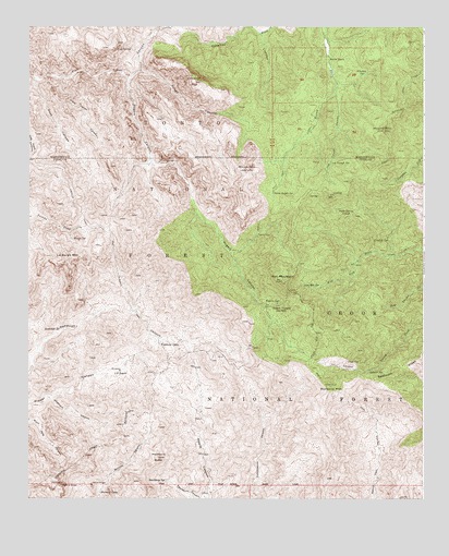
Iron Mountain, AZ USGS Topographic Map
Click on map above to begin viewing in our Map Viewer.

This topographic map contains these locations and features:
Feature Name Type Latitude Longitude GNIS ID View Map
Angel BasinBasinN33.4637°W111.2118°40881View Map
Angel SpringSpringN33.4620°W111.2121°40304View Map
Bear Spring Number OneSpringN33.4589°W111.1666°40313View Map
Black Jack SpringSpringN33.4760°W111.1301°36930View Map
Black SpringParkN33.4003°W111.1432°40316View Map
Cimeron MountainSummitN33.4856°W111.1973°27650View Map
Cimeron SpringSpringN33.4962°W111.2118°36957View Map
Cottonwood WellWellN33.3828°W111.1765°40329View Map
Crockett SpringSpringN33.4437°W111.1414°28177View Map
Crockett SpringSpringN33.4401°W111.1354°40330View Map
Deer SpringSpringN33.4223°W111.1551°40332View Map
Eagle SpringSpringN33.3751°W111.2485°40336View Map
Frog SpringSpringN33.4942°W111.2179°29215View Map
Goat CanyonValleyN33.4859°W111.2479°29357View Map
Goldwater TankReservoirN33.4253°W111.2076°40877View Map
Hackberry ButteSummitN33.3862°W111.2087°29658View Map
Hackberry CanyonValleyN33.3753°W111.1940°29660View Map
Hackberry SpringSpringN33.3798°W111.2065°29669View Map
Hole SpringSpringN33.4742°W111.2162°37001View Map
Honeycutt SpringSpringN33.4645°W111.1746°40356View Map
Iron MountainSummitN33.4326°W111.1701°30421View Map
Iron Mountain SpringSpringN33.4312°W111.1634°30422View Map
J F RanchLocaleN33.4089°W111.2210°30443View Map
J F Ranch TrailTrailN33.4287°W111.2187°30444View Map
La Barge MountainSummitN33.4387°W111.2380°42801View Map
La Barge MountainSummitN33.4389°W111.2379°30826View Map
Little Goat CanyonValleyN33.4859°W111.2387°31068View Map
Log Trough CanyonValleyN33.4823°W111.1529°31188View Map
Log Trough SpringSpringN33.4639°W111.1546°31189View Map
Maverick CampLocaleN33.3767°W111.2273°31577View Map
Maverick SpringSpringN33.3837°W111.2268°40872View Map
Mesquite SpringSpringN33.3998°W111.1982°40876View Map
Montana MountainSummitN33.4048°W111.1543°31959View Map
Mound MountainSummitN33.4726°W111.1379°32071View Map
Mountain SpringSpringN33.4367°W111.1704°40383View Map
Mullin SpringSpringN33.4438°W111.2364°32188View Map
Musk Hog SpringSpringN33.3939°W111.2273°40875View Map
New SpringSpringN33.4514°W111.1323°40387View Map
Paradise CanyonValleyN33.4989°W111.2015°32670View Map
Park SpringSpringN33.4895°W111.1890°37056View Map
Pinto Spring TroughReservoirN33.4517°W111.1515°33016View Map
Pointer SpringSpringN33.4553°W111.1589°40409View Map
Pope SpringSpringN33.4112°W111.1466°33105View Map
Randolph SpringSpringN33.4198°W111.2396°33370View Map
Rattlesnake SpringSpringN33.3781°W111.2265°40873View Map
Reavis RanchLocaleN33.4912°W111.1554°33561View Map
Reavis Saddle SpringSpringN33.4560°W111.1731°33562View Map
Red Wood SpringSpringN33.4617°W111.1954°40416View Map
Reevis GraveCemeteryN33.4451°W111.1779°33560View Map
Reevis RanchLocaleN33.4914°W111.1551°40880View Map
Reevis TrailTrailN33.4026°W111.1543°33563View Map
Reevis TrailTrailN33.4520°W111.1729°33564View Map
Rogers CanyonValleyN33.4859°W111.2182°33777View Map
Rogers Canyon SpringSpringN33.4517°W111.1973°40421View Map
Rogers SpringSpringN33.4269°W111.1714°33780View Map
Rogers TrailheadLocaleN33.4217°W111.1732°40879View Map
Rogers TroughsLocaleN33.4259°W111.1732°33782View Map
Rough CanyonValleyN33.4878°W111.2143°33816View Map
Silver Spur CabinLocaleN33.4356°W111.1465°40878View Map
Spencer SpringSpringN33.4090°W111.1423°34708View Map
Superstition WildernessReserveN33.4771°W111.2403°2035316View Map
Swede Camp SpringSpringN33.4062°W111.1257°40441View Map
Tortilla Camp TrailTrailN33.4517°W111.2332°35404View Map
Tortilla PassGapN33.4462°W111.2246°40444View Map
Turney SpringSpringN33.4884°W111.1318°37107View Map
Upper Campaign SpringSpringN33.4626°W111.1357°40447View Map
Valles Well Number TwoWellN33.3787°W111.1923°40870View Map
Walnut SpringSpringN33.4217°W111.1398°40451View Map
Whetrock CanyonValleyN33.4020°W111.2437°36046View Map
Whetstone SpringSpringN33.4014°W111.2451°40453View Map
Whiskey SpringSpringN33.4876°W111.1442°36054View Map
White MountainSummitN33.4620°W111.1810°36088View Map
Willow CreekStreamN33.4981°W111.1768°36233View Map
Woodbury CabinLocaleN33.4167°W111.2082°36371View Map
Woodbury TrailheadLocaleN33.4084°W111.2068°40874View Map

Note: Coordinates in the location and feature list above are referenced to NAD83 datum.


Copyright (C) 2008-2024 Ryan Niemi / Sunset Dynamics ... All Rights Reserved