TopoQuest Logo
Do you find TopoQuest useful?
Help keep TopoQuest running and adding new maps/features by donating!
Bitcoin:  19c7KJd3qBynnjoSw5npx9KScwjBe4ifkT
Litecoin:  LXs6TkuXGGXo1vDsWCkWVdjQX94eUKd6ui
Home View Maps Find Maps Find Places Resources & Links


Foley, Missouri Topographic Map

USGS Map Title: Foley, MO
USGS Map MRC: 39090A6
DRG (GeoTIFF) Download: o39090a6.tif


Neighboring USGS Topographic Map Quads:


  Elsberry, MO  
39090B7
 

  Hamburg, IL  
39090B6
 

  Hardin, IL  
39090B5
 

  Luckett Ridge, MO  
39090A7
 

  Foley, MO  
39090A6
 

  Nutwood, IL  
39090A5
 

  Maryknoll, MO  
38090H7
 

  Winfield, MO  
38090H6
 

  Brussels, IL  
38090H5


Map MRC Location:

N40°
W91°
N40°
W90°
H8 H7 H6 H5 H4 H3 H2 H1
G8 G7 G6 G5 G4 G3 G2 G1
F8 F7 F6 F5 F4 F3 F2 F1
E8 E7 E6 E5 E4 E3 E2 E1
D8 D7 D6 D5 D4 D3 D2 D1
C8 C7 C6 C5 C4 C3 C2 C1
B8 B7 B6 B5 B4 B3 B2 B1
A8 A7 A6 A5 A4 A3 A2 A1
N39°
W91°
N39°
W90°

Foley, MO USGS 1:24K Topographic Map Preview:
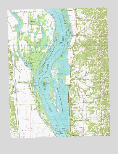
Foley, MO USGS Topographic Map
Click on map above to begin viewing in our Map Viewer.

This topographic map contains these locations and features:
Feature Name Type Latitude Longitude GNIS ID View Map
Bailey LakeLakeN39.0795°W90.6782°403807View Map
Barley BranchStreamN39.0528°W90.7418°713653View Map
BatchtownPopulated PlaceN39.0331°W90.6576°403961View Map
Batchtown Post OfficePost OfficeN39.0326°W90.6549°2788333View Map
Batchtown State Fish and Waterfowl Management AreaParkN39.0417°W90.6854°1748280View Map
Bates SloughLakeN39.0928°W90.6961°713731View Map
Bell PondLakeN39.0237°W90.6773°404125View Map
Birch SloughLakeN39.0899°W90.7239°714258View Map
Black LakeLakeN39.0681°W90.6807°404492View Map
Bradley Island Public Use AreaParkN39.0048°W90.6918°714617View Map
Briar Ridge School (historical)SchoolN39.1095°W90.7079°748195View Map
Burns PondLakeN39.0892°W90.7022°715086View Map
Campbells IslandIslandN39.0903°W90.6760°1748284View Map
Cap au Gris School (historical)SchoolN39.0008°W90.6958°735409View Map
Cave SpringSpringN39.0148°W90.6673°405720View Map
Church SloughGutN39.1031°W90.6723°1748285View Map
City of FoleyCivilN39.0457°W90.7414°2394780View Map
Clear PondLakeN39.0820°W90.7212°715951View Map
Crooked SloughGutN39.0770°W90.7154°716522View Map
Dixon HollowValleyN39.0516°W90.6743°407254View Map
Dixon PondLakeN39.0509°W90.6801°407255View Map
Dogfish SloughLakeN39.0961°W90.7063°716960View Map
Flat PondLakeN39.1128°W90.7209°717993View Map
FoleyPopulated PlaceN39.0464°W90.7423°718049View Map
Foley Post OfficePost OfficeN39.0454°W90.7421°2782782View Map
Foley Public AccessLocaleN39.0506°W90.7185°718050View Map
Foley School (historical)SchoolN39.0434°W90.7443°735410View Map
Garden Pond (historical)LakeN39.0239°W90.7071°739958View Map
George Bain SloughGutN39.0389°W90.6823°408947View Map
GileadPopulated PlaceN39.1242°W90.6673°409003View Map
Gilead LandingLocaleN39.1231°W90.6832°422737View Map
Goose PondLakeN39.0709°W90.7423°718602View Map
Grots PondLakeN39.0754°W90.7104°718897View Map
Hausgen IslandIslandN39.0770°W90.7031°719214View Map
Hogville LandingLocaleN39.0828°W90.6804°422812View Map
Horseshoe LakeLakeN39.0709°W90.7252°719869View Map
Jakes PondLakeN39.0816°W90.7452°735411View Map
Jim Crow IslandIslandN39.0662°W90.7082°720320View Map
Keeton IslandIslandN39.0914°W90.6862°720489View Map
Kings LakePopulated PlaceN39.0684°W90.7437°740985View Map
Kings LakeLakeN39.0745°W90.7304°735676View Map
Knocker PondsLakeN39.0738°W90.7214°720674View Map
KritesvillePopulated PlaceN39.0992°W90.6643°411622View Map
Lick HollowValleyN39.0117°W90.7412°721041View Map
Lick SpringSpringN39.0134°W90.7410°721044View Map
Ligon SloughLakeN39.0851°W90.7160°721050View Map
Little Round PondLakeN39.0389°W90.6865°412405View Map
Little Stag IslandIslandN39.0845°W90.6960°721325View Map
Lock and Dam 25DamN39.0049°W90.6868°1748305View Map
Logging SloughGutN39.1025°W90.7068°721429View Map
Long LakeLakeN39.0456°W90.6885°412574View Map
Long LakeLakeN39.0659°W90.6876°412575View Map
Lost CreekStreamN39.1020°W90.7360°721584View Map
Lower Flat PondLakeN39.0342°W90.6857°412715View Map
Lower Gilead School (historical)SchoolN39.1045°W90.6546°412716View Map
Madison CreekStreamN39.0023°W90.6754°412825View Map
Maple IslandIslandN39.1028°W90.6737°1748306View Map
Masons PondLakeN39.0793°W90.7304°721961View Map
Maxey IslandIslandN39.0034°W90.6773°1748307View Map
Metz LakeLakeN39.0753°W90.6815°413458View Map
Mount Victory School (historical)SchoolN39.0692°W90.6712°414105View Map
OasisPopulated PlaceN39.0828°W90.7471°735412View Map
Oasis LakeLakeN39.0801°W90.7400°723690View Map
Old Kings Lake CreekStreamN39.0817°W90.7351°723758View Map
Ox PondLakeN39.0168°W90.7038°723930View Map
Parkers LandingPopulated PlaceN39.0559°W90.7193°724039View Map
Parkers ParkPopulated PlaceN39.0437°W90.7210°724040View Map
Plummer CemeteryCemeteryN39.1153°W90.6637°1748319View Map
Prairie LakeLakeN39.0625°W90.6821°416147View Map
Richwood Election PrecinctCivilN39.0232°W90.6380°1928633View Map
Richwood Volunteer Fire Protection DistrictBuildingN39.0337°W90.6567°2640888View Map
Round LakeLakeN39.0698°W90.7180°725604View Map
Round LakeLakeN39.0667°W90.6837°416990View Map
Round PondLakeN39.0409°W90.6918°416999View Map
Saint Barbara CemeteryCemeteryN39.0289°W90.6587°1748325View Map
Salt SpringSpringN39.1125°W90.6546°417903View Map
Salt Spring HollowValleyN39.1169°W90.6646°417904View Map
Sand BayLakeN39.0278°W90.6812°417926View Map
Sandy ChuteStreamN39.0006°W90.6879°726034View Map
Sandy CreekStreamN39.0423°W90.7187°735840View Map
Sandy Creek DitchCanalN39.0539°W90.7337°735413View Map
Sandy IslandIslandN39.0275°W90.7104°726045View Map
Sandy Slough DikeLeveeN39.0261°W90.7062°2742774View Map
Sarah Ann IslandIslandN39.0128°W90.6871°418017View Map
Skunk PondLakeN39.1145°W90.7120°726519View Map
Stag IslandIslandN39.0962°W90.6882°726986View Map
Sterling LandingPopulated PlaceN39.1131°W90.6943°741288View Map
Stonebraker CemeteryCemeteryN39.0632°W90.7480°727140View Map
Stump LakeLakeN39.1178°W90.6743°419238View Map
Swan PondLakeN39.1025°W90.7302°735874View Map
Titus Hollow Public Access AreaParkN39.0506°W90.6771°1748331View Map
Turner BranchStreamN39.0528°W90.6810°419946View Map
Turner IslandIslandN39.0517°W90.7062°424551View Map
Turner LandingLocaleN39.0700°W90.6946°422206View Map
Turner LandingPopulated PlaceN39.0703°W90.6954°423258View Map
Twin PondsLakeN39.1056°W90.7127°727928View Map
Upper Flat PondLakeN39.0345°W90.6787°420166View Map
Village of BatchtownCivilN39.0332°W90.6534°2398048View Map
Watson LakeLakeN39.0637°W90.6844°420645View Map
West Point CreekStreamN39.0000°W90.6746°420891View Map
Whiteside CreekStreamN39.0978°W90.7382°728790View Map
Willow Bar LandingLocaleN39.1123°W90.6801°423316View Map
Willow IslandIslandN39.0584°W90.7032°421250View Map
Willow PondLakeN39.0809°W90.7086°728945View Map
Wilson CemeteryCemeteryN39.0378°W90.6751°1748338View Map
Wilson LandingLocaleN39.0264°W90.6921°423319View Map
Winfield - Foley Fire Protection District Station 2BuildingN39.0458°W90.7421°2620788View Map

Note: Coordinates in the location and feature list above are referenced to NAD83 datum.


Copyright (C) 2008-2025 Ryan Niemi / Sunset Dynamics ... All Rights Reserved