TopoQuest Logo
Do you find TopoQuest useful?
Help keep TopoQuest running and adding new maps/features by donating!
Bitcoin:  19c7KJd3qBynnjoSw5npx9KScwjBe4ifkT
Litecoin:  LXs6TkuXGGXo1vDsWCkWVdjQX94eUKd6ui
Home View Maps Find Maps Find Places Resources & Links


Luckett Ridge, Missouri Topographic Map

USGS Map Title: Luckett Ridge, MO
USGS Map MRC: 39090A7
DRG (GeoTIFF) Download: o39090a7.tif


Neighboring USGS Topographic Map Quads:


  Auburn, MO  
39090B8
 

  Elsberry, MO  
39090B7
 

  Hamburg, IL  
39090B6
 

  Okete, MO  
39090A8
 

  Luckett Ridge, MO  
39090A7
 

  Foley, MO  
39090A6
 

  Troy, MO  
38090H8
 

  Maryknoll, MO  
38090H7
 

  Winfield, MO  
38090H6


Map MRC Location:

N40°
W91°
N40°
W90°
H8 H7 H6 H5 H4 H3 H2 H1
G8 G7 G6 G5 G4 G3 G2 G1
F8 F7 F6 F5 F4 F3 F2 F1
E8 E7 E6 E5 E4 E3 E2 E1
D8 D7 D6 D5 D4 D3 D2 D1
C8 C7 C6 C5 C4 C3 C2 C1
B8 B7 B6 B5 B4 B3 B2 B1
A8 A7 A6 A5 A4 A3 A2 A1
N39°
W91°
N39°
W90°

Luckett Ridge, MO USGS 1:24K Topographic Map Preview:
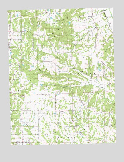
Luckett Ridge, MO USGS Topographic Map
Click on map above to begin viewing in our Map Viewer.

This topographic map contains these locations and features:
Feature Name Type Latitude Longitude GNIS ID View Map
ApexPopulated PlaceN39.1109°W90.7551°740628View Map
Argent CemeteryCemeteryN39.0088°W90.7986°713379View Map
ArgentvillePopulated PlaceN39.0162°W90.7982°740633View Map
Ashbury ChapelChurchN39.0456°W90.8610°735490View Map
Ashbury Chapel CemeteryCemeteryN39.0460°W90.8610°2582500View Map
Bald KnobSummitN39.1175°W90.7879°713589View Map
Bethany CemeteryCemeteryN39.0289°W90.7726°714012View Map
Bethany Methodist Church (historical)ChurchN39.0278°W90.7729°735405View Map
Birkhead LakeReservoirN39.0117°W90.8235°762070View Map
Birkhead Lake DamDamN39.0117°W90.8235°762069View Map
Boehm LakeReservoirN39.1067°W90.8635°762080View Map
Boehm Lake DamDamN39.1067°W90.8635°762079View Map
Britt School (historical)SchoolN39.0770°W90.8072°742463View Map
Brussells School (historical)SchoolN39.0684°W90.8632°742461View Map
Burr Oak (historical)Populated PlaceN39.0592°W90.7640°740153View Map
Burr Oak School (historical)SchoolN39.0625°W90.7673°742464View Map
Camp CreekStreamN39.1242°W90.7546°735547View Map
Campbell LakeReservoirN39.1064°W90.8552°761582View Map
Campbell Lake DamDamN39.1067°W90.8551°761581View Map
Corinth CemeteryCemeteryN39.0543°W90.7556°2582629View Map
Corinth ChurchChurchN39.0542°W90.7557°735564View Map
Cornick School (historical)SchoolN39.0270°W90.7723°742466View Map
Cunningham CreekStreamN39.0481°W90.8749°716595View Map
Ellis School (historical)SchoolN39.1214°W90.8246°742459View Map
Gentry LakeReservoirN39.1099°W90.8388°760538View Map
Gentry Lake DamDamN39.1100°W90.8385°760537View Map
Glosier LakeReservoirN39.1119°W90.8301°761525View Map
Glosier Lake DamDamN39.1117°W90.8301°761524View Map
Hickory Ridge School (historical)SchoolN39.1125°W90.8735°742460View Map
Hillside Gardens LakeReservoirN39.0680°W90.7677°761703View Map
Hillside Gardens Lake DamDamN39.0667°W90.7668°761702View Map
Hurricane CreekStreamN39.1170°W90.7512°720037View Map
Little Sandy CreekStreamN39.0531°W90.7893°721312View Map
Lost Creek Watershed E-2 DamDamN39.1217°W90.8168°760512View Map
Lost Creek Watershed E-2 ReservoirReservoirN39.1204°W90.8156°760513View Map
Lost Creek Watershed Structure E-7 LakeReservoirN39.1241°W90.8268°761619View Map
Lost LakeReservoirN39.1168°W90.8236°760536View Map
Lost Lake DamDamN39.1184°W90.8251°760535View Map
Luckett CemeteryCemeteryN39.1234°W90.8660°721662View Map
Luckett RidgeRidgeN39.1059°W90.8268°721663View Map
McCane LakeReservoirN39.0802°W90.8582°761538View Map
McCane Lake DamDamN39.0800°W90.8585°761537View Map
McCullen CemeteryCemeteryN39.0558°W90.8150°722073View Map
Merenaught Farms LakeReservoirN39.0721°W90.8472°761590View Map
Merenaught Farms Lake DamDamN39.0717°W90.8451°761589View Map
Myers School (historical)SchoolN39.0912°W90.7710°742462View Map
Nelsens LakeReservoirN39.0826°W90.8658°762074View Map
Nelsens Lake DamDamN39.0817°W90.8651°762073View Map
New Galilee CemeteryCemeteryN39.0030°W90.8679°2585179View Map
New Galilee ChurchChurchN39.0025°W90.8685°723202View Map
New Salem (historical)Populated PlaceN39.0136°W90.7991°735408View Map
New Salem CemeteryCemeteryN39.0304°W90.8165°2585129View Map
New Salem ChurchChurchN39.0300°W90.8154°735747View Map
New Salem School (historical)SchoolN39.0304°W90.8175°742465View Map
Overall CemeteryCemeteryN39.0194°W90.8168°723899View Map
Peek Lake Section 13ReservoirN39.0934°W90.8418°762078View Map
Peek Lake Section 13 DamDamN39.0934°W90.8418°762077View Map
Peek Lake Section 18ReservoirN39.1000°W90.8401°762076View Map
Peek Lake Section 18 DamDamN39.1000°W90.8401°762075View Map
Pleasant Hill CemeteryCemeteryN39.1093°W90.8448°2585183View Map
Ross-Mulvehill LakeReservoirN39.0287°W90.8217°761414View Map
Ross-Mulvehill Lake DamDamN39.0284°W90.8218°761413View Map
Skyway LakeReservoirN39.1201°W90.8637°761676View Map
Skyway Lake DamDamN39.1184°W90.8635°761675View Map
Smith LakeReservoirN39.1120°W90.8023°761606View Map
Smith Lake DamDamN39.1134°W90.8018°761605View Map
Star Hope CemeteryCemeteryN39.1166°W90.7763°2585197View Map
Star Hope ChurchChurchN39.1167°W90.7751°735867View Map
Star Hope School (historical)SchoolN39.1166°W90.7745°742458View Map
Taylor CemeteryCemeteryN39.0943°W90.8745°727492View Map
Taylor LakeReservoirN39.0853°W90.8728°761586View Map
Taylor Lake DamDamN39.0850°W90.8718°761585View Map
Taylor School (historical)SchoolN39.0306°W90.8726°735404View Map
Terrell LakeReservoirN39.0742°W90.8582°762072View Map
Terrell Lake DamDamN39.0734°W90.8568°762071View Map
Township of Burr OakCivilN39.0662°W90.7654°766901View Map
Upper Sandy CreekStreamN39.0545°W90.7776°728077View Map
Wilson CemeteryCemeteryN39.0019°W90.8707°728963View Map
Winfield - Foley Fire Protection District Station 4BuildingN39.0460°W90.8489°2621727View Map
Winfield Manor HeliportAirportN39.0178°W90.8179°759006View Map
Wollgast LakeReservoirN39.0945°W90.8553°761584View Map
Wollgast Lake DamDamN39.0950°W90.8551°761583View Map

Note: Coordinates in the location and feature list above are referenced to NAD83 datum.


Copyright (C) 2008-2024 Ryan Niemi / Sunset Dynamics ... All Rights Reserved