TopoQuest Logo
Do you find TopoQuest useful?
Help keep TopoQuest running and adding new maps/features by donating!
Bitcoin:  19c7KJd3qBynnjoSw5npx9KScwjBe4ifkT
Litecoin:  LXs6TkuXGGXo1vDsWCkWVdjQX94eUKd6ui
Home View Maps Find Maps Find Places Resources & Links


Forestville, Michigan Topographic Map

USGS Map Title: Forestville, MI
USGS Map MRC: 43082F5
DRG (GeoTIFF) Download: o43082f5.tif


Neighboring USGS Topographic Map Quads:


  Harbor Beach, MI  
43082G6


  Ruth, MI  
43082F6
 

  Forestville, MI  
43082F5


  Deckerville, MI  
43082E6
 

  Richmondville, MI  
43082E5


Map MRC Location:

N44°
W83°
N44°
W82°
H8 H7 H6 H5 H4 H3 H2 H1
G8 G7 G6 G5 G4 G3 G2 G1
F8 F7 F6 F5 F4 F3 F2 F1
E8 E7 E6 E5 E4 E3 E2 E1
D8 D7 D6 D5 D4 D3 D2 D1
C8 C7 C6 C5 C4 C3 C2 C1
B8 B7 B6 B5 B4 B3 B2 B1
A8 A7 A6 A5 A4 A3 A2 A1
N43°
W83°
N43°
W82°

Forestville, MI USGS 1:24K Topographic Map Preview:
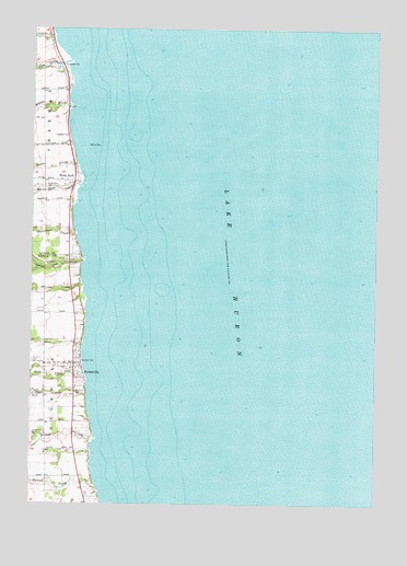
Forestville, MI USGS Topographic Map
Click on map above to begin viewing in our Map Viewer.

This topographic map contains these locations and features:
Feature Name Type Latitude Longitude GNIS ID View Map
Benhke CreekStreamN43.6411°W82.6016°621097View Map
County Line CreekStreamN43.6897°W82.6049°623887View Map
Elm CreekStreamN43.7420°W82.6108°625503View Map
ForestvillePopulated PlaceN43.6620°W82.6094°626287View Map
Forestville CemeteryCemeteryN43.6542°W82.6111°2554467View Map
Forestville Post OfficePost OfficeN43.6619°W82.6092°2554127View Map
Martell CreekStreamN43.6295°W82.6005°631646View Map
Mill CreekStreamN43.6578°W82.6041°632322View Map
Saint Johns CemeteryCemeteryN43.6626°W82.6244°636730View Map
Slatestone CreekStreamN43.6970°W82.6091°638087View Map
Stephens ParkParkN43.6622°W82.6069°638789View Map
Stover CreekStreamN43.7136°W82.6077°638931View Map
The FlatsBarN43.7167°W82.6058°1623101View Map
Village of ForestvilleCivilN43.6599°W82.6126°2398898View Map
Wanke CreekStreamN43.6822°W82.6060°1615761View Map
Wankes ReefBarN43.6875°W82.5938°1623132View Map
White RiverStreamN43.7303°W82.6096°1616329View Map
White RockIslandN43.7195°W82.6046°1616330View Map
White RockPopulated PlaceN43.7100°W82.6096°1616331View Map
White Rock CemeteryCemeteryN43.7089°W82.6205°1616332View Map
White Rock CreekStreamN43.7078°W82.6074°1616333View Map
White Rock School Historical MarkerParkN43.7097°W82.6114°2548574View Map
Whiterock Post Office (historical)Post OfficeN43.7100°W82.6097°2548488View Map

Note: Coordinates in the location and feature list above are referenced to NAD83 datum.


Copyright (C) 2008-2025 Ryan Niemi / Sunset Dynamics ... All Rights Reserved