TopoQuest Logo
Do you find TopoQuest useful?
Help keep TopoQuest running and adding new maps/features by donating!
Bitcoin:  19c7KJd3qBynnjoSw5npx9KScwjBe4ifkT
Litecoin:  LXs6TkuXGGXo1vDsWCkWVdjQX94eUKd6ui
Home View Maps Find Maps Find Places Resources & Links


Deckerville, Michigan Topographic Map

USGS Map Title: Deckerville, MI
USGS Map MRC: 43082E6
DRG (GeoTIFF) Download: o43082e6.tif


Neighboring USGS Topographic Map Quads:


  Minden City, MI  
43082F7
 

  Ruth, MI  
43082F6
 

  Forestville, MI  
43082F5
 

  Palms, MI  
43082E7
 

  Deckerville, MI  
43082E6
 

  Richmondville, MI  
43082E5
 

  Sandusky, MI  
43082D7
 

  Carsonville, MI  
43082D6
 

  Port Sanilac, MI  
43082D5


Map MRC Location:

N44°
W83°
N44°
W82°
H8 H7 H6 H5 H4 H3 H2 H1
G8 G7 G6 G5 G4 G3 G2 G1
F8 F7 F6 F5 F4 F3 F2 F1
E8 E7 E6 E5 E4 E3 E2 E1
D8 D7 D6 D5 D4 D3 D2 D1
C8 C7 C6 C5 C4 C3 C2 C1
B8 B7 B6 B5 B4 B3 B2 B1
A8 A7 A6 A5 A4 A3 A2 A1
N43°
W83°
N43°
W82°

Deckerville, MI USGS 1:24K Topographic Map Preview:
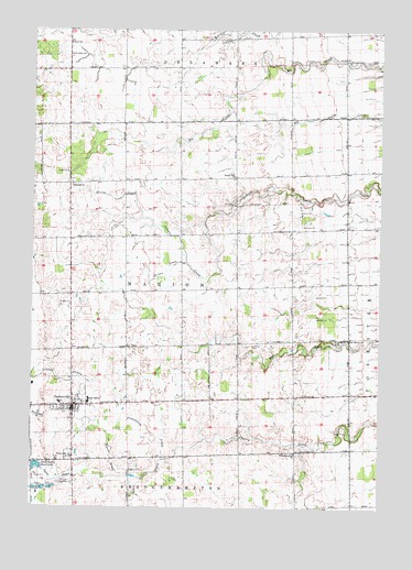
Deckerville, MI USGS Topographic Map
Click on map above to begin viewing in our Map Viewer.

This topographic map contains these locations and features:
Feature Name Type Latitude Longitude GNIS ID View Map
Bridgehampton ChurchChurchN43.5145°W82.6552°621965View Map
Cedardale ChurchChurchN43.5845°W82.7360°622960View Map
DeckervillePopulated PlaceN43.5267°W82.7352°624443View Map
Deckerville ChurchChurchN43.5134°W82.7352°624444View Map
Deckerville Community High SchoolSchoolN43.5278°W82.7292°2554139View Map
Deckerville Community HospitalHospitalN43.5282°W82.7343°2554117View Map
Deckerville Community HospitalHospitalN43.5275°W82.7339°2554138View Map
Deckerville Fire DepartmentBuildingN43.5272°W82.7341°2626938View Map
Deckerville Police DepartmentBuildingN43.5269°W82.7339°2554136View Map
Deckerville Post OfficePost OfficeN43.5256°W82.7344°2554130View Map
Deckerville Public LibraryBuildingN43.5253°W82.7350°2554135View Map
Deckerville ReservoirReservoirN43.5109°W82.7478°624445View Map
Delaware CemeteryCemeteryN43.6222°W82.6835°624525View Map
Dowington Post Office (historical)Post OfficeN43.5122°W82.7347°2554236View Map
East Marion CemeteryCemeteryN43.5439°W82.6410°625228View Map
East Marion ChurchChurchN43.5445°W82.6360°625229View Map
Evans DrainCanalN43.5806°W82.7199°625675View Map
Farnsworth DrainCanalN43.5181°W82.7083°625841View Map
First Baptist ChurchChurchN43.5239°W82.7353°2554134View Map
First United Presbyterian ChurchChurchN43.5264°W82.7381°2554132View Map
Gospel Hall ChurchChurchN43.5867°W82.6774°627015View Map
Grandy DrainCanalN43.5331°W82.7383°627129View Map
Hunt SchoolSchoolN43.6214°W82.7372°628824View Map
Indian Creek Ranch AirportAirportN43.5785°W82.6493°1623859View Map
Leitch Post Office (historical)Post OfficeN43.5294°W82.6556°2554224View Map
Mills CemeteryCemeteryN43.5800°W82.6777°632420View Map
Mills Post Office (historical)Post OfficeN43.5869°W82.6772°2554223View Map
Osgood DrainCanalN43.5125°W82.7208°634135View Map
Parson DrainCanalN43.5620°W82.7016°634433View Map
Rosbury CemeteryCemeteryN43.5097°W82.7144°636188View Map
Rusnell Farm CemeteryCemeteryN43.5569°W82.7375°2554456View Map
Saint Johns ChurchChurchN43.6184°W82.7369°636738View Map
Snay Post Office (historical)Post OfficeN43.6228°W82.6781°2554190View Map
Township of MarionCivilN43.5572°W82.6960°1626692View Map
Village of DeckervilleCivilN43.5265°W82.7420°2398701View Map
Wright CemeteryCemeteryN43.5531°W82.7366°1616836View Map

Note: Coordinates in the location and feature list above are referenced to NAD83 datum.


Copyright (C) 2008-2024 Ryan Niemi / Sunset Dynamics ... All Rights Reserved