TopoQuest Logo
Do you find TopoQuest useful?
Help keep TopoQuest running and adding new maps/features by donating!
Bitcoin:  19c7KJd3qBynnjoSw5npx9KScwjBe4ifkT
Litecoin:  LXs6TkuXGGXo1vDsWCkWVdjQX94eUKd6ui
Home View Maps Find Maps Find Places Resources & Links


Forks Butte, Arizona Topographic Map

USGS Map Title: Forks Butte, AZ
USGS Map MRC: 33110F2
DRG (GeoTIFF) Download: o33110f2.tif


Neighboring USGS Topographic Map Quads:


  Carrizo SE, AZ  
33110G3
 

  Cone Butte, AZ  
33110G2
 

  Canyon Day, AZ  
33110G1
 

  Popcorn Canyon, AZ  
33110F3
 

  Forks Butte, AZ  
33110F2
 

  Velasquez Butte, AZ  
33110F1
 

  Sontag Creek, AZ  
33110E3
 

  Chiricahua Butte, AZ  
33110E2
 

  Georges Butte, AZ  
33110E1


Map MRC Location:

N34°
W111°
N34°
W110°
H8 H7 H6 H5 H4 H3 H2 H1
G8 G7 G6 G5 G4 G3 G2 G1
F8 F7 F6 F5 F4 F3 F2 F1
E8 E7 E6 E5 E4 E3 E2 E1
D8 D7 D6 D5 D4 D3 D2 D1
C8 C7 C6 C5 C4 C3 C2 C1
B8 B7 B6 B5 B4 B3 B2 B1
A8 A7 A6 A5 A4 A3 A2 A1
N33°
W111°
N33°
W110°

Forks Butte, AZ USGS 1:24K Topographic Map Preview:
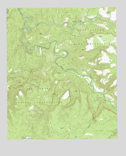
Forks Butte, AZ USGS Topographic Map
Click on map above to begin viewing in our Map Viewer.

This topographic map contains these locations and features:
Feature Name Type Latitude Longitude GNIS ID View Map
Amos WashStreamN33.7367°W110.1623°635View Map
Baskin TankReservoirN33.6264°W110.1701°1050View Map
Baskin Tank CanyonValleyN33.6656°W110.1451°1051View Map
Black RiverStreamN33.7389°W110.2257°26443View Map
Black RiverLocaleN33.7084°W110.2173°23851View Map
Black River CrossingPopulated PlaceN33.7128°W110.2118°24325View Map
Box TankReservoirN33.7455°W110.1835°1921View Map
Bread SpringSpringN33.6706°W110.1734°1947View Map
Bronco CanyonValleyN33.7045°W110.2112°1981View Map
Calf CreekStreamN33.7489°W110.2359°2369View Map
Deer CreekStreamN33.6859°W110.1662°3802View Map
Forks ButteSummitN33.7253°W110.2132°4732View Map
Four Diamond TankReservoirN33.7219°W110.1459°4774View Map
Jackson Hole TankReservoirN33.6354°W110.1913°6325View Map
Jaquar TankReservoirN33.7099°W110.1656°6361View Map
John Moore TankReservoirN33.7228°W110.1715°6454View Map
Maverick SpringSpringN33.6881°W110.1893°7791View Map
Navajo Bill TankReservoirN33.7453°W110.1374°8527View Map
Packing Horse CreekStreamN33.6806°W110.1765°23979View Map
Phillips Park DamDamN33.6264°W110.2243°22356View Map
Phillips Park TankReservoirN33.6250°W110.2275°9369View Map
Pineasco CreekStreamN33.6884°W110.1715°9497View Map
Pineasco SpringSpringN33.6681°W110.1954°9498View Map
Wagon Road TankReservoirN33.7371°W110.1755°13271View Map
Warm SpringSpringN33.7345°W110.2162°13346View Map
White RiverStreamN33.7389°W110.2257°13653View Map

Note: Coordinates in the location and feature list above are referenced to NAD83 datum.


Copyright (C) 2008-2024 Ryan Niemi / Sunset Dynamics ... All Rights Reserved