TopoQuest Logo
Do you find TopoQuest useful?
Help keep TopoQuest running and adding new maps/features by donating!
Bitcoin:  19c7KJd3qBynnjoSw5npx9KScwjBe4ifkT
Litecoin:  LXs6TkuXGGXo1vDsWCkWVdjQX94eUKd6ui
Home View Maps Find Maps Find Places Resources & Links


Fort Cobb, Oklahoma Topographic Map

USGS Map Title: Fort Cobb, OK
USGS Map MRC: 35098A4
DRG (GeoTIFF) Download: o35098a4.tif


Neighboring USGS Topographic Map Quads:


  Alfalfa, OK  
35098B5
 

  Fort Cobb Dam, OK  
35098B4
 

  Gracemont, OK  
35098B3
 

  Carnegie, OK  
35098A5
 

  Fort Cobb, OK  
35098A4
 

  Anadarko West, OK  
35098A3
 

  Alden, OK  
34098H5
 

  Boone, OK  
34098H4
 

  Apache, OK  
34098H3


Map MRC Location:

N36°
W99°
N36°
W98°
H8 H7 H6 H5 H4 H3 H2 H1
G8 G7 G6 G5 G4 G3 G2 G1
F8 F7 F6 F5 F4 F3 F2 F1
E8 E7 E6 E5 E4 E3 E2 E1
D8 D7 D6 D5 D4 D3 D2 D1
C8 C7 C6 C5 C4 C3 C2 C1
B8 B7 B6 B5 B4 B3 B2 B1
A8 A7 A6 A5 A4 A3 A2 A1
N35°
W99°
N35°
W98°

Fort Cobb, OK USGS 1:24K Topographic Map Preview:
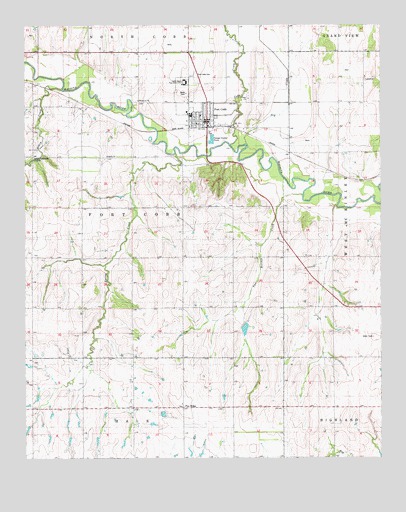
Fort Cobb, OK USGS Topographic Map
Click on map above to begin viewing in our Map Viewer.

This topographic map contains these locations and features:
Feature Name Type Latitude Longitude GNIS ID View Map
Apache ChurchChurchN35.0876°W98.4712°1089667View Map
Behel Assembly of God ChurchChurchN35.0959°W98.4428°1798213View Map
Buzzard CreekStreamN35.0728°W98.3909°1802966View Map
Caddo ChurchChurchN35.1039°W98.4214°1090796View Map
Caddo Kiowa Technology CenterSchoolN35.1085°W98.4434°1090803View Map
Cobb CreekStreamN35.0903°W98.4276°1091527View Map
Cowden Laterals Site 14 DamDamN35.1201°W98.4703°1754596View Map
Cowden Laterals Site 14 ReservoirReservoirN35.1201°W98.4703°1754597View Map
Dry CreekStreamN35.0906°W98.4220°1092234View Map
First Baptist ChurchChurchN35.0987°W98.4406°1798214View Map
Fort CobbPopulated PlaceN35.0978°W98.4356°1092951View Map
Fort Cobb - Broxton High SchoolSchoolN35.0990°W98.4417°1790333View Map
Fort Cobb - Broxton Lower Elementary SchoolSchoolN35.0990°W98.4417°1790650View Map
Fort Cobb - Broxton Middle SchoolSchoolN35.0990°W98.4417°1101137View Map
Fort Cobb CemeteryCemeteryN35.1109°W98.4406°1092952View Map
Fort Cobb DivisionCivilN35.1146°W98.4308°1937714View Map
Fort Cobb Fire DepartmentBuildingN35.0973°W98.4358°2658287View Map
Fort Cobb Laterals Site 7 DamDamN35.0334°W98.4237°1754604View Map
Fort Cobb Laterals Site 7 ReservoirReservoirN35.0334°W98.4237°1754605View Map
Fort Cobb Police DepartmentBuildingN35.0972°W98.4351°2757496View Map
Fort Cobb Post OfficePost OfficeN35.0989°W98.4358°1814120View Map
Gokey CreekStreamN35.1067°W98.4873°1093233View Map
Macedonia ChurchChurchN35.1034°W98.4601°1095074View Map
Pine RidgePopulated PlaceN35.0151°W98.4445°1100741View Map
Pleasant View CemeteryCemeteryN35.0152°W98.4456°2701810View Map
Spring CreekStreamN35.0878°W98.4470°1098378View Map
Town of Fort CobbCivilN35.1097°W98.4449°2412638View Map
Township of Fort CobbCivilN35.0695°W98.4642°1825303View Map
Two Hatchet CreekStreamN35.0759°W98.4020°1099123View Map

Note: Coordinates in the location and feature list above are referenced to NAD83 datum.


Copyright (C) 2008-2024 Ryan Niemi / Sunset Dynamics ... All Rights Reserved