TopoQuest Logo
Do you find TopoQuest useful?
Help keep TopoQuest running and adding new maps/features by donating!
Bitcoin:  19c7KJd3qBynnjoSw5npx9KScwjBe4ifkT
Litecoin:  LXs6TkuXGGXo1vDsWCkWVdjQX94eUKd6ui
Home View Maps Find Maps Find Places Resources & Links


Carnegie, Oklahoma Topographic Map

USGS Map Title: Carnegie, OK
USGS Map MRC: 35098A5
DRG (GeoTIFF) Download: o35098a5.tif


Neighboring USGS Topographic Map Quads:


  Cowden, OK  
35098B6
 

  Alfalfa, OK  
35098B5
 

  Fort Cobb Dam, OK  
35098B4
 

  Stinking Creek, OK  
35098A6
 

  Carnegie, OK  
35098A5
 

  Fort Cobb, OK  
35098A4
 

  Bally Mountain, OK  
34098H6
 

  Alden, OK  
34098H5
 

  Boone, OK  
34098H4


Map MRC Location:

N36°
W99°
N36°
W98°
H8 H7 H6 H5 H4 H3 H2 H1
G8 G7 G6 G5 G4 G3 G2 G1
F8 F7 F6 F5 F4 F3 F2 F1
E8 E7 E6 E5 E4 E3 E2 E1
D8 D7 D6 D5 D4 D3 D2 D1
C8 C7 C6 C5 C4 C3 C2 C1
B8 B7 B6 B5 B4 B3 B2 B1
A8 A7 A6 A5 A4 A3 A2 A1
N35°
W99°
N35°
W98°

Carnegie, OK USGS 1:24K Topographic Map Preview:
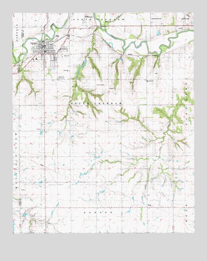
Carnegie, OK USGS Topographic Map
Click on map above to begin viewing in our Map Viewer.

This topographic map contains these locations and features:
Feature Name Type Latitude Longitude GNIS ID View Map
Botone Memorial ChurchChurchN35.0867°W98.5323°1747188View Map
Carlin Lawrence Airport (historical)AirportN35.1183°W98.5293°1102393View Map
CarnegiePopulated PlaceN35.1037°W98.6037°1090977View Map
Carnegie CemeteryCemeteryN35.0882°W98.5919°1090978View Map
Carnegie ChurchChurchN35.0823°W98.5592°1090979View Map
Carnegie DivisionCivilN35.0934°W98.5536°1937661View Map
Carnegie Elementary SchoolSchoolN35.1014°W98.6060°2713106View Map
Carnegie Fire DepartmentBuildingN35.1068°W98.6037°2658454View Map
Carnegie High SchoolSchoolN35.1033°W98.6028°1803879View Map
Carnegie Junior High SchoolSchoolN35.0991°W98.6087°1803880View Map
Carnegie Municipal AirportAirportN35.1209°W98.5762°1102394View Map
Carnegie Municipal Hospital HeliportAirportN35.1167°W98.6006°1102395View Map
Carnegie Police DepartmentBuildingN35.1067°W98.6052°2757595View Map
Carnegie Post OfficePost OfficeN35.1066°W98.6051°1813466View Map
Carnegie Tri - County Municipal HospitalHospitalN35.1072°W98.6052°2695761View Map
Cedar CreekStreamN35.1162°W98.5645°1091075View Map
Cedar Creek CemeteryCemeteryN35.0839°W98.5676°1091104View Map
Cedar Creek ChurchChurchN35.0923°W98.5867°1091105View Map
Cedar Dale Indian MissionChurchN35.0876°W98.5395°1091110View Map
Cowden Laterals Site 11 DamDamN35.1217°W98.5237°1754590View Map
Cowden Laterals Site 11 ReservoirReservoirN35.1217°W98.5237°1754591View Map
Cowden Laterals Site 13 DamDamN35.1217°W98.5037°1754594View Map
Cowden Laterals Site 13 ReservoirReservoirN35.1217°W98.5037°1754595View Map
First Christian ChurchChurchN35.1073°W98.6017°1782638View Map
Fort Cobb Laterals Site 1 DamDamN35.0967°W98.5753°1754600View Map
Fort Cobb Laterals Site 1 ReservoirReservoirN35.0951°W98.5771°1754601View Map
Fort Cobb Laterals Site 2 DamDamN35.0967°W98.5537°1754602View Map
Fort Cobb Laterals Site 2 ReservoirReservoirN35.0967°W98.5537°1754603View Map
Lawrence Landing Strip (historical)AirportN35.1212°W98.5295°1747187View Map
Running CreekStreamN35.1156°W98.5615°1097527View Map
Saddle Mountain Site 3 DamDamN35.0117°W98.6170°1758746View Map
Saddle Mountain Site 3 ReservoirReservoirN35.0110°W98.6166°1758747View Map
Stinking CreekStreamN35.0967°W98.6220°1098552View Map
Town of CarnegieCivilN35.1024°W98.5995°2413171View Map
Township of South LathramCivilN35.0723°W98.5642°1825282View Map
Westselline ChurchChurchN35.0862°W98.5326°1099634View Map

Note: Coordinates in the location and feature list above are referenced to NAD83 datum.


Copyright (C) 2008-2025 Ryan Niemi / Sunset Dynamics ... All Rights Reserved