TopoQuest Logo
Do you find TopoQuest useful?
Help keep TopoQuest running and adding new maps/features by donating!
Bitcoin:  19c7KJd3qBynnjoSw5npx9KScwjBe4ifkT
Litecoin:  LXs6TkuXGGXo1vDsWCkWVdjQX94eUKd6ui
Home View Maps Find Maps Find Places Resources & Links


Fort Lupton, Colorado Topographic Map

USGS Map Title: Fort Lupton, CO
USGS Map MRC: 40104A7
DRG (GeoTIFF) Download: o40104a7.tif


Neighboring USGS Topographic Map Quads:


  Gowanda, CO  
40104B8
 

  Platteville, CO  
40104B7
 

  Milton Reservoir, CO  
40104B6
 

  Frederick, CO  
40104A8
 

  Fort Lupton, CO  
40104A7
 

  Hudson, CO  
40104A6
 

  Eastlake, CO  
39104H8
 

  Brighton, CO  
39104H7
 

  Mile High Lakes, CO  
39104H6


Map MRC Location:

N41°
W105°
N41°
W104°
H8 H7 H6 H5 H4 H3 H2 H1
G8 G7 G6 G5 G4 G3 G2 G1
F8 F7 F6 F5 F4 F3 F2 F1
E8 E7 E6 E5 E4 E3 E2 E1
D8 D7 D6 D5 D4 D3 D2 D1
C8 C7 C6 C5 C4 C3 C2 C1
B8 B7 B6 B5 B4 B3 B2 B1
A8 A7 A6 A5 A4 A3 A2 A1
N40°
W105°
N40°
W104°

Fort Lupton, CO USGS 1:24K Topographic Map Preview:
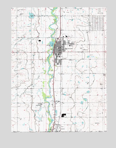
Fort Lupton, CO USGS Topographic Map
Click on map above to begin viewing in our Map Viewer.

This topographic map contains these locations and features:
Feature Name Type Latitude Longitude GNIS ID View Map
Alpha MineMineN40.0947°W104.8397°1735431View Map
Aristocrat RanchettesPopulated PlaceN40.1091°W104.7625°1852836View Map
Aristocrat Ranchettes Census Designated PlaceCensusN40.1096°W104.7549°2407757View Map
Big Dry CreekStreamN40.0725°W104.8269°181264View Map
Brantner DitchCanalN40.0278°W104.8561°180845View Map
Brighton DitchCanalN40.0222°W104.8478°202767View Map
Brighton Lateral DitchCanalN40.0250°W104.7877°202766View Map
Butler Elementary SchoolSchoolN40.0755°W104.8142°2060204View Map
City of Fort LuptonCivilN40.0826°W104.8015°2410528View Map
Coal Ridge Waste DamDamN40.1167°W104.8455°198342View Map
Coal Ridge Waste ReservoirReservoirN40.1166°W104.8486°198343View Map
Delventhal Farm Airport (historical)AirportN40.0108°W104.7902°204283View Map
Fort LuptonPopulated PlaceN40.0847°W104.8130°180857View Map
Fort Lupton DivisionCivilN40.0739°W104.8221°1935464View Map
Fort Lupton Fire Department Station 1BuildingN40.0904°W104.8109°2060207View Map
Fort Lupton Fire Department Station 2BuildingN40.0880°W104.7738°2667036View Map
Fort Lupton High SchoolSchoolN40.0757°W104.8116°2060201View Map
Fort Lupton Middle SchoolSchoolN40.0778°W104.8136°2060202View Map
Fort Lupton Police DepartmentBuildingN40.0798°W104.8125°2060205View Map
Fort Lupton Post OfficePost OfficeN40.0836°W104.8119°2734578View Map
Fulton Lateral DitchCanalN40.0136°W104.8119°202768View Map
H A Smith DamDamN40.0500°W104.7889°200216View Map
H A Smith ReservoirReservoirN40.0499°W104.7867°200217View Map
Hillside CemeteryCemeteryN40.0722°W104.7955°180855View Map
Independence SchoolSchoolN40.0311°W104.8111°180852View Map
KLTT-AM (Brighton)TowerN40.0280°W104.8230°203970View Map
Little Dry CreekStreamN40.0955°W104.8319°180836View Map
Lupton Bottoms DitchCanalN40.0417°W104.8350°180856View Map
Munger Number 1 DamDamN40.0300°W104.7772°200202View Map
Munger Number 2 DamDamN40.0400°W104.7739°200204View Map
Munger Reservoir Number 1ReservoirN40.0325°W104.7781°200203View Map
Munger Reservoir Number 2ReservoirN40.0404°W104.7745°200205View Map
Porter SchoolSchoolN40.1161°W104.8066°180854View Map
PowarsPopulated PlaceN40.0408°W104.8080°180853View Map
Smith MoundSummitN40.0578°W104.7516°202765View Map
Twombly Elementary SchoolSchoolN40.0864°W104.7983°2060203View Map
WattenbergPopulated PlaceN40.0278°W104.8366°180850View Map
Wattenberg SchoolSchoolN40.0292°W104.8491°180851View Map
Weld County Paramedic Services Station 3BuildingN40.0877°W104.7740°2667231View Map
Weld County Sheriff's OfficeBuildingN40.0869°W104.7740°2060206View Map

Note: Coordinates in the location and feature list above are referenced to NAD83 datum.


Copyright (C) 2008-2025 Ryan Niemi / Sunset Dynamics ... All Rights Reserved