TopoQuest Logo
Do you find TopoQuest useful?
Help keep TopoQuest running and adding new maps/features by donating!
Bitcoin:  19c7KJd3qBynnjoSw5npx9KScwjBe4ifkT
Litecoin:  LXs6TkuXGGXo1vDsWCkWVdjQX94eUKd6ui
Home View Maps Find Maps Find Places Resources & Links


Fort Sumner East, New Mexico Topographic Map

USGS Map Title: Fort Sumner East, NM
USGS Map MRC: 34104D2
DRG (GeoTIFF) Download: o34104d2.tif


Neighboring USGS Topographic Map Quads:


  Windmill Draw, NM  
34104E3
 

  Twin Mesa, NM  
34104E2
 

  Candy Mesa, NM  
34104E1
 

  Fort Sumner West, NM  
34104D3
 

  Fort Sumner East, NM  
34104D2
 

  Taiban, NM  
34104D1
 

  Alamo Ranch, NM  
34104C3
 

  Bonner Lake, NM  
34104C2
 

  Lomas Gatos, NM  
34104C1


Map MRC Location:

N35°
W105°
N35°
W104°
H8 H7 H6 H5 H4 H3 H2 H1
G8 G7 G6 G5 G4 G3 G2 G1
F8 F7 F6 F5 F4 F3 F2 F1
E8 E7 E6 E5 E4 E3 E2 E1
D8 D7 D6 D5 D4 D3 D2 D1
C8 C7 C6 C5 C4 C3 C2 C1
B8 B7 B6 B5 B4 B3 B2 B1
A8 A7 A6 A5 A4 A3 A2 A1
N34°
W105°
N34°
W104°

Fort Sumner East, NM USGS 1:24K Topographic Map Preview:
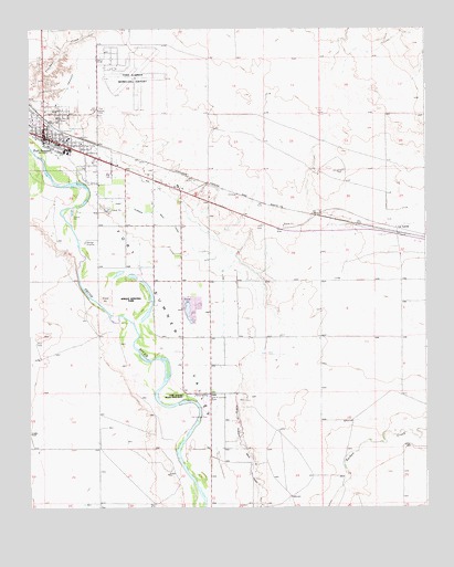
Fort Sumner East, NM USGS Topographic Map
Click on map above to begin viewing in our Map Viewer.

This topographic map contains these locations and features:
Feature Name Type Latitude Longitude GNIS ID View Map
Billy the Kid MuseumBuildingN34.4051°W104.2455°929476View Map
Christ Full Gospel ChurchChurchN34.4717°W104.2455°921131View Map
Church of ChristChurchN34.4717°W104.2455°921124View Map
De Baca County Sheriff's OfficeBuildingN34.4716°W104.2442°2722595View Map
De Baca General HospitalHospitalN34.4717°W104.2455°934096View Map
Early Spanish Route Historical MarkerParkN34.4717°W104.2455°932346View Map
First Assembly of God ChurchChurchN34.4717°W104.2455°921175View Map
First Baptist ChurchChurchN34.4717°W104.2455°921014View Map
Fort SumnerPopulated PlaceN34.4717°W104.2455°923600View Map
Fort Sumner Army Air Field (historical)MilitaryN34.4886°W104.2167°2091971View Map
Fort Sumner CemeteryCemeteryN34.4788°W104.2270°897009View Map
Fort Sumner Church of ChristChurchN34.4717°W104.2455°921130View Map
Fort Sumner Elementary SchoolSchoolN34.4717°W104.2455°933859View Map
Fort Sumner High SchoolSchoolN34.4717°W104.2455°933861View Map
Fort Sumner Historical MarkerParkN34.4717°W104.2455°932348View Map
Fort Sumner Main CanalCanalN34.4456°W104.2014°897011View Map
Fort Sumner Middle SchoolSchoolN34.4717°W104.2455°933860View Map
Fort Sumner Municipal AirportAirportN34.4843°W104.2164°942027View Map
Fort Sumner PitMineN34.4390°W104.2266°917867View Map
Fort Sumner Post OfficePost OfficeN34.4717°W104.2455°938259View Map
Fort Sumner Public LibraryBuildingN34.4834°W104.2172°930528View Map
Fort Sumner State MonumentParkN34.3978°W104.1955°929582View Map
Fort Sumner State MonumentBuildingN34.4042°W104.2047°933141View Map
Fort Sumner State Monument Historical MarkerParkN34.4717°W104.2455°932339View Map
Fort Sumner Volunteer Fire Department and AmbulanceBuildingN34.4695°W104.2374°2657557View Map
Fort Sumner Weather StationLocaleN34.4717°W104.2455°931840View Map
Kingdom HallChurchN34.4717°W104.2455°920086View Map
La LandePopulated PlaceN34.4481°W104.1341°898807View Map
La Lande CemeteryCemeteryN34.4631°W104.1508°897077View Map
La Lande Post Office (historical)Post OfficeN34.4481°W104.1341°938302View Map
Nazarene ChurchChurchN34.4717°W104.2455°921125View Map
Old Fort Sumner CemeteryCemeteryN34.4040°W104.1933°897155View Map
Rodrick Drug Store Historic SiteBuildingN34.4717°W104.2455°934423View Map
Saint Anthony Catholic ChurchChurchN34.4717°W104.2455°920950View Map
Saint Johns Episcopal ChurchChurchN34.4717°W104.2455°920532View Map
Sunnyside SpringsSpringN34.4934°W104.2408°933176View Map
Valley Volunteer Fire DepartmentBuildingN34.4574°W104.2027°2657866View Map
Village of Fort SumnerCivilN34.4729°W104.2440°2413553View Map

Note: Coordinates in the location and feature list above are referenced to NAD83 datum.


Copyright (C) 2008-2025 Ryan Niemi / Sunset Dynamics ... All Rights Reserved