TopoQuest Logo
Do you find TopoQuest useful?
Help keep TopoQuest running and adding new maps/features by donating!
Bitcoin:  19c7KJd3qBynnjoSw5npx9KScwjBe4ifkT
Litecoin:  LXs6TkuXGGXo1vDsWCkWVdjQX94eUKd6ui
Home View Maps Find Maps Find Places Resources & Links


Alamo Ranch, New Mexico Topographic Map

USGS Map Title: Alamo Ranch, NM
USGS Map MRC: 34104C3
DRG (GeoTIFF) Download: o34104c3.tif


Neighboring USGS Topographic Map Quads:


  Ricardo, NM  
34104D4
 

  Fort Sumner West, NM  
34104D3
 

  Fort Sumner East, NM  
34104D2
 

  West Camp, NM  
34104C4
 

  Alamo Ranch, NM  
34104C3
 

  Bonner Lake, NM  
34104C2
 

  Conejo Creek West, NM  
34104B4
 

  Conejo Creek East, NM  
34104B3
 

  Eighteenmile Hill, NM  
34104B2


Map MRC Location:

N35°
W105°
N35°
W104°
H8 H7 H6 H5 H4 H3 H2 H1
G8 G7 G6 G5 G4 G3 G2 G1
F8 F7 F6 F5 F4 F3 F2 F1
E8 E7 E6 E5 E4 E3 E2 E1
D8 D7 D6 D5 D4 D3 D2 D1
C8 C7 C6 C5 C4 C3 C2 C1
B8 B7 B6 B5 B4 B3 B2 B1
A8 A7 A6 A5 A4 A3 A2 A1
N34°
W105°
N34°
W104°

Alamo Ranch, NM USGS 1:24K Topographic Map Preview:
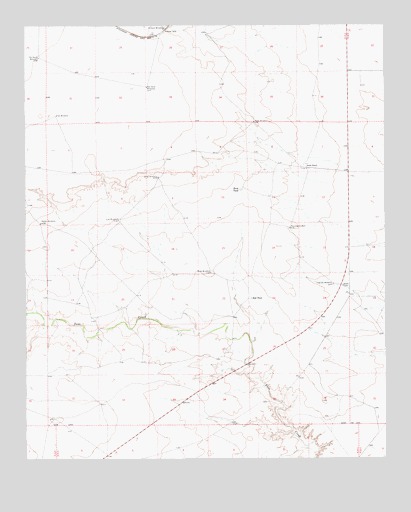
Alamo Ranch, NM USGS Topographic Map
Click on map above to begin viewing in our Map Viewer.

This topographic map contains these locations and features:
Feature Name Type Latitude Longitude GNIS ID View Map
10019 Water WellWellN34.2507°W104.3317°931974View Map
10081 Water WellWellN34.3353°W104.2741°931981View Map
10082 Water WellWellN34.3190°W104.3431°931979View Map
10083 Water WellWellN34.3292°W104.3255°931980View Map
10084 Water WellWellN34.3167°W104.2834°931978View Map
10085 Water WellWellN34.3000°W104.2653°931977View Map
10086 Water WellWellN34.2661°W104.3496°931975View Map
10087 Water WellWellN34.2670°W104.2675°931976View Map
10089 Water WellWellN34.3468°W104.2602°931982View Map
10166 Water WellWellN34.3575°W104.3330°931983View Map
10176 Water WellWellN34.3660°W104.3706°931970View Map
10177 Water WellWellN34.3748°W104.3366°931971View Map
10178 Water WellWellN34.3651°W104.2989°931969View Map
Alamo RanchLocaleN34.3340°W104.2775°896891View Map
Buck TankLocaleN34.3276°W104.2997°896926View Map
Buck WindmillLocaleN34.3312°W104.3286°896928View Map
Highway WindmillLocaleN34.3004°W104.2683°897043View Map
Line WindmillLocaleN34.3190°W104.3425°897085View Map
Miles WindmillLocaleN34.3037°W104.3105°897116View Map
Old South WindmillLocaleN34.3659°W104.3705°897156View Map
Orchard WindmillLocaleN34.3740°W104.3258°897158View Map
Pennington WellLocaleN34.3165°W104.2833°897169View Map
Rabbit WindmillLocaleN34.3179°W104.3700°897177View Map
Red Sand WindmillLocaleN34.3570°W104.3325°897183View Map
Red TankReservoirN34.2964°W104.2971°897185View Map
Star WindmillLocaleN34.3490°W104.3644°897240View Map

Note: Coordinates in the location and feature list above are referenced to NAD83 datum.


Copyright (C) 2008-2024 Ryan Niemi / Sunset Dynamics ... All Rights Reserved