TopoQuest Logo
Do you find TopoQuest useful?
Help keep TopoQuest running and adding new maps/features by donating!
Bitcoin:  19c7KJd3qBynnjoSw5npx9KScwjBe4ifkT
Litecoin:  LXs6TkuXGGXo1vDsWCkWVdjQX94eUKd6ui
Home View Maps Find Maps Find Places Resources & Links


Fort Washakie, Wyoming Topographic Map

USGS Map Title: Fort Washakie, WY
USGS Map MRC: 43108A8
DRG (GeoTIFF) Download: o43108a8.tif


Neighboring USGS Topographic Map Quads:


  Bull Lake East, WY  
43109B1
 

  Argo Butte, WY  
43108B8
 

  Morton, WY  
43108B7
 

  Wise Flat, WY  
43109A1
 

  Fort Washakie, WY  
43108A8
 

  Ethete, WY  
43108A7
 

  Moccasin Lake, WY  
42109H1
 

  Wind River, WY  
42108H8
 

  Ray Lake, WY  
42108H7


Map MRC Location:

N44°
W109°
N44°
W108°
H8 H7 H6 H5 H4 H3 H2 H1
G8 G7 G6 G5 G4 G3 G2 G1
F8 F7 F6 F5 F4 F3 F2 F1
E8 E7 E6 E5 E4 E3 E2 E1
D8 D7 D6 D5 D4 D3 D2 D1
C8 C7 C6 C5 C4 C3 C2 C1
B8 B7 B6 B5 B4 B3 B2 B1
A8 A7 A6 A5 A4 A3 A2 A1
N43°
W109°
N43°
W108°

Fort Washakie, WY USGS 1:24K Topographic Map Preview:
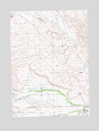
Fort Washakie, WY USGS Topographic Map
Click on map above to begin viewing in our Map Viewer.

This topographic map contains these locations and features:
Feature Name Type Latitude Longitude GNIS ID View Map
Countryman BasinBasinN43.0397°W108.9748°1587088View Map
Countryman SchoolSchoolN43.0333°W108.9532°1587091View Map
Crooked CreekStreamN43.0052°W108.8926°1587239View Map
Fort WashakiePopulated PlaceN43.0063°W108.8823°1609092View Map
Fort Washakie CemeteryCemeteryN43.0047°W108.8906°2774467View Map
Fort Washakie Census Designated PlaceCensusN43.0069°W108.9204°2408245View Map
Fort Washakie Post OfficePost OfficeN43.0039°W108.8823°2765625View Map
Fremont County Fire Protection District Battalion 12 Fort Washakie Fire DepartmentBuildingN43.0019°W108.8834°2673417View Map
Juniper ButteSummitN43.0505°W108.8890°1590256View Map
Little Norkok CreekStreamN43.1138°W108.9648°1609115View Map
Morning Star Manor HospitalHospitalN43.0063°W108.8823°1794906View Map
Norkok ButteSummitN43.1180°W108.9998°1609130View Map
Norkok CreekStreamN43.0813°W108.9212°1609131View Map
Norkok MeadowsFlatN43.0819°W108.9157°1609132View Map
Norkok Meadows CreekStreamN43.0794°W108.8923°1609133View Map
North Fork Ditch Number 1CanalN43.0380°W108.9773°1605402View Map
North Fork Ditch Number 2CanalN43.0369°W108.9493°1605403View Map
North Fork Ditch Number 5CanalN43.0241°W108.9737°1605405View Map
North Fork Diversion CanalCanalN43.0213°W108.9821°1592167View Map
North Fork Little Wind RiverStreamN43.0102°W108.8815°1601786View Map
Sage Creek Number One MineMineN43.0616°W108.9026°1726333View Map
Sage Creek Number Three MineMineN43.0619°W108.8837°1746019View Map
Sage Creek Number Two MineMineN43.0619°W108.8829°1726334View Map
Sand DrawValleyN43.0619°W108.8860°1593861View Map
Sandstone ButteSummitN43.1136°W108.9496°1593928View Map
South Fork Little Wind RiverStreamN43.0102°W108.8818°1603154View Map

Note: Coordinates in the location and feature list above are referenced to NAD83 datum.


Copyright (C) 2008-2025 Ryan Niemi / Sunset Dynamics ... All Rights Reserved