TopoQuest Logo
Do you find TopoQuest useful?
Help keep TopoQuest running and adding new maps/features by donating!
Bitcoin:  19c7KJd3qBynnjoSw5npx9KScwjBe4ifkT
Litecoin:  LXs6TkuXGGXo1vDsWCkWVdjQX94eUKd6ui
Home View Maps Find Maps Find Places Resources & Links


Foster Ranch, New Mexico Topographic Map

USGS Map Title: Foster Ranch, NM
USGS Map MRC: 32104E5
DRG (GeoTIFF) Download: o32104e5.tif


Neighboring USGS Topographic Map Quads:


  Antelope Sink, NM  
32104F6
 

  Parish Ranch, NM  
32104F5
 

  Dayton, NM  
32104F4
 

  Box Canyon Ranch, NM  
32104E6
 

  Foster Ranch, NM  
32104E5
 

  Seven Rivers, NM  
32104E4
 

  Cawley Draw, NM  
32104D6
 

  Martha Creek, NM  
32104D5
 

  Azotea Peak, NM  
32104D4


Map MRC Location:

N33°
W105°
N33°
W104°
H8 H7 H6 H5 H4 H3 H2 H1
G8 G7 G6 G5 G4 G3 G2 G1
F8 F7 F6 F5 F4 F3 F2 F1
E8 E7 E6 E5 E4 E3 E2 E1
D8 D7 D6 D5 D4 D3 D2 D1
C8 C7 C6 C5 C4 C3 C2 C1
B8 B7 B6 B5 B4 B3 B2 B1
A8 A7 A6 A5 A4 A3 A2 A1
N32°
W105°
N32°
W104°

Foster Ranch, NM USGS 1:24K Topographic Map Preview:
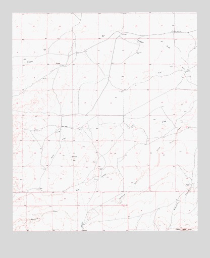
Foster Ranch, NM USGS Topographic Map
Click on map above to begin viewing in our Map Viewer.

This topographic map contains these locations and features:
Feature Name Type Latitude Longitude GNIS ID View Map
Black Muley MillLocaleN32.6140°W104.5158°886443View Map
Bone Tank DrawValleyN32.5057°W104.5786°886585View Map
Box CanyonValleyN32.5346°W104.5364°904033View Map
C C TankReservoirN32.5950°W104.5902°887010View Map
Dagger DrawValleyN32.6062°W104.5039°897352View Map
East WellWellN32.5357°W104.5650°888726View Map
Foster RanchLocaleN32.5598°W104.5930°889166View Map
Horner TankReservoirN32.6118°W104.5651°890133View Map
Howell RanchLocaleN32.5268°W104.5058°890225View Map
Klendenen WellWellN32.5804°W104.5505°890734View Map
Knowles PlaceLocaleN32.5590°W104.5797°899696View Map
Lee RanchLocaleN32.5001°W104.5789°891025View Map
Long DrawValleyN32.5626°W104.5030°891302View Map
McDonald CemeteryCemeteryN32.5882°W104.5072°891745View Map
North Prong Long DrawValleyN32.5565°W104.5791°892648View Map
Oil City WellWellN32.6123°W104.5511°892816View Map
Old Ball WellWellN32.6021°W104.5411°892846View Map
Rock HouseLocaleN32.5907°W104.5083°894045View Map
Round TankReservoirN32.5396°W104.5690°894186View Map
Round Tank WellWellN32.5354°W104.6030°894188View Map
Sinkhole FlatFlatN32.5415°W104.5841°894869View Map
South Prong Long DrawValleyN32.5565°W104.5791°895110View Map
Stinking DrawValleyN32.5343°W104.5364°895354View Map
Wadcutter DrawValleyN32.5357°W104.5005°896177View Map

Note: Coordinates in the location and feature list above are referenced to NAD83 datum.


Copyright (C) 2008-2024 Ryan Niemi / Sunset Dynamics ... All Rights Reserved