TopoQuest Logo
Do you find TopoQuest useful?
Help keep TopoQuest running and adding new maps/features by donating!
Bitcoin:  19c7KJd3qBynnjoSw5npx9KScwjBe4ifkT
Litecoin:  LXs6TkuXGGXo1vDsWCkWVdjQX94eUKd6ui
Home View Maps Find Maps Find Places Resources & Links


Azotea Peak, New Mexico Topographic Map

USGS Map Title: Azotea Peak, NM
USGS Map MRC: 32104D4
DRG (GeoTIFF) Download: o32104d4.tif


Neighboring USGS Topographic Map Quads:


  Foster Ranch, NM  
32104E5
 

  Seven Rivers, NM  
32104E4
 

  Lake McMillan South, NM  
32104E3
 

  Martha Creek, NM  
32104D5
 

  Azotea Peak, NM  
32104D4
 

  Carlsbad West, NM  
32104D3
 

  Bandanna Point, NM  
32104C5
 

  Carnero Peak, NM  
32104C4
 

  Kitchen Cove, NM  
32104C3


Map MRC Location:

N33°
W105°
N33°
W104°
H8 H7 H6 H5 H4 H3 H2 H1
G8 G7 G6 G5 G4 G3 G2 G1
F8 F7 F6 F5 F4 F3 F2 F1
E8 E7 E6 E5 E4 E3 E2 E1
D8 D7 D6 D5 D4 D3 D2 D1
C8 C7 C6 C5 C4 C3 C2 C1
B8 B7 B6 B5 B4 B3 B2 B1
A8 A7 A6 A5 A4 A3 A2 A1
N32°
W105°
N32°
W104°

Azotea Peak, NM USGS 1:24K Topographic Map Preview:
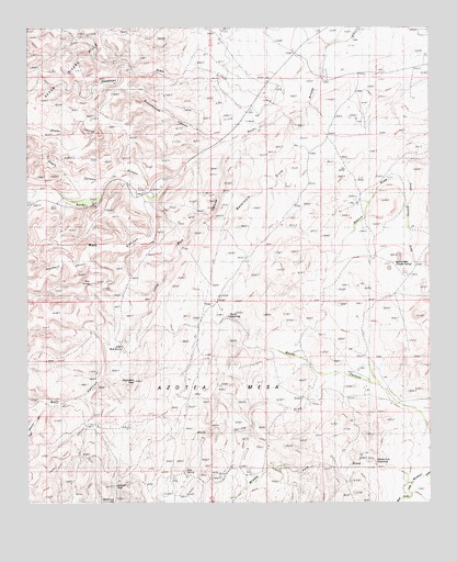
Azotea Peak, NM USGS Topographic Map
Click on map above to begin viewing in our Map Viewer.

This topographic map contains these locations and features:
Feature Name Type Latitude Longitude GNIS ID View Map
06731 Water WellWellN32.4615°W104.4858°931990View Map
06732 Water WellWellN32.4593°W104.4652°931989View Map
06733 Water WellWellN32.4590°W104.4652°931968View Map
06734 Water WellWellN32.4484°W104.4530°931964View Map
06735 Water WellWellN32.4557°W104.4602°931967View Map
06736 Water WellWellN32.4526°W104.4986°931965View Map
06740 Water WellWellN32.4907°W104.4022°931994View Map
06741 Water WellWellN32.4890°W104.4072°931961View Map
06742 Water WellWellN32.4890°W104.4072°931962View Map
06743 Water WellWellN32.4898°W104.4019°931963View Map
06744 Water WellWellN32.4771°W104.4272°931993View Map
06745 Water WellWellN32.4759°W104.4327°931992View Map
06746 Water WellWellN32.4715°W104.4400°931991View Map
06748 Water WellWellN32.4407°W104.3919°931987View Map
20028 Water WellWellN32.4890°W104.4069°931960View Map
20031 Water WellWellN32.4868°W104.4250°931959View Map
20033 Water WellWellN32.4557°W104.4602°931966View Map
20034 Water WellWellN32.4407°W104.3925°931988View Map
20143 Water WellWellN32.3843°W104.4502°931984View Map
20150 Water WellWellN32.4032°W104.4102°931985View Map
20151 Water WellWellN32.4068°W104.3963°931986View Map
20153 Water WellWellN32.3832°W104.4311°931972View Map
20154 Water WellWellN32.3832°W104.4311°931973View Map
Azotea PeakSummitN32.3790°W104.4705°929226View Map
Barber CrossingPopulated PlaceN32.4854°W104.3966°899518View Map
Boy D S WaterholeReservoirN32.4101°W104.4233°929699View Map
Boyds CanyonValleyN32.3996°W104.3780°886688View Map
Catclaw DrawValleyN32.4859°W104.3755°887282View Map
Deadman DrawValleyN32.4804°W104.4208°888242View Map
Denny RanchLocaleN32.4396°W104.3922°888324View Map
Indian Big SpringSpringN32.4554°W104.4889°890297View Map
J Staple CanyonValleyN32.4607°W104.4747°890378View Map
Lepee ClaimsMineN32.4501°W104.4694°914623View Map
Little Walt CanyonValleyN32.4671°W104.4386°891191View Map
Little Walt CanyonMineN32.4182°W104.4716°914629View Map
Little Walt SpringSpringN32.4165°W104.4710°891192View Map
McKittrick HillSummitN32.3796°W104.4733°891785View Map
Middle Fork Little McKittrick DrawValleyN32.3809°W104.3811°891949View Map
Middle Fork WaterholeReservoirN32.3853°W104.3924°891950View Map
Miller RanchLocaleN32.3821°W104.4322°908749View Map
Nagooltee PeakSummitN32.4076°W104.4669°899808View Map
Old Jones RanchLocaleN32.4023°W104.4113°892866View Map
Rain Spring DrawValleyN32.4096°W104.4036°893624View Map
Rain Spring RanchLocaleN32.3834°W104.4513°893625View Map
Righthand CanyonValleyN32.4393°W104.4805°893896View Map
Rock Waterhole CanyonValleyN32.4007°W104.4977°910402View Map
Rocky ArroyoMineN32.4462°W104.4658°915667View Map
Rocky Arroyo CemeteryCemeteryN32.4607°W104.4569°894111View Map
Rocky Arroyo SchoolSchoolN32.4715°W104.4397°894112View Map
Round MountainSummitN32.4359°W104.3975°929297View Map
Round MountainSummitN32.4354°W104.3833°898424View Map
Rounds WaterholeReservoirN32.4241°W104.4378°894198View Map
Schoolhouse CanyonValleyN32.4687°W104.4427°894653View Map
Seven Rivers HillsRangeN32.4857°W104.4864°894729View Map
Shafer CanyonValleyN32.4626°W104.4702°894744View Map
South Spencer DrawValleyN32.4626°W104.3805°895125View Map
Spencer DamDamN32.4654°W104.3788°895224View Map
Toms CanyonValleyN32.4046°W104.4825°911744View Map
Walt CanyonValleyN32.4554°W104.4616°896236View Map
Walt Canyon HillsRangeN32.4443°W104.4930°896237View Map
Walt SpringSpringN32.4326°W104.4812°898470View Map
Waterhole DrawValleyN32.4784°W104.4197°896277View Map

Note: Coordinates in the location and feature list above are referenced to NAD83 datum.


Copyright (C) 2008-2024 Ryan Niemi / Sunset Dynamics ... All Rights Reserved