TopoQuest Logo
Do you find TopoQuest useful?
Help keep TopoQuest running and adding new maps/features by donating!
Bitcoin:  19c7KJd3qBynnjoSw5npx9KScwjBe4ifkT
Litecoin:  LXs6TkuXGGXo1vDsWCkWVdjQX94eUKd6ui
Home View Maps Find Maps Find Places Resources & Links


Fountain Green North, Utah Topographic Map

USGS Map Title: Fountain Green North, UT
USGS Map MRC: 39111F6
DRG (GeoTIFF) Download: o39111f6.tif


Neighboring USGS Topographic Map Quads:


  Mona, UT  
39111G7
 

  Nebo Basin, UT  
39111G6
 

  Spencer Canyon, UT  
39111G5
 

  Nephi, UT  
39111F7
 

  Fountain Green North, UT  
39111F6
 

  Big Hollow, UT  
39111F5
 

  Levan, UT  
39111E7
 

  Fountain Green South, UT  
39111E6
 

  Moroni, UT  
39111E5


Map MRC Location:

N40°
W112°
N40°
W111°
H8 H7 H6 H5 H4 H3 H2 H1
G8 G7 G6 G5 G4 G3 G2 G1
F8 F7 F6 F5 F4 F3 F2 F1
E8 E7 E6 E5 E4 E3 E2 E1
D8 D7 D6 D5 D4 D3 D2 D1
C8 C7 C6 C5 C4 C3 C2 C1
B8 B7 B6 B5 B4 B3 B2 B1
A8 A7 A6 A5 A4 A3 A2 A1
N39°
W112°
N39°
W111°

Fountain Green North, UT USGS 1:24K Topographic Map Preview:
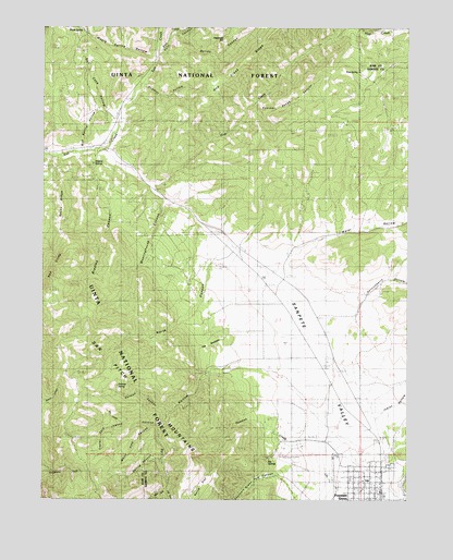
Fountain Green North, UT USGS Topographic Map
Click on map above to begin viewing in our Map Viewer.

This topographic map contains these locations and features:
Feature Name Type Latitude Longitude GNIS ID View Map
Big SpringsSpringN39.6361°W111.6735°1438745View Map
Box HollowValleyN39.6447°W111.7233°1439078View Map
Bradley CanyonValleyN39.7163°W111.7335°1439088View Map
Bradley SpringsSpringN39.7127°W111.7349°1448175View Map
Cazier ForkStreamN39.6447°W111.7230°1439552View Map
City of Fountain GreenCivilN39.6281°W111.6413°2410536View Map
Fountain GreenPopulated PlaceN39.6300°W111.6352°1441187View Map
Fountain Green CemeteryCemeteryN39.6341°W111.6310°1448419View Map
Fountain Green Fish HatcheryLocaleN39.6380°W111.6677°1455284View Map
Fountain Green Police DepartmentBuildingN39.6302°W111.6395°2730494View Map
Fountain Green Post OfficePost OfficeN39.6275°W111.6347°1455285View Map
Fountain Green SchoolSchoolN39.6265°W111.6415°1448420View Map
Fountain Green Volunteer Fire DepartmentBuildingN39.6280°W111.6342°2627386View Map
Gammett CreekStreamN39.6383°W111.6513°1441263View Map
Haystack HillSummitN39.7475°W111.6891°1441647View Map
Holman CanyonValleyN39.6483°W111.7074°1441815View Map
Holman SpringSpringN39.6551°W111.7249°1441817View Map
Hop CreekStreamN39.7097°W111.7146°1441844View Map
Indian HollowValleyN39.6500°W111.6305°1442009View Map
Jewkes CanyonValleyN39.6441°W111.7141°1442139View Map
Left Fork Log HollowValleyN39.6277°W111.7080°1442511View Map
Log HollowValleyN39.6608°W111.6835°1442845View Map
Maple SpringSpringN39.7500°W111.7372°1443182View Map
Maple Spring HollowValleyN39.7422°W111.7141°1443187View Map
Meetinghouse CanyonValleyN39.6886°W111.6919°1443298View Map
Mud Spring HollowValleyN39.7177°W111.7383°1443717View Map
North CanyonValleyN39.6888°W111.6921°1443859View Map
North FlatFlatN39.6266°W111.6983°1443883View Map
Pine SpringSpringN39.7382°W111.6430°1444409View Map
Pole CreekStreamN39.7430°W111.7113°1444544View Map
Quadrat HollowValleyN39.7338°W111.7166°1444680View Map
Red CliffsCliffN39.6863°W111.7472°1448902View Map
Right Fork Log HollowValleyN39.6277°W111.7080°1444934View Map
Rocky RidgeRidgeN39.7027°W111.7460°1445124View Map
Rolley CanyonValleyN39.7486°W111.7063°1445133View Map
Salt Cave HollowValleyN39.7275°W111.7291°1445276View Map
Salt Creek PeakSummitN39.6616°W111.7430°1455496View Map
Serviceberry HollowValleyN39.6547°W111.6427°1445434View Map
Skyline TrailTrailN39.6488°W111.7394°1445653View Map
Skyline TrailTrailN39.6863°W111.7452°1451350View Map
Spring CanyonValleyN39.6363°W111.7085°1445982View Map
Summer Range CanyonValleyN39.7297°W111.6785°1446233View Map
The BuckskinSummitN39.6658°W111.6933°1448203View Map
The Church of Jesus Christ of Latter Day SaintsChurchN39.6313°W111.6446°1450752View Map
Water HollowValleyN39.7175°W111.7291°1447059View Map
White Pine CanyonValleyN39.6441°W111.7099°1447266View Map
Yorgason Family CemetaryCemeteryN39.6408°W111.6359°2769401View Map

Note: Coordinates in the location and feature list above are referenced to NAD83 datum.


Copyright (C) 2008-2024 Ryan Niemi / Sunset Dynamics ... All Rights Reserved