TopoQuest Logo
Do you find TopoQuest useful?
Help keep TopoQuest running and adding new maps/features by donating!
Bitcoin:  19c7KJd3qBynnjoSw5npx9KScwjBe4ifkT
Litecoin:  LXs6TkuXGGXo1vDsWCkWVdjQX94eUKd6ui
Home View Maps Find Maps Find Places Resources & Links


Levan, Utah Topographic Map

USGS Map Title: Levan, UT
USGS Map MRC: 39111E7
DRG (GeoTIFF) Download: o39111e7.tif


Neighboring USGS Topographic Map Quads:


  Sugarloaf, UT  
39111F8
 

  Nephi, UT  
39111F7
 

  Fountain Green North, UT  
39111F6
 

  Juab, UT  
39111E8
 

  Levan, UT  
39111E7
 

  Fountain Green South, UT  
39111E6
 

  Skinner Peaks, UT  
39111D8
 

  Chriss Canyon, UT  
39111D7
 

  Wales, UT  
39111D6


Map MRC Location:

N40°
W112°
N40°
W111°
H8 H7 H6 H5 H4 H3 H2 H1
G8 G7 G6 G5 G4 G3 G2 G1
F8 F7 F6 F5 F4 F3 F2 F1
E8 E7 E6 E5 E4 E3 E2 E1
D8 D7 D6 D5 D4 D3 D2 D1
C8 C7 C6 C5 C4 C3 C2 C1
B8 B7 B6 B5 B4 B3 B2 B1
A8 A7 A6 A5 A4 A3 A2 A1
N39°
W112°
N39°
W111°

Levan, UT USGS 1:24K Topographic Map Preview:
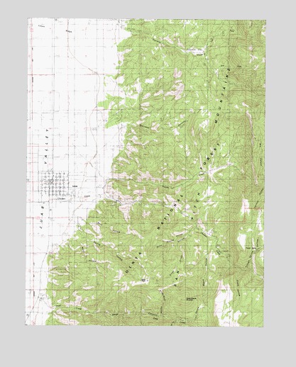
Levan, UT USGS Topographic Map
Click on map above to begin viewing in our Map Viewer.

This topographic map contains these locations and features:
Feature Name Type Latitude Longitude GNIS ID View Map
Burnt Ground HollowValleyN39.5386°W111.7902°1439352View Map
Chicken CreekStreamN39.5538°W111.8713°1439667View Map
Chicken Creek CampLocaleN39.5319°W111.7758°1439671View Map
Chicken Creek CampgroundLocaleN39.5305°W111.7738°1448265View Map
Chicken HollowValleyN39.5602°W111.8316°1439675View Map
Coleman FlatFlatN39.6127°W111.7869°1439891View Map
Deep CanyonValleyN39.5069°W111.8602°1440341View Map
Deep CreekStreamN39.5111°W111.8674°1440354View Map
Deep Creek Wildlife Management AreaParkN39.5166°W111.8591°1448336View Map
Dry CanyonValleyN39.5583°W111.7505°1440587View Map
Dry ForkStreamN39.6033°W111.7760°1440622View Map
Green Grove HollowValleyN39.5408°W111.7866°1441470View Map
Hartleys CanyonValleyN39.5816°W111.8330°1441620View Map
Horse Heaven MountainSummitN39.5108°W111.7905°1441875View Map
Juab Special Service Fire District Levan StationBuildingN39.5578°W111.8634°2627313View Map
Left Fork Fourmile CreekStreamN39.6108°W111.7833°1442498View Map
LevanPopulated PlaceN39.5586°W111.8619°1442564View Map
Levan CemeteryCemeteryN39.5500°W111.8527°1448591View Map
Levan Fire DepartmentBuildingN39.5571°W111.8662°2665435View Map
Levan PeakSummitN39.5184°W111.8116°1442565View Map
Levan Post OfficePost OfficeN39.5583°W111.8646°2769067View Map
Levan RidgeSlopeN39.6172°W111.8569°1442566View Map
Levan Wildlife Management AreaParkN39.5847°W111.8135°1448592View Map
Maple HollowValleyN39.5341°W111.7769°1443171View Map
Pigeon CreekStreamN39.5602°W111.8316°1444349View Map
Right Fork Deep CreekStreamN39.5025°W111.7963°1444915View Map
Rock HollowValleyN39.5450°W111.8513°1445073View Map
Slide Rock HollowValleyN39.5041°W111.8044°1445691View Map
Spring HollowValleyN39.5375°W111.8488°1446034View Map
Stump HollowValleyN39.5227°W111.7627°1446204View Map
The Church of Jesus Christ of Latter Day SaintsChurchN39.5577°W111.8624°1450808View Map
Town of LevanCivilN39.5561°W111.8606°2412891View Map
Trail HollowValleyN39.5016°W111.7877°1446677View Map
Trough SpringSpringN39.5319°W111.7531°1446735View Map
Trough Spring HollowValleyN39.5227°W111.7599°1446736View Map
Water HollowValleyN39.5355°W111.8510°1447051View Map

Note: Coordinates in the location and feature list above are referenced to NAD83 datum.


Copyright (C) 2008-2025 Ryan Niemi / Sunset Dynamics ... All Rights Reserved