TopoQuest Logo
Do you find TopoQuest useful?
Help keep TopoQuest running and adding new maps/features by donating!
Bitcoin:  19c7KJd3qBynnjoSw5npx9KScwjBe4ifkT
Litecoin:  LXs6TkuXGGXo1vDsWCkWVdjQX94eUKd6ui
Home View Maps Find Maps Find Places Resources & Links


Fowler, South Carolina Topographic Map

USGS Map Title: Fowler, SC
USGS Map MRC: 33079F6
DRG (GeoTIFF) Download: o33079f6.tif


Neighboring USGS Topographic Map Quads:


  Lake City West, SC  
33079G7
 

  Lake City East, SC  
33079G6
 

  Prospect Crossroads, SC  
33079G5
 

  Kingstree, SC  
33079F7
 

  Fowler, SC  
33079F6
 

  Indiantown, SC  
33079F5
 

  Salters, SC  
33079E7
 

  Kellehan Crossroads, SC  
33079E6
 

  Warsaw, SC  
33079E5


Map MRC Location:

N34°
W80°
N34°
W79°
H8 H7 H6 H5 H4 H3 H2 H1
G8 G7 G6 G5 G4 G3 G2 G1
F8 F7 F6 F5 F4 F3 F2 F1
E8 E7 E6 E5 E4 E3 E2 E1
D8 D7 D6 D5 D4 D3 D2 D1
C8 C7 C6 C5 C4 C3 C2 C1
B8 B7 B6 B5 B4 B3 B2 B1
A8 A7 A6 A5 A4 A3 A2 A1
N33°
W80°
N33°
W79°

Fowler, SC USGS 1:24K Topographic Map Preview:
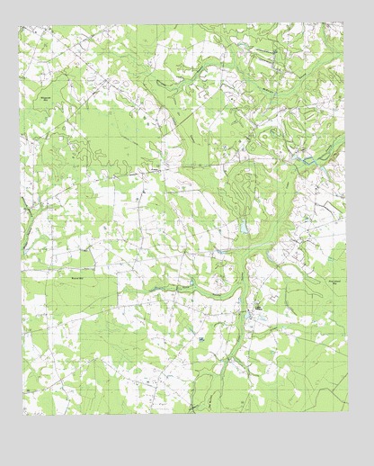
Fowler, SC USGS Topographic Map
Click on map above to begin viewing in our Map Viewer.

This topographic map contains these locations and features:
Feature Name Type Latitude Longitude GNIS ID View Map
Beulah ChurchChurchN33.6946°W79.7373°1220633View Map
Beulah School (historical)SchoolN33.6946°W79.7376°1241378View Map
Cedar Grove ChurchChurchN33.6546°W79.6603°1247209View Map
Cedar SwampPopulated PlaceN33.6568°W79.6673°1247224View Map
Cedar Swamp Baptist ChurchChurchN33.6582°W79.6628°1241395View Map
Cedar Swamp CemeteryCemeteryN33.6577°W79.6720°1241396View Map
Cedar Swamp CemeteryCemeteryN33.6582°W79.6631°1241397View Map
Cedar Swamp Methodist ChurchChurchN33.6571°W79.6728°1241398View Map
Cedar Swamp School (historical)SchoolN33.6566°W79.6728°1241399View Map
Cooper Fire TowerTowerN33.7279°W79.7106°1242377View Map
Dry SwampStreamN33.6252°W79.6842°1222118View Map
Elijah ChurchChurchN33.7018°W79.7123°1222259View Map
FowlerPopulated PlaceN33.7027°W79.6967°1231295View Map
Fowler SchoolSchoolN33.7238°W79.6934°1222526View Map
Hickory Hill ChurchChurchN33.7191°W79.6540°1241427View Map
Hickory Hill School (historical)SchoolN33.7199°W79.6509°1245970View Map
Home SwampStreamN33.6674°W79.6634°1223262View Map
Inglenook School (historical)SchoolN33.6785°W79.7376°1246124View Map
Jack McGill PondReservoirN33.6843°W79.6640°1238733View Map
Kennedyville ChurchChurchN33.6877°W79.6251°1246236View Map
King SchoolSchoolN33.6907°W79.7276°1223736View Map
McCants BayBasinN33.7146°W79.6698°1241459View Map
Orr SwampSwampN33.7057°W79.6831°1225247View Map
Pine Island BayBasinN33.6641°W79.6259°1225460View Map
Round BayBasinN33.6660°W79.7290°1226039View Map
Saint James ChurchChurchN33.6602°W79.7034°1226105View Map
Saint Luke ChurchChurchN33.6824°W79.6990°1226167View Map
Saint Michael ChurchChurchN33.6568°W79.6795°1241512View Map
Saint Michael SchoolSchoolN33.6566°W79.6781°1226220View Map
Saint Paul ChurchChurchN33.7029°W79.7026°1250639View Map
Saint Pauls ChurchChurchN33.6266°W79.7484°1250650View Map
South Carolina Noname 45004 D-3094 DamDamN33.6835°W79.6631°1238732View Map
Spring Branch School (historical)SchoolN33.6863°W79.6884°1241520View Map
Whiteoak BayBasinN33.7263°W79.7387°1251428View Map
Whiteoak SwampStreamN33.7366°W79.6648°1251431View Map
Whiteoak SwampStreamN33.6899°W79.7451°1227566View Map
Williamsburg County Fire Department Station 3BuildingN33.7020°W79.7033°2368251View Map

Note: Coordinates in the location and feature list above are referenced to NAD83 datum.


Copyright (C) 2008-2024 Ryan Niemi / Sunset Dynamics ... All Rights Reserved