TopoQuest Logo
Do you find TopoQuest useful?
Help keep TopoQuest running and adding new maps/features by donating!
Bitcoin:  19c7KJd3qBynnjoSw5npx9KScwjBe4ifkT
Litecoin:  LXs6TkuXGGXo1vDsWCkWVdjQX94eUKd6ui
Home View Maps Find Maps Find Places Resources & Links


Fox Gulch, Montana Topographic Map

USGS Map Title: Fox Gulch, MT
USGS Map MRC: 45113D4
DRG (GeoTIFF) Download: o45113d4.tif


Neighboring USGS Topographic Map Quads:


  Highland Ranch, MT  
45113E5
 

  Wisdom, MT  
45113E4
 

  Stewart Mountain, MT  
45113E3
 

  Ajax Ranch, MT  
45113D5
 

  Fox Gulch, MT  
45113D4
 

  Jackson Hill, MT  
45113D3
 

  Lower Miner Lakes, MT  
45113C5
 

  Jackson, MT  
45113C4
 

  Butch Hill, MT  
45113C3


Map MRC Location:

N46°
W114°
N46°
W113°
H8 H7 H6 H5 H4 H3 H2 H1
G8 G7 G6 G5 G4 G3 G2 G1
F8 F7 F6 F5 F4 F3 F2 F1
E8 E7 E6 E5 E4 E3 E2 E1
D8 D7 D6 D5 D4 D3 D2 D1
C8 C7 C6 C5 C4 C3 C2 C1
B8 B7 B6 B5 B4 B3 B2 B1
A8 A7 A6 A5 A4 A3 A2 A1
N45°
W114°
N45°
W113°

Fox Gulch, MT USGS 1:24K Topographic Map Preview:
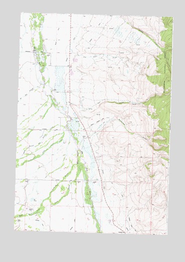
Fox Gulch, MT USGS Topographic Map
Click on map above to begin viewing in our Map Viewer.

This topographic map contains these locations and features:
Feature Name Type Latitude Longitude GNIS ID View Map
04S15W20BDCB01 WellWellN45.4699°W113.4853°809648View Map
04S15W20CBAA01 WellWellN45.4699°W113.4856°809649View Map
04S15W28BDDC01 WellWellN45.4552°W113.4620°809564View Map
04S15W29ADCA01 WellWellN45.4563°W113.4728°809570View Map
04S15W29ADCA02 WellWellN45.4563°W113.4728°809571View Map
04S15W29ADDB01 WellWellN45.4566°W113.4720°809574View Map
04S15W29ADDC01 WellWellN45.4555°W113.4717°809566View Map
05S15W03BDBC01 WellWellN45.4280°W113.4448°809430View Map
05S15W10AADB01 WellWellN45.4163°W113.4326°809386View Map
05S15W10DCDD01 WellWellN45.4049°W113.4353°809337View Map
05S15W17BABA01 WellWellN45.4041°W113.4851°809331View Map
05S15W19DBAC01 WellWellN45.3808°W113.4981°809206View Map
Big DitchCanalN45.3877°W113.4098°779800View Map
Broomfield GulchValleyN45.4316°W113.4348°780436View Map
Cow Cabin CreekStreamN45.4833°W113.4581°781765View Map
Cox RanchLocaleN45.3880°W113.4739°794527View Map
Forty Bar RanchLocaleN45.4563°W113.4714°783619View Map
Fox GulchValleyN45.4455°W113.4451°783673View Map
Fox Post Office (historical)Post OfficeN45.4471°W113.4559°1797236View Map
Fox School (historical)SchoolN45.4471°W113.4559°1797338View Map
Helming DitchCanalN45.4074°W113.4267°784753View Map
Helming DitchCanalN45.4874°W113.4373°784754View Map
Hirschy Landing Strip (historical)AirportN45.4374°W113.4353°806269View Map
Hirschy RanchLocaleN45.4288°W113.4451°784904View Map
Huntley DitchCanalN45.4816°W113.4606°785175View Map
Ice PondLakeN45.3931°W113.4860°785211View Map
Jardine Ditch Number OneCanalN45.3791°W113.4026°778812View Map
Little Lake CreekStreamN45.4366°W113.4587°786320View Map
Miller DitchCanalN45.4844°W113.4692°787412View Map
Miner CreekStreamN45.4224°W113.4487°787454View Map
North Branch Big Swamp CreekStreamN45.4606°W113.4799°788068View Map
North Branch Miner CreekStreamN45.4146°W113.4495°788070View Map
Popularis CemeteryCemeteryN45.3752°W113.4101°789092View Map
South Branch Big Swamp CreekStreamN45.4372°W113.4594°790882View Map
South Branch Miner CreekStreamN45.4144°W113.4495°790884View Map
Spring (historical)LocaleN45.4041°W113.4287°1797268View Map
Warm Springs CreekStreamN45.3771°W113.4312°792835View Map
Willow RanchLocaleN45.3810°W113.4967°793375View Map

Note: Coordinates in the location and feature list above are referenced to NAD83 datum.


Copyright (C) 2008-2024 Ryan Niemi / Sunset Dynamics ... All Rights Reserved