TopoQuest Logo
Do you find TopoQuest useful?
Help keep TopoQuest running and adding new maps/features by donating!
Bitcoin:  19c7KJd3qBynnjoSw5npx9KScwjBe4ifkT
Litecoin:  LXs6TkuXGGXo1vDsWCkWVdjQX94eUKd6ui
Home View Maps Find Maps Find Places Resources & Links


Ash River NE, Minnesota Topographic Map

USGS Map Title: Ash River NE, MN
USGS Map MRC: 48092D7
DRG (GeoTIFF) Download: o48092d7.tif


Neighboring USGS Topographic Map Quads:


  Soldier Point, MN  
48092E8
 

  Kempton Bay, MN  
48092E7
 

  Kettle Falls, MN  
48092E6
 

  Daley Bay, MN  
48092D8
 

  Ash River NE, MN  
48092D7
 

  Namakan Island, MN  
48092D6
 

  Ash River SW, MN  
48092C8
 

  Ash River SE, MN  
48092C7
 

  Marion Lake, MN  
48092C6


Map MRC Location:

N49°
W93°
N49°
W92°
H8 H7 H6 H5 H4 H3 H2 H1
G8 G7 G6 G5 G4 G3 G2 G1
F8 F7 F6 F5 F4 F3 F2 F1
E8 E7 E6 E5 E4 E3 E2 E1
D8 D7 D6 D5 D4 D3 D2 D1
C8 C7 C6 C5 C4 C3 C2 C1
B8 B7 B6 B5 B4 B3 B2 B1
A8 A7 A6 A5 A4 A3 A2 A1
N48°
W93°
N48°
W92°

Ash River NE, MN USGS 1:24K Topographic Map Preview:
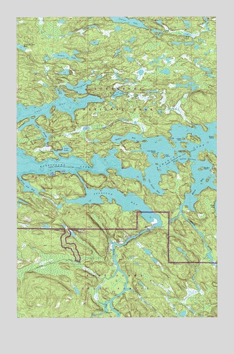
Ash River NE, MN USGS Topographic Map
Click on map above to begin viewing in our Map Viewer.

This topographic map contains these locations and features:
Feature Name Type Latitude Longitude GNIS ID View Map
Agnes LakeLakeN48.4678°W92.8117°660630View Map
Ash RiverStreamN48.4171°W92.7890°660688View Map
Ash River CampgroundLocaleN48.4066°W92.8140°660689View Map
Ash River FallsFallsN48.3771°W92.8193°660690View Map
Ash River Lookout TowerTowerN48.4066°W92.7871°660691View Map
Big Sky IslandIslandN48.4366°W92.7599°660800View Map
Blind Ash BayBayN48.4291°W92.8679°660832View Map
Blind Indian NarrowsChannelN48.4402°W92.7702°660833View Map
Boblore IslandIslandN48.4394°W92.8196°660558View Map
Camp Ninety CreekStreamN48.3819°W92.8168°660938View Map
Cemetery IslandIslandN48.4491°W92.7649°660974View Map
Cruiser LakeLakeN48.4981°W92.8058°661075View Map
Ek (Leif) LakeLakeN48.4708°W92.8356°661188View Map
Eks BayBayN48.4685°W92.8479°661189View Map
Filla IslandIslandN48.4235°W92.8293°660522View Map
Foote IslandIslandN48.4319°W92.7952°660497View Map
Gannon CreekStreamN48.3866°W92.8071°661336View Map
Indian CemeteryCemeteryN48.4418°W92.7621°660520View Map
Indian PointCapeN48.4491°W92.7710°661545View Map
Jorgens LakeLakeN48.4835°W92.8445°661595View Map
Kohler BayBayN48.4499°W92.8063°661660View Map
Long SloughStreamN48.4557°W92.8640°661801View Map
Lost BayBayN48.4616°W92.8565°661814View Map
Lost LakeLakeN48.4449°W92.8443°661824View Map
Moose BayBayN48.4294°W92.7627°661946View Map
Moose RiverStreamN48.4213°W92.7718°661959View Map
Mud LakeLakeN48.4926°W92.7686°661997View Map
Nokomis IslandIslandN48.4424°W92.7888°661790View Map
Old Dutch BayBayN48.4285°W92.7896°662093View Map
Quarter Line LakeLakeN48.4769°W92.8452°662239View Map
Round Bear IslandIslandN48.4480°W92.8693°662302View Map
Sullivan BayBayN48.4241°W92.8090°662585View Map
Sweetnose IslandIslandN48.4438°W92.7690°662616View Map
Tar PointCapeN48.4463°W92.7768°662625View Map
Voyageurs National ParkParkN48.4835°W92.8381°660491View Map
Williams IslandIslandN48.4352°W92.7504°662801View Map
Ziski IslandIslandN48.4419°W92.7840°662846View Map

Note: Coordinates in the location and feature list above are referenced to NAD83 datum.


Copyright (C) 2008-2025 Ryan Niemi / Sunset Dynamics ... All Rights Reserved