TopoQuest Logo
Do you find TopoQuest useful?
Help keep TopoQuest running and adding new maps/features by donating!
Bitcoin:  19c7KJd3qBynnjoSw5npx9KScwjBe4ifkT
Litecoin:  LXs6TkuXGGXo1vDsWCkWVdjQX94eUKd6ui
Home View Maps Find Maps Find Places Resources & Links


Franklin, North Carolina Topographic Map

USGS Map Title: Franklin, NC
USGS Map MRC: 35083B4
DRG (GeoTIFF) Download: o35083b4.tif


Neighboring USGS Topographic Map Quads:


  Wesser, NC  
35083C5
 

  Alarka, NC  
35083C4
 

  Greens Creek, NC  
35083C3
 

  Wayah Bald, NC  
35083B5
 

  Franklin, NC  
35083B4
 

  Corbin Knob, NC  
35083B3
 

  Rainbow Springs, NC  
35083A5
 

  Prentiss, NC  
35083A4
 

  Scaly Mountain, NC  
35083A3


Map MRC Location:

N36°
W84°
N36°
W83°
H8 H7 H6 H5 H4 H3 H2 H1
G8 G7 G6 G5 G4 G3 G2 G1
F8 F7 F6 F5 F4 F3 F2 F1
E8 E7 E6 E5 E4 E3 E2 E1
D8 D7 D6 D5 D4 D3 D2 D1
C8 C7 C6 C5 C4 C3 C2 C1
B8 B7 B6 B5 B4 B3 B2 B1
A8 A7 A6 A5 A4 A3 A2 A1
N35°
W84°
N35°
W83°

Franklin, NC USGS 1:24K Topographic Map Preview:
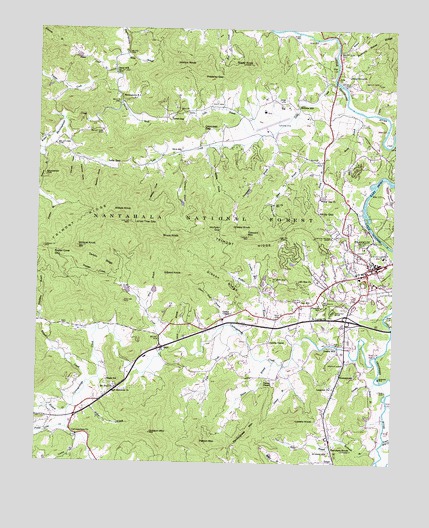
Franklin, NC USGS Topographic Map
Click on map above to begin viewing in our Map Viewer.

This topographic map contains these locations and features:
Feature Name Type Latitude Longitude GNIS ID View Map
Allen BranchStreamN35.2426°W83.4696°1008675View Map
Angel Medical CenterHospitalN35.1846°W83.3783°2701524View Map
Baldwin CoveValleyN35.2098°W83.4776°1008887View Map
Blaine BranchStreamN35.1540°W83.4168°1009463View Map
BlossomtownPopulated PlaceN35.1504°W83.3935°1019221View Map
Bruce KnobSummitN35.1898°W83.4518°1019328View Map
BurningtownPopulated PlaceN35.2312°W83.4710°1019423View Map
Burningtown - Iotla Volunteer Fire and Rescue DepartmentBuildingN35.2374°W83.4773°2639217View Map
Burningtown DamDamN35.2418°W83.4882°1017100View Map
Burningtown FallsFallsN35.2072°W83.4981°1009843View Map
Buzzard Roost RidgeRidgeN35.2451°W83.3827°1009868View Map
Campbell GapGapN35.2220°W83.4421°1009987View Map
Carson ChapelChurchN35.1684°W83.4315°1010060View Map
Carson CoveValleyN35.2139°W83.4497°1010062View Map
Cartoogechaye ChurchChurchN35.1329°W83.4846°1010071View Map
Cartoogechaye CreekStreamN35.1565°W83.3804°1010072View Map
Clanpit CoveValleyN35.2126°W83.4874°1010285View Map
Cochran CoveValleyN35.2120°W83.4849°1010352View Map
Cozads MillPopulated PlaceN35.1581°W83.3940°1019832View Map
Dates CreekStreamN35.2379°W83.4757°1010662View Map
Deans MillPopulated PlaceN35.2373°W83.4727°1010715View Map
Dobson BranchStreamN35.1537°W83.4127°1010837View Map
Dobson MountainSummitN35.1340°W83.4596°1010839View Map
Downes BranchStreamN35.2031°W83.4999°1010900View Map
Edwards BranchStreamN35.2415°W83.4852°1011028View Map
Fout CemeteryCemeteryN35.2290°W83.4379°1011354View Map
FranklinPopulated PlaceN35.1823°W83.3815°1011373View Map
Franklin Fire and Rescue DepartmentBuildingN35.1785°W83.3876°2638496View Map
Franklin Police DepartmentBuildingN35.1787°W83.3882°2769673View Map
Franklin SchoolSchoolN35.1709°W83.4013°1011380View Map
Gibson Cove BranchStreamN35.1634°W83.4293°1011485View Map
Gibson KnobSummitN35.1801°W83.4490°1020426View Map
Gibson RidgeRidgeN35.1770°W83.4346°1011486View Map
Grant DamDamN35.1301°W83.4199°1017021View Map
Grant LakeReservoirN35.1296°W83.4202°1017022View Map
Grassy KnobSummitN35.1932°W83.4321°1020508View Map
Gribble BranchStreamN35.1490°W83.3810°1011745View Map
Hayes Mill CreekStreamN35.1320°W83.3777°1011926View Map
Holiness Church (historical)ChurchN35.1259°W83.4015°1958592View Map
Horton KnobSummitN35.2401°W83.4527°1020847View Map
IotlaPopulated PlaceN35.2362°W83.3952°1020891View Map
Iotla (historical)Populated PlaceN35.2345°W83.3993°1958595View Map
Iotla BranchStreamN35.2198°W83.4227°1012366View Map
Iotla ChurchChurchN35.2295°W83.4154°1012367View Map
Iotla CreekStreamN35.2351°W83.3963°1012368View Map
Iotla GapGapN35.2115°W83.4704°1012369View Map
Jacob BranchStreamN35.2118°W83.4007°1012415View Map
Jones CoveValleyN35.2001°W83.4178°1012549View Map
Jones CreekStreamN35.1345°W83.4888°1018023View Map
Lenoir BranchStreamN35.1590°W83.4482°1012823View Map
Locust Tree GapGapN35.1943°W83.4657°1013073View Map
Longview ChurchChurchN35.1479°W83.3968°1013185View Map
Louisa ChapelChurchN35.1604°W83.4177°1013205View Map
Lowery CreekStreamN35.1326°W83.4843°1013251View Map
Lowery KnobSummitN35.1373°W83.4090°1021301View Map
Macon CountyCivilN35.1505°W83.4222°1025833View Map
Macon County AirportAirportN35.2207°W83.4201°1016910View Map
Macon County Emergency Medical Services - Franklin StationBuildingN35.1821°W83.3793°2720526View Map
Malonee MillPopulated PlaceN35.2279°W83.4090°1021332View Map
Mason BranchStreamN35.2434°W83.3952°1013355View Map
Mason Mountain Rhodolite MineMineN35.2465°W83.3935°1017681View Map
Masons Sapphire MineMineN35.2140°W83.4527°1017683View Map
Maxwell School (historical)SchoolN35.1501°W83.4588°1958588View Map
McDowell BranchStreamN35.1304°W83.3793°1013418View Map
McGhee CemeteryCemeteryN35.1281°W83.3971°1013389View Map
McKee BranchStreamN35.1448°W83.4840°1013434View Map
Mill CreekStreamN35.1581°W83.4540°1013551View Map
Miller CreekStreamN35.2234°W83.4913°1958596View Map
Mint BranchStreamN35.1687°W83.4613°1013622View Map
Mint LakeReservoirN35.1748°W83.4588°1017069View Map
Mint Lake DamDamN35.1734°W83.4599°1017070View Map
Mount Hope ChurchChurchN35.1570°W83.4563°1013740View Map
Mount Zion CemeteryCemeteryN35.1787°W83.4121°1013777View Map
Mount Zion ChurchChurchN35.1468°W83.4718°1013780View Map
Mount Zion ChurchChurchN35.1779°W83.4082°1013781View Map
Muskrat CreekStreamN35.1406°W83.4885°1013859View Map
North Carolina State Prison CampLocaleN35.1898°W83.3963°1018232View Map
Oak HillPopulated PlaceN35.1715°W83.4077°1021694View Map
Oakdale School (historical)SchoolN35.2129°W83.4993°1958589View Map
Old Cardinal MineMineN35.2362°W83.3952°1017680View Map
Olive HillPopulated PlaceN35.2151°W83.4507°1021743View Map
Olive Hill School (historical)SchoolN35.2148°W83.4504°1958590View Map
Owenby BranchStreamN35.1490°W83.3807°1014151View Map
Palmer Street Shopping CenterLocaleN35.1804°W83.3852°1017850View Map
Parrish CreekStreamN35.2290°W83.4713°1014235View Map
Parrish GapPopulated PlaceN35.2254°W83.4532°1021822View Map
Patton ChapelChurchN35.1493°W83.4185°1014265View Map
Patton MountainSummitN35.1315°W83.4421°1021831View Map
Pattons School (historical)SchoolN35.1573°W83.4285°1958591View Map
Pendergrass MountainSummitN35.1334°W83.4252°1021859View Map
Piney Grove ChurchChurchN35.2373°W83.3913°1014455View Map
Podgys MountainSummitN35.1562°W83.4660°1016899View Map
Poindexter BranchStreamN35.2201°W83.4182°1014544View Map
Poplar CoveValleyN35.1784°W83.4728°1014577View Map
Poplar Cove CreekStreamN35.1351°W83.4890°1014588View Map
Poplar Cove GapGapN35.1862°W83.4940°1014589View Map
Potts CreekStreamN35.1626°W83.4290°1014618View Map
Pressley GapGapN35.2368°W83.4360°1014643View Map
Rocky BranchStreamN35.2265°W83.3874°1015019View Map
Roper KnobSummitN35.2401°W83.4254°1022389View Map
Rose Creek MineMineN35.2365°W83.3979°1017682View Map
Saint Cyprian ChurchChurchN35.1684°W83.4021°1015154View Map
Sanders KnobSummitN35.1290°W83.3921°1022481View Map
Satser BranchStreamN35.1315°W83.3943°1015284View Map
Shingletree BranchStreamN35.1790°W83.4996°1015440View Map
Slagle Memorial ChurchChurchN35.1459°W83.4724°1015569View Map
Slagle SchoolSchoolN35.1490°W83.4749°1015570View Map
Tarkiln RidgeRidgeN35.1843°W83.4774°1016031View Map
Tippet BranchStreamN35.2265°W83.3813°1016160View Map
Town of FranklinCivilN35.1799°W83.3812°2406519View Map
Township of FranklinCivilN35.1654°W83.4044°1026906View Map
Trimont BranchStreamN35.1765°W83.4229°1016226View Map
Trimont MountainSummitN35.1901°W83.4260°1016227View Map
Trimont RidgeRidgeN35.1918°W83.4857°1016228View Map
Tubb QuarryMineN35.1603°W83.4281°2649306View Map
Wallace BranchStreamN35.1601°W83.4088°1016409View Map
Wayah CreekStreamN35.1481°W83.4815°1016478View Map
Wayah Ranger District OfficeBuildingN35.1701°W83.4065°1018233View Map
West Macon Fire and RescueBuildingN35.1398°W83.4851°2638120View Map
Wildcat KnobSummitN35.1873°W83.4857°1016676View Map
Wildes CreekStreamN35.2190°W83.4952°1016679View Map
Wilkes CoveValleyN35.2069°W83.4564°1016683View Map
Wilkes KnobSummitN35.1976°W83.4729°1023252View Map
Willis CoveValleyN35.2133°W83.4406°1016706View Map
Windy GapGapN35.1979°W83.4015°1016746View Map
Windy Gap ChurchChurchN35.2018°W83.4013°1016754View Map
Wolfpen GapGapN35.1920°W83.4368°1016799View Map
Woodlawn CemeteryCemeteryN35.1713°W83.4002°1011375View Map
Younce CreekStreamN35.2381°W83.4732°1016875View Map

Note: Coordinates in the location and feature list above are referenced to NAD83 datum.


Copyright (C) 2008-2024 Ryan Niemi / Sunset Dynamics ... All Rights Reserved