TopoQuest Logo
Do you find TopoQuest useful?
Help keep TopoQuest running and adding new maps/features by donating!
Bitcoin:  19c7KJd3qBynnjoSw5npx9KScwjBe4ifkT
Litecoin:  LXs6TkuXGGXo1vDsWCkWVdjQX94eUKd6ui
Home View Maps Find Maps Find Places Resources & Links


Scaly Mountain, North Carolina Topographic Map

USGS Map Title: Scaly Mountain, NC
USGS Map MRC: 35083A3
DRG (GeoTIFF) Download: o35083a3.tif


Neighboring USGS Topographic Map Quads:


  Franklin, NC  
35083B4
 

  Corbin Knob, NC  
35083B3
 

  Glenville, NC  
35083B2
 

  Prentiss, NC  
35083A4
 

  Scaly Mountain, NC  
35083A3
 

  Highlands, NC  
35083A2
 

  Dillard, GA  
34083H4
 

  Rabun Bald, GA  
34083H3
 

  Satolah, GA  
34083H2


Map MRC Location:

N36°
W84°
N36°
W83°
H8 H7 H6 H5 H4 H3 H2 H1
G8 G7 G6 G5 G4 G3 G2 G1
F8 F7 F6 F5 F4 F3 F2 F1
E8 E7 E6 E5 E4 E3 E2 E1
D8 D7 D6 D5 D4 D3 D2 D1
C8 C7 C6 C5 C4 C3 C2 C1
B8 B7 B6 B5 B4 B3 B2 B1
A8 A7 A6 A5 A4 A3 A2 A1
N35°
W84°
N35°
W83°

Scaly Mountain, NC USGS 1:24K Topographic Map Preview:
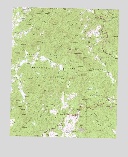
Scaly Mountain, NC USGS Topographic Map
Click on map above to begin viewing in our Map Viewer.

This topographic map contains these locations and features:
Feature Name Type Latitude Longitude GNIS ID View Map
Abes CreekStreamN35.0104°W83.2549°1008647View Map
Ammons KnobSummitN35.1248°W83.3374°1018815View Map
Bates GapGapN35.1195°W83.3465°1008954View Map
Bates RidgeRidgeN35.1145°W83.3518°1008955View Map
Bennies BranchStreamN35.0662°W83.2657°1009179View Map
Board GapGapN35.0326°W83.3399°1009508View Map
Bristle RidgeRidgeN35.1176°W83.3604°1009613View Map
Broadway GapGapN35.0395°W83.2629°1009625View Map
Brush CreekStreamN35.1131°W83.2654°1009677View Map
Buck CreekStreamN35.1234°W83.2829°1009738View Map
Buck KnobSummitN35.0451°W83.3354°1009745View Map
Buckeye CreekStreamN35.0751°W83.3432°1009763View Map
Buckhorn GapGapN35.0773°W83.2721°1009775View Map
Buckhorn MountainSummitN35.0776°W83.2702°1019381View Map
Cadon BranchStreamN35.0629°W83.3024°1009892View Map
Cadon GapGapN35.0726°W83.2943°1009893View Map
California GapGapN35.1054°W83.2854°1009918View Map
California RidgeRidgeN35.1040°W83.2871°1009919View Map
Cedar CliffCliffN35.0923°W83.3454°1010114View Map
Chestnut MountainSummitN35.0318°W83.3246°1019637View Map
Conley RidgeRidgeN35.0856°W83.3196°1010441View Map
Crow CreekStreamN35.1184°W83.2785°1010597View Map
Cullasaja FallsFallsN35.1167°W83.2699°1019880View Map
Curtiss KnobSummitN35.0426°W83.2790°1019888View Map
Dan GapGapN35.0990°W83.3018°1010640View Map
Doubletop BranchStreamN35.1068°W83.3518°1010888View Map
Doubletop FieldsRidgeN35.0979°W83.3402°1010890View Map
Dover KnobSummitN35.0045°W83.3654°1020021View Map
Drymans BranchStreamN35.0309°W83.3565°1010924View Map
Drymans ChapelChurchN35.0709°W83.3521°1010925View Map
Duck MountainSummitN35.0254°W83.2999°1020038View Map
Emmaline GapGapN35.1176°W83.2593°1011085View Map
Evans CreekStreamN35.0676°W83.3515°1011114View Map
Everett MountainSummitN35.1198°W83.2554°1020179View Map
Falls Poplar CoveValleyN35.1139°W83.3414°1011172View Map
Fisher LakeReservoirN35.0068°W83.3022°1011231View Map
Fishhawk MountainSummitN35.0979°W83.3118°1011235View Map
Fork MountainSummitN35.0476°W83.2657°1020307View Map
Fork RidgeRidgeN35.1062°W83.3063°1011321View Map
Fulcher BranchStreamN35.1237°W83.3738°1011412View Map
FulchertownPopulated PlaceN35.1223°W83.3582°1020379View Map
George Gray MountainSummitN35.0804°W83.3643°1016900View Map
Gold MineLocaleN35.1026°W83.2757°1011548View Map
Gold Mine BranchStreamN35.1045°W83.2707°1011549View Map
Grassy KnobsSummitN35.0231°W83.3182°1020520View Map
Gray GapGapN35.0831°W83.3629°1011672View Map
Green CoveValleyN35.0637°W83.3120°1011693View Map
Happy HillSummitN35.0029°W83.3279°1020614View Map
Henderson MountainSummitN35.1073°W83.2949°1020679View Map
Hickory GapGapN35.0659°W83.2840°1012007View Map
Hickory Knoll ChurchChurchN35.0998°W83.3710°1012010View Map
High HollySummitN35.0054°W83.3340°1020734View Map
High TopSummitN35.0256°W83.3621°1020761View Map
Howard GapGapN35.0093°W83.3540°1012241View Map
Hurrah RidgeRidgeN35.0220°W83.2752°1012293View Map
Jake BranchStreamN35.0079°W83.3140°1012417View Map
Jimmy GapGapN35.1087°W83.3585°1012481View Map
Jones GapGapN35.0773°W83.2921°1012557View Map
Jones KnobSummitN35.0815°W83.2957°1012561View Map
Kinley MountainSummitN35.0015°W83.3404°1021051View Map
Lake CharlesReservoirN35.0791°W83.3578°1016969View Map
Lake Charles DamDamN35.0784°W83.3565°1016968View Map
Lamb MountainSummitN35.1176°W83.2643°1021090View Map
Laurel BranchStreamN35.0854°W83.2699°1012694View Map
Licklog GapGapN35.0159°W83.3246°1012858View Map
LickskilletPopulated PlaceN35.0476°W83.2813°1021145View Map
Little Fishhawk MountainSummitN35.0923°W83.3068°1021187View Map
Little ScalySummitN35.0312°W83.2574°1021237View Map
Lloyd CoveValleyN35.0565°W83.3076°1013052View Map
Low GapGapN35.0293°W83.3654°1013219View Map
Mc Connell CemeteryCemeteryN35.0387°W83.3582°1013386View Map
McDowell MountainSummitN35.0343°W83.3679°1021389View Map
Middle CreekStreamN35.0518°W83.3743°1013487View Map
Middle Creek MillLocaleN35.0556°W83.3688°1013490View Map
Miller CemeteryCemeteryN35.0823°W83.2574°1013578View Map
Mount Moriah CemeteryCemeteryN35.1023°W83.2726°1013749View Map
Natural BridgeArchN35.0298°W83.3327°1013882View Map
Nichols BranchStreamN35.0640°W83.3115°1013956View Map
Nickajack GapGapN35.1190°W83.3327°1013963View Map
NonameReservoirN35.0891°W83.2819°1016975View Map
Osage LakeReservoirN35.0076°W83.2909°1016933View Map
Osage Lake DamDamN35.0084°W83.2915°1016932View Map
Osage MountainSummitN35.0051°W83.2852°1021757View Map
Panther KnobSummitN35.1245°W83.3324°1021791View Map
Peggy KnobSummitN35.0609°W83.2868°1021855View Map
Penson MountainSummitN35.0129°W83.3565°1014328View Map
Pine KnobSummitN35.0209°W83.3610°1021910View Map
Piney Knob ForkStreamN35.0615°W83.2613°1014457View Map
Plass GapGapN35.0190°W83.3588°1014505View Map
Possum BranchStreamN35.0673°W83.3179°1014602View Map
Possum BranchStreamN35.1020°W83.3560°1014603View Map
R C Balfour Lower DamDamN35.0887°W83.2818°1016976View Map
Rattlesnake RidgeRidgeN35.0226°W83.3363°1014756View Map
Rector KnobSummitN35.0695°W83.2968°1022183View Map
Richey GapGapN35.0501°W83.3421°1014868View Map
Richey KnobSummitN35.0562°W83.3485°1022273View Map
Rocky KnobSummitN35.0115°W83.2924°1022346View Map
Rocky KnobSummitN35.1115°W83.3177°1022347View Map
Saltrock GapGapN35.0268°W83.2929°1015193View Map
Scaly MountainPopulated PlaceN35.0118°W83.3163°1015312View Map
Scaly MountainSummitN35.0373°W83.2852°1015313View Map
Scaly Mountain Post OfficePost OfficeN35.0217°W83.3042°2774352View Map
Scaly SchoolSchoolN35.0237°W83.3102°1015315View Map
Sheep HollowValleyN35.0599°W83.3415°1015401View Map
Shoal CreekStreamN35.0173°W83.3504°1015449View Map
Short CreekStreamN35.0954°W83.2640°1015484View Map
Sky Valley - Scaly Mountain Volunteer Fire and RescueBuildingN35.0262°W83.2949°2639016View Map
Slick RockSummitN35.0929°W83.2865°1022658View Map
Smart BranchStreamN35.0384°W83.3596°1015601View Map
Stephens CreekStreamN35.0904°W83.2682°1015814View Map
Stiles CemeteryCemeteryN35.0993°W83.3607°1015833View Map
Stillhouse BranchStreamN35.0737°W83.3324°1015840View Map
Tater HillSummitN35.0173°W83.3315°1022891View Map
Tater HillSummitN35.1093°W83.3240°1022892View Map
Tessentee ChurchChurchN35.0720°W83.3299°1016076View Map
The CatstairsCliffN35.0326°W83.2710°1016084View Map
The FlatsFlatN35.0101°W83.3046°1016086View Map
The PinnacleSummitN35.0893°W83.3574°1022927View Map
Thomas KnobSummitN35.0018°W83.3218°1022936View Map
Township of FlatsCivilN35.0225°W83.3183°1026905View Map
Township of SugarforkCivilN35.1241°W83.2560°1026911View Map
TumblervillePopulated PlaceN35.1140°W83.3640°1023001View Map
Turkey KnobSummitN35.0384°W83.3393°1023003View Map
Turtle Pond CreekStreamN35.0770°W83.2529°1016290View Map
Watkins CemeteryCemeteryN35.0067°W83.3068°1016471View Map
Watkins CreekStreamN35.0001°W83.3013°1016474View Map
Watkins MillPopulated PlaceN35.0059°W83.3088°1023129View Map
Webb BranchStreamN35.0115°W83.2613°1016486View Map
Wheatfield BranchStreamN35.0754°W83.3335°1016566View Map
Whiterock BranchStreamN35.0670°W83.3171°1016628View Map
Whiterock GapGapN35.0854°W83.3007°1016631View Map
Whiterock MountainSummitN35.0856°W83.3054°1023221View Map
Wilson CemeteryCemeteryN35.0443°W83.2735°1016718View Map
Wolf GapGapN35.0401°W83.3365°1016776View Map
Wolf RockSummitN35.1031°W83.3210°1023304View Map

Note: Coordinates in the location and feature list above are referenced to NAD83 datum.


Copyright (C) 2008-2024 Ryan Niemi / Sunset Dynamics ... All Rights Reserved