TopoQuest Logo
Do you find TopoQuest useful?
Help keep TopoQuest running and adding new maps/features by donating!
Bitcoin:  19c7KJd3qBynnjoSw5npx9KScwjBe4ifkT
Litecoin:  LXs6TkuXGGXo1vDsWCkWVdjQX94eUKd6ui
Home View Maps Find Maps Find Places Resources & Links


Freeman, Washington Topographic Map

USGS Map Title: Freeman, WA
USGS Map MRC: 47117E2
DRG (GeoTIFF) Download: o47117e2.tif


Neighboring USGS Topographic Map Quads:


  Spokane NE, WA  
47117F3
 

  Greenacres, WA  
47117F2
 

  Liberty Lake, WA  
47117F1
 

  Spokane SE, WA  
47117E3
 

  Freeman, WA  
47117E2
 

  Mica Peak, WA  
47117E1
 

  Spangle East, WA  
47117D3
 

  Fairfield, WA  
47117D2
 

  Setters, ID  
47117D1


Map MRC Location:

N48°
W118°
N48°
W117°
H8 H7 H6 H5 H4 H3 H2 H1
G8 G7 G6 G5 G4 G3 G2 G1
F8 F7 F6 F5 F4 F3 F2 F1
E8 E7 E6 E5 E4 E3 E2 E1
D8 D7 D6 D5 D4 D3 D2 D1
C8 C7 C6 C5 C4 C3 C2 C1
B8 B7 B6 B5 B4 B3 B2 B1
A8 A7 A6 A5 A4 A3 A2 A1
N47°
W118°
N47°
W117°

Freeman, WA USGS 1:24K Topographic Map Preview:
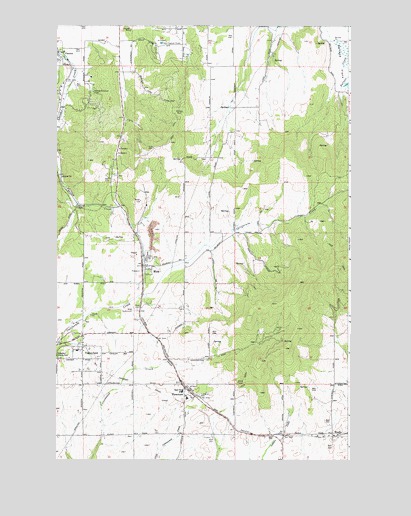
Freeman, WA USGS Topographic Map
Click on map above to begin viewing in our Map Viewer.

This topographic map contains these locations and features:
Feature Name Type Latitude Longitude GNIS ID View Map
Chester Elementary SchoolSchoolN47.6239°W117.2386°1515602View Map
Deruwe DamDamN47.6082°W117.1260°1532532View Map
Evergreen CemeteryCemeteryN47.5188°W117.1891°1504782View Map
FreemanPopulated PlaceN47.5182°W117.1958°1512227View Map
Freeman Elementary SchoolSchoolN47.5177°W117.1944°1515571View Map
Freeman High SchoolSchoolN47.5197°W117.1964°1515570View Map
Horizon Middle SchoolSchoolN47.6214°W117.2375°1515569View Map
KSVY-AM (Opportunity)TowerN47.6107°W117.2421°1534278View Map
LockwoodLocaleN47.5082°W117.1521°1514733View Map
ManitoPopulated PlaceN47.5077°W117.1324°1511118View Map
MicaPopulated PlaceN47.5560°W117.2121°1512460View Map
Mica CemeteryCemeteryN47.5433°W117.2160°1506641View Map
Morrow ParkParkN47.5993°W117.1974°1506800View Map
Sky Meadows AirparkAirportN47.6085°W117.1808°2443401View Map
Spokane County Fire District 8 Station 82BuildingN47.5341°W117.2421°2643791View Map
Spokane County Fire District 8 Station 84BuildingN47.6130°W117.2496°2643792View Map
ValleyfordPopulated PlaceN47.5318°W117.2391°1512756View Map
Valleyford DivisionCivilN47.5545°W117.1765°1939663View Map
Vallyford Post OfficePost OfficeN47.5369°W117.2381°2769145View Map

Note: Coordinates in the location and feature list above are referenced to NAD83 datum.


Copyright (C) 2008-2024 Ryan Niemi / Sunset Dynamics ... All Rights Reserved