TopoQuest Logo
Do you find TopoQuest useful?
Help keep TopoQuest running and adding new maps/features by donating!
Bitcoin:  19c7KJd3qBynnjoSw5npx9KScwjBe4ifkT
Litecoin:  LXs6TkuXGGXo1vDsWCkWVdjQX94eUKd6ui
Home View Maps Find Maps Find Places Resources & Links


Spokane SE, Washington Topographic Map

USGS Map Title: Spokane SE, WA
USGS Map MRC: 47117E3
DRG (GeoTIFF) Download: o47117e3.tif


Neighboring USGS Topographic Map Quads:


  Spokane NW, WA  
47117F4
 

  Spokane NE, WA  
47117F3
 

  Greenacres, WA  
47117F2
 

  Spokane SW, WA  
47117E4
 

  Spokane SE, WA  
47117E3
 

  Freeman, WA  
47117E2
 

  Spangle West, WA  
47117D4
 

  Spangle East, WA  
47117D3
 

  Fairfield, WA  
47117D2


Map MRC Location:

N48°
W118°
N48°
W117°
H8 H7 H6 H5 H4 H3 H2 H1
G8 G7 G6 G5 G4 G3 G2 G1
F8 F7 F6 F5 F4 F3 F2 F1
E8 E7 E6 E5 E4 E3 E2 E1
D8 D7 D6 D5 D4 D3 D2 D1
C8 C7 C6 C5 C4 C3 C2 C1
B8 B7 B6 B5 B4 B3 B2 B1
A8 A7 A6 A5 A4 A3 A2 A1
N47°
W118°
N47°
W117°

Spokane SE, WA USGS 1:24K Topographic Map Preview:
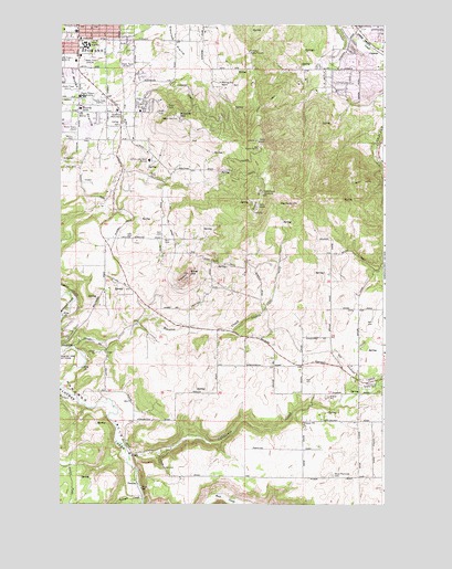
Spokane SE, WA USGS Topographic Map
Click on map above to begin viewing in our Map Viewer.

This topographic map contains these locations and features:
Feature Name Type Latitude Longitude GNIS ID View Map
Adams Elementary SchoolSchoolN47.6213°W117.3677°1530781View Map
Big RockSummitN47.5782°W117.2858°1503356View Map
Browne MountainSummitN47.6007°W117.3283°1503573View Map
California CreekStreamN47.5121°W117.3480°1503713View Map
ChesterPopulated PlaceN47.6180°W117.2505°1503945View Map
DuncanPopulated PlaceN47.5046°W117.3449°1510922View Map
ExcelsiorLocaleN47.5324°W117.2630°1511755View Map
Ferris High SchoolSchoolN47.6197°W117.3653°1530884View Map
Glenrose PrairieFlatN47.6199°W117.3308°1505150View Map
Hangman Valley Golf CourseLocaleN47.5371°W117.3730°1533133View Map
HillbyLocaleN47.5791°W117.3358°1511770View Map
Immaculate Heart RetreatLocaleN47.5896°W117.3405°1505697View Map
KAQQ-AM (Spokane)TowerN47.6163°W117.3710°1534303View Map
KAYU-TV (Spokane)TowerN47.5788°W117.2971°1534434View Map
KEWU-FM (Cheney)TowerN47.5785°W117.2983°1534336View Map
KEYF-FM (Cheney)TowerN47.5949°W117.2991°1534337View Map
KEZE-FM (Spokane)TowerN47.5788°W117.2971°1534393View Map
KGA-AM (Spokane)TowerN47.5954°W117.3719°1534305View Map
KHDL-AM (Opportunity)TowerN47.6152°W117.2502°1534279View Map
KHQ-TV (Spokane)TowerN47.5810°W117.2974°1534431View Map
KieslingLocaleN47.5563°W117.3155°1511776View Map
KISC-FM (Spokane)TowerN47.5813°W117.2974°1534391View Map
KKZX-FM (Spokane)TowerN47.5929°W117.2972°1534392View Map
KMBI-AM (Spokane)TowerN47.6046°W117.3585°1534300View Map
Krell HillSummitN47.5793°W117.2974°1512360View Map
KREM-TV (Spokane)TowerN47.5949°W117.2991°1534432View Map
KSKN-TV (Spokane)TowerN47.5949°W117.2991°1534433View Map
KSPS-TV (Spokane)TowerN47.5760°W117.3005°1534430View Map
KTRW-AM (Spokane)TowerN47.6163°W117.3663°1534307View Map
KUDY-AM (Spokane)TowerN47.6074°W117.3622°1534306View Map
KXLY-AM (Spokane)TowerN47.6082°W117.3747°1534304View Map
KZZU-FM (Spokane)TowerN47.5949°W117.2991°1534394View Map
MoranLocaleN47.5991°W117.3524°1511783View Map
Moran CemeteryCemeteryN47.5956°W117.3691°1506782View Map
Moran PrairieFlatN47.6046°W117.3674°1506783View Map
Morning Star RanchLocaleN47.6099°W117.3127°1506797View Map
Mullan Road Elementary SchoolSchoolN47.5960°W117.3728°1514820View Map
ParkviewLocaleN47.5827°W117.3358°1511833View Map
PiedmontLocaleN47.5949°W117.3474°1511834View Map
Regal Post OfficePost OfficeN47.6045°W117.3693°2769136View Map
SharonLocaleN47.5471°W117.2941°1511849View Map
Silver HillSummitN47.5602°W117.3249°1508342View Map
Spangle CreekStreamN47.5013°W117.3433°1508578View Map
Spokane County Fire District 8 Station 81BuildingN47.5976°W117.3514°2643793View Map
Stevens CreekStreamN47.5407°W117.3705°1508728View Map
Valleyford County ParkParkN47.5305°W117.2524°1509205View Map
Willow SpringsLocaleN47.5693°W117.3430°1513657View Map
Willow SpringsLocaleN47.5685°W117.3455°1511803View Map
Wood Memorial CemeteryCemeteryN47.5073°W117.2700°1509612View Map

Note: Coordinates in the location and feature list above are referenced to NAD83 datum.


Copyright (C) 2008-2025 Ryan Niemi / Sunset Dynamics ... All Rights Reserved