TopoQuest Logo
Do you find TopoQuest useful?
Help keep TopoQuest running and adding new maps/features by donating!
Bitcoin:  19c7KJd3qBynnjoSw5npx9KScwjBe4ifkT
Litecoin:  LXs6TkuXGGXo1vDsWCkWVdjQX94eUKd6ui
Home View Maps Find Maps Find Places Resources & Links


Fruitvale, Idaho Topographic Map

USGS Map Title: Fruitvale, ID
USGS Map MRC: 44116G4
DRG (GeoTIFF) Download: o44116g4.tif


Neighboring USGS Topographic Map Quads:


  Weasel Gulch, ID  
44116H5
 

  Tamarack, ID  
44116H4
 

  New Meadows, ID  
44116H3
 

  Peck Mountain, ID  
44116G5
 

  Fruitvale, ID  
44116G4
 

  Cold Spring Summit, ID  
44116G3
 

  Goodrich, ID  
44116F5
 

  Council, ID  
44116F4
 

  Council Mountain, ID  
44116F3


Map MRC Location:

N45°
W117°
N45°
W116°
H8 H7 H6 H5 H4 H3 H2 H1
G8 G7 G6 G5 G4 G3 G2 G1
F8 F7 F6 F5 F4 F3 F2 F1
E8 E7 E6 E5 E4 E3 E2 E1
D8 D7 D6 D5 D4 D3 D2 D1
C8 C7 C6 C5 C4 C3 C2 C1
B8 B7 B6 B5 B4 B3 B2 B1
A8 A7 A6 A5 A4 A3 A2 A1
N44°
W117°
N44°
W116°

Fruitvale, ID USGS 1:24K Topographic Map Preview:
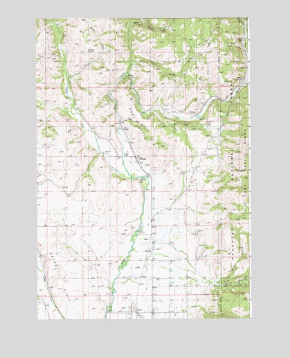
Fruitvale, ID USGS Topographic Map
Click on map above to begin viewing in our Map Viewer.

This topographic map contains these locations and features:
Feature Name Type Latitude Longitude GNIS ID View Map
Camp CreekStreamN44.7513°W116.4288°378775View Map
Cold Spring GulchValleyN44.8571°W116.4435°379549View Map
Council Municipal AirportAirportN44.7502°W116.4462°400799View Map
Dale (historical)Populated PlaceN44.8382°W116.4843°399506View Map
East Fork Weiser RiverStreamN44.8466°W116.3804°381196View Map
Fir Point SpringSpringN44.8616°W116.4696°395383View Map
Fort Hall HillSummitN44.8224°W116.4299°381938View Map
FruitvalePopulated PlaceN44.8152°W116.4401°396522View Map
Gaylord CreekStreamN44.8604°W116.3757°382221View Map
GlendalePopulated PlaceN44.8346°W116.4074°382296View Map
HooverPopulated PlaceN44.7524°W116.4415°383318View Map
Hoover StationLocaleN44.7527°W116.4421°394962View Map
Hornet RidgeRidgeN44.7707°W116.4913°383346View Map
Mill CreekStreamN44.7649°W116.4546°386928View Map
North Fork Mill CreekStreamN44.7643°W116.3840°387738View Map
Pin CreekStreamN44.8707°W116.3779°388464View Map
Rocky GulchValleyN44.8513°W116.4810°389556View Map
South Fork Mill CreekStreamN44.7643°W116.3840°390973View Map
Spring CreekStreamN44.7641°W116.3960°391188View Map
StarkeyPopulated PlaceN44.8504°W116.4485°397205View Map
Starkey Hot SpringsSpringN44.8560°W116.4449°399507View Map
Starkey Post Office (historical)Post OfficeN44.8504°W116.4485°2027012View Map
StevensPopulated PlaceN44.8485°W116.3787°397212View Map
Trail CreekStreamN44.8416°W116.3982°392306View Map
Trestle CreekStreamN44.8735°W116.3790°392379View Map
Warm Spring CreekStreamN44.8524°W116.4463°392865View Map
West Fork Weiser RiverStreamN44.8082°W116.4438°393220View Map
White SchoolLocaleN44.7743°W116.4315°393371View Map
Winkler CemeteryCemeteryN44.7544°W116.4456°393597View Map

Note: Coordinates in the location and feature list above are referenced to NAD83 datum.


Copyright (C) 2008-2024 Ryan Niemi / Sunset Dynamics ... All Rights Reserved