TopoQuest Logo
Do you find TopoQuest useful?
Help keep TopoQuest running and adding new maps/features by donating!
Bitcoin:  19c7KJd3qBynnjoSw5npx9KScwjBe4ifkT
Litecoin:  LXs6TkuXGGXo1vDsWCkWVdjQX94eUKd6ui
Home View Maps Find Maps Find Places Resources & Links


Fryburg NW, North Dakota Topographic Map

USGS Map Title: Fryburg NW, ND
USGS Map MRC: 46103H4
DRG (GeoTIFF) Download: o46103h4.tif


Neighboring USGS Topographic Map Quads:


  Wannagan Creek East, ND  
47103A5
 

  Gorham SW, ND  
47103A4
 

  Gorham SE, ND  
47103A3
 

  Medora, ND  
46103H5
 

  Fryburg NW, ND  
46103H4
 

  Fryburg NE, ND  
46103H3
 

  Chimney Butte, ND  
46103G5
 

  Tracy Mountain, ND  
46103G4
 

  Fryburg, ND  
46103G3


Map MRC Location:

N47°
W104°
N47°
W103°
H8 H7 H6 H5 H4 H3 H2 H1
G8 G7 G6 G5 G4 G3 G2 G1
F8 F7 F6 F5 F4 F3 F2 F1
E8 E7 E6 E5 E4 E3 E2 E1
D8 D7 D6 D5 D4 D3 D2 D1
C8 C7 C6 C5 C4 C3 C2 C1
B8 B7 B6 B5 B4 B3 B2 B1
A8 A7 A6 A5 A4 A3 A2 A1
N46°
W104°
N46°
W103°

Fryburg NW, ND USGS 1:24K Topographic Map Preview:
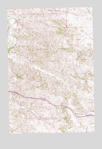
Fryburg NW, ND USGS Topographic Map
Click on map above to begin viewing in our Map Viewer.

This topographic map contains these locations and features:
Feature Name Type Latitude Longitude GNIS ID View Map
Beef Corral BottomBendN46.9786°W103.4946°1034710View Map
Beef Corral WashStreamN46.9822°W103.4938°1034711View Map
Boicourt SpringSpringN46.9686°W103.3988°1034732View Map
Buck HillSummitN46.9258°W103.3888°1034739View Map
Halliday Flowing WellWellN46.9520°W103.4944°1034904View Map
Halliday Well Recreation SiteLocaleN46.9503°W103.4877°1035421View Map
Jones CreekStreamN46.9692°W103.4905°1034950View Map
Jules CreekStreamN46.9906°W103.4996°1034951View Map
Mike Auney Flowing WellWellN46.9925°W103.4999°1035004View Map
Paddock CreekStreamN46.9678°W103.4905°1035049View Map
Painted Canyon OverlookLocaleN46.8956°W103.3796°1035051View Map
Painted Canyon Rest AreaLocaleN46.8955°W103.3816°2745796View Map
Peaceful ValleyValleyN46.9661°W103.4936°1035052View Map
Scoria PointPopulated PlaceN46.9311°W103.4855°1035135View Map
Sheep Butte SpringSpringN46.9572°W103.3788°1035140View Map
Theodore Roosevelt National ParkParkN46.9536°W103.4592°1033824View Map

Note: Coordinates in the location and feature list above are referenced to NAD83 datum.


Copyright (C) 2008-2025 Ryan Niemi / Sunset Dynamics ... All Rights Reserved